Area Overview for Howwood
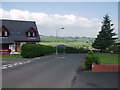
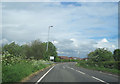
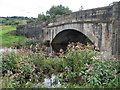
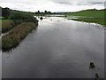
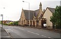
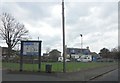
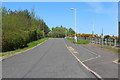
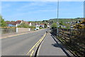
Photos of Howwood


Area Information
Howwood is a built-up area in Scotland covering 44.9 hectares. It operates as a distinct residential neighbourhood within the wider living landscape of the region. Residents here enjoy a compact layout that keeps daily needs within easy reach. The area sits near key transport links and practical services, which shapes the rhythm of life for those calling it home. You will find Howwood characterised by a focus on functional living rather than grand architecture or tourist attractions. Its identity is rooted in accessibility to major infrastructure like rail stations and supermarkets. This makes it a practical choice for families or commuters who prioritise convenience over a polished town centre feel. The neighbourhood does not pretend to be a major cultural hub, yet it provides the essential foundations for a stable household. When you consider living in Howwood, you are choosing a location defined by its proximity to vital amenities and established transport routes. There are no hidden surprises about the area's layout; it is a straightforward environment designed for people who want reliable access to shops and train services without the need for lengthy commutes to distant city centres. The straightforward nature of the area appeals to those seeking a no-frills, high-functionality address in Scotland.
- Area Type
- Built Up Area 250
- Area Size
- 44.9 hectares
- Population
- Not available
- Population Density
- Not available
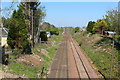
Your lifestyle in Howwood centres on nearby amenities that are within practical reach. You have access to several railway stations, including Howwood Railway Station, Milliken Park Railway Station, and Johnstone Railway Station. These locations provide essential rail transport options for your daily commute or leisure trips. For essential shopping needs, you can visit Aldi Patons Mill RP, Iceland Johnstone, and Lidl Johnstone. These stores cover your grocery requirements and offer supermarket convenience without requiring a long journey into a major city. The area is also situated one journey away from Glasgow International Airport, giving you connectivity to regional and international travel. While Howwood itself lacks a high street with diverse independent boutiques or a sprawling town centre, it functions effectively as a satellite outpost for larger retail hubs. You will find the amenities sufficient for everyday living but not elaborate enough for a nightlife scene or a wide variety of dining options. The character of life here is defined by these reliable, no-frills services that support a basic, functional routine for families and couples.
Amenities
Schools
| Rank | School | Type | Entry gender | Ages |
|---|
Explore more schools in this area
Go to Schools tabDemographics
You will not find detailed demographic breakdowns such as specific age profiles or household composition data in the current public records for this section. Similarly, information regarding home ownership levels, deprivation indices, or the specific diversity of the population remains unrecorded in the available datasets. This lack of granular data means you cannot assess the typical resident or the economic standing of the neighbourhood with precision. You are left without clear figures on whether most people rent or buy homes, what the average age of residents is, or how income levels distribute across Howwood. In the absence of these statistics, any claim about the community's character would be pure speculation. The demographic reality of living in Howwood is currently undocumented in the form of hard numbers. You must rely on general observations of the built-up area rather than statistical portraits of its people. Without access to specific census figures or local authority reports in this instance, the profile of the community remains invisible beyond the basic classification of the area as a built-up zone in Scotland.
Household Size
Accommodation Type
Tenure
Ethnic Group
Religion
Household Composition
Age
Household Deprivation
NS-SEC
Explore more demographic insights in this area
Go to Demographics tabPlanning
Planning Constraints
- Crime RiskPremium