Area Overview for G52 4RP
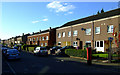
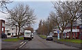
Photos of G52 4RP


Area Information
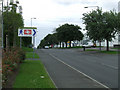
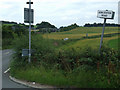
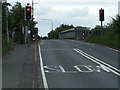
Living in G52 4RP means residing in a small residential cluster in Scotland, where proximity to transport hubs and amenities shapes daily life. The area is defined by its compact nature, with residents likely relying on nearby infrastructure for mobility and convenience. Within practical reach are five retail outlets, including Farmfoods Earl Haig and Tesco Renfrew, ensuring access to essentials. The presence of multiple railway stations—Hillington West, Hillington East, and Cardonald—alongside metro links like Govan Underground Station and Kelvinhall Underground Station, suggests a well-connected community. Glasgow International Airport is also within reach, adding to the area’s accessibility. Digital connectivity is robust, with broadband and mobile scores of 88 and 83 respectively, supporting both remote work and everyday internet use. While the area’s small size may limit local diversity, its strategic location near transport networks and retail options makes it appealing for those prioritising convenience over sprawling landscapes.
- Area Type
- Postcode
- Area Size
- Not available
- Population
- Not available
- Population Density
- Not available
House Prices in G52 4RP
No properties found in this postcode.
Energy Efficiency in G52 4RP
Daily life in G52 4RP is shaped by its proximity to a range of amenities. Retail options include Farmfoods Earl Haig, Co-op Thurston, and Tesco Renfrew, offering groceries and everyday essentials. The area’s transport links—rail, metro, and ferry—ensure easy access to leisure and work opportunities. Nearby, the Braehead Shopping Centre Ferry Landing and Renfrew Ferry Terminal provide connections to wider destinations. While the data does not specify parks or recreational spaces, the presence of multiple transport hubs suggests a focus on practicality over expansive green spaces. The area’s compact nature means residents are likely within walking or short-vehicle distance of shops, dining, and services, fostering a convenient, if modest, lifestyle.
Amenities
Schools
| Rank | School | Type | Entry gender | Ages |
|---|
Explore more schools in this area
Go to Schools tabDemographics
Household Size
Accommodation Type
Tenure
Ethnic Group
Religion
Household Composition
Age
Household Deprivation
NS-SEC
Explore more demographic insights in this area
Go to Demographics tabPlanning
Planning Constraints
- Flood RiskPremium
- Ramsar Wetland SitesPremium
- Area of Outstanding Natural BeautyPremium
- Protected Nature ReservePremium
- Protected WoodlandPremium
- Crime & SafetyPremium