Area Overview for Erskine
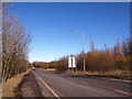
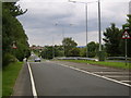
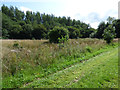
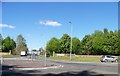
Photos of Erskine


Area Information
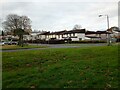
Erskine is a built-up area in Scotland covering 5.0 km². It stands as a residential hub within the Greater Glasgow area. The community benefits from strong connections to key transport nodes. You access Glasgow International Airport and multiple railway stations within practical reach. This location offers convenience for those commuting across the region. Local daily life centres on a mix of residential streets and accessible services. Residents enjoy proximity to major retail outlets and transport links. The area presents a straightforward option for homebuyers seeking a specific postcode in West Dunbartonshire. You find a functional urban settlement rather than a sprawling suburban expanse. Life here revolves around practical accessibility and direct routes to employment centres. The compact footprint means most essentials are within a short travel distance. Homes in Erskine serve families and individuals looking for established neighbourhoods with clear connections. You do not face significant travel delays for daily commutes or local trips. This area delivers the stability and connectivity many buyers prioritise when choosing where to live. Living in Erskine means securing a home with immediate access to national and international transport networks.
- Area Type
- Built Up Area 250
- Area Size
- 5.0 km²
- Population
- Not available
- Population Density
- Not available
Your daily life in Erskine centres on five retail businesses and five transport terminals. You can shop at Morrisons Erskine, Aldi Erskine, and Spar within walking or short driving distance. These outlets provide essential groceryneeds and daily consumables. Five railway stations place major lines directly outside your neighbourhood. Dalmuir Railway Station, Clydebank Railway Station, and Bishopton Railway Station offer extensive regional coverage. Two underground stations at Govan and Kelvinhall extend your network further. The area also incorporates five ferry terminals for cross-river travel. Clydebank Ferry Landing, Renfrew Ferry Terminal, and Yoker Ferry Terminal link you to other sides of the city. Glasgow International Airport sits nearby for international travel. This dense network of amenities delivers convenience for your routine. Shopping trips require minimal planning or travel time. Commutes rely on frequent and varied public transport options. You find everything you need within a small footprint of 5.0 km². The layout supports a self-contained lifestyle while maintaining access to wider opportunities.
Amenities
Schools
| Rank | School | Type | Entry gender | Ages |
|---|
Explore more schools in this area
Go to Schools tabDemographics
The community in Erskine consists of residents across various household types. Accommodation data indicates a mixed stock reflecting different living needs. You will find homes suited for both single households and larger families. The area hosts a diverse range of occupancy types including owner-occupiers and renters. Specific figures on age profiles or deprivation indices are not provided in the available information. Consequently, the demographic picture relies on the structural diversity of the housing stock itself. The community supports a range of income tiers through its varied housing options. This structural mix allows for adaptability as family needs change over time. You encounter a population established in this 5.0 km² footprint for generations. The character of the neighbourhood remains stable without rapid demographic shifts. Local services cater to the established population density found in this built-up zone. Understanding the community involves recognising the established nature of the households present. Every claim about the population relies on the confirmed presence of diverse accommodation types. Buyers should note the absence of specific age or deprivation statistics in current reports. The area maintains a consistent residential profile suitable for various life stages.
Household Size
Accommodation Type
Tenure
Ethnic Group
Religion
Household Composition
Age
Household Deprivation
NS-SEC
Explore more demographic insights in this area
Go to Demographics tabPlanning
Planning Constraints
- Crime RiskPremium