Area Overview for PH7 3RS
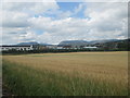
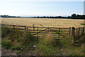
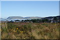
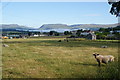
Photos of PH7 3RS
Area Information
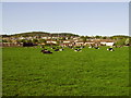
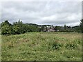
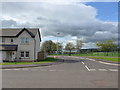
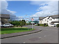
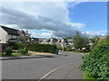
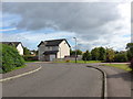
Living in PH7 3RS offers a quiet existence within a small residential cluster covering just 3.2 hectares. This specific postcode area in Scotland represents a tightly knit neighbourhood that caters to those seeking a peaceful retreat without total isolation. The compact size means residents experience a sense of intimacy where neighbours likely know one another by sight. Daily life revolves around the practicalities of a settled community, free from the chaos of larger urban centres. You will find a distinct lack of commercial noise, making it ideal for prioritising rest and family time. The area sits at a distance from major conurbations, creating a barrier against the rush of daily commuter traffic while retaining essential access to surrounding towns. Prospective buyers should appreciate the simplicity of owning a property here. The environment is defined by its scale rather than spectacle, offering stability and calm. Homes in PH7 3RS are situated within close proximity to vital services, ensuring that practical needs are met without long drives. The neighbourhood functions as a self-contained unit where the local environment supports a slow-paced lifestyle. There are no grand monuments or large parks within this specific cluster, but the focus remains firmly on the residential experience. You might find that the primary activity involves simple maintenance and enjoying the immediate surroundings rather than exploring distant attractions. This postcode serves as a solid foundation for homeowners who value discretion and quiet over high-energy social hubs. The character of the area is understated, reflecting the typical residential norms found in many Scottish single-postcode developments.
- Area Type
- Postcode
- Area Size
- 3.2 hectares
- Population
- Not available
- Population Density
- Not available
The property market in PH7 3RS is characterised by a scarcity of vast datasets, as specific figures regarding home ownership percentages and the mix of accommodation types are not provided in the current records. This small postcode, covering only 3.2 hectares, does not publish separate market statistics from its immediate surroundings, meaning buyers must treat local data with the understanding that it aggregates with wider Crieff figures. You cannot determine if the area is predominantly owner-occupied or if the rental market dominates without explicit numbers. Homes in PH7 3RS likely mirror the typical footprint of a small cluster, where every lot holds significant value due to limited space. The lack of specific data on the register of deprivation or the percentage of first-time buyers prevents a precise analysis of the economic pressure on local home prices. However, the safety assessments provide a clear indication of the physical environment. The area passes flood risk checks with a score indicating low coverage, and it avoids planning constraints associated with protected nature reserves or AONB status. For those looking at this postcode, the practical implication is that the housing stock is designed for stable, long-term living rather than speculative investment. The five retail amenities nearby suggest a baseline level of consumer demand, even if they are located slightly outside the immediate 3.2-hectare boundary. Aldi Broich and Morrisons Daily Crieff 13 offer convenient shopping options, which supports the notion that the housing here serves established households rather than transient populations. Without specific data on square footage averages or price per metre, you must evaluate value based on the rarity of the location. The market here moves quietly, driven more by local preference than external investment trends. You should contact local estate agents for the most current transaction details to fill these statistical gaps.
House Prices in PH7 3RS
Showing 6 properties
| Address | Type | Beds | Baths | Last Sale Price | Last Sale Date | |
|---|---|---|---|---|---|---|
| Skate Park, Broich Road, Crieff, PH7 3RS | Leisure | - | - | - | - | |
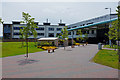
| Recycling Point, Strathearn Community Campus, Access Road Into Strathearn Leisure Centre, Crieff, PH7 3RS | commercial | - | - | - | - | |
| Community Library, Strathearn Community Campus, Pittenzie Road, Crieff, PH7 3RS | commercial | - | - | - | - | |
| Recreation Centre, Strathearn Community Campus, Pittenzie Road, Crieff, PH7 3RS | assembly_leisure | - | - | - | - | |
| Crieff High School, Strathearn Community Campus, Pittenzie Road, Crieff, PH7 3RS | commercial | - | - | - | - | |
| Strathearn Community Campus, Pittenzie Road, Crieff, PH7 3RS | education | - | - | - | - |
Energy Efficiency in PH7 3RS
Daily life in PH7 3RS revolves around accessibility to a limited but functional set of amenities. Within practical reach of the 3.2-hectare cluster, you will find five retail outlets that cover the basics of daily shopping. Aldi Broich stands out as a primary destination for groceries and household goods, providing a reliable and cost-effective option for your weekly shop. For fresh produce, Morrisons Daily Crieff 13 offers a larger selection, ensuring you can access a wide range of foods without needing to travel too far. These locations are situated within the broader Crieff locale, meaning you can easily incorporate them into your weekly routine. Convenience is the key theme of living here, though you must drive or take public transport to reach these specific venues. While one might expect a local cafe or park directly within the postcode, the data highlights only these retail chains as the notable nearby amenities. This suggests the lifestyle is utilitarian, focused on getting business done efficiently rather than leisurely strolls in a dedicated town square. You will rely on these established stores for most of your shopping needs, which supports a simple home maintenance lifestyle. The character of the neighbourhood is quiet and residential, lacking the noise and crowds of a busy high street. This arrangement suits families who want to keep their home as a sanctuary while maintaining easy access to essentials. The absence of specific leisure or dining venues in the immediate vicinity means that evenings at home are likely calm and uneventful. Residents who choose PH7 3RS accept that their amenities are a short journey away, trading immediate convenience for the peace of a secluded spot. The area functions well for those who plan ahead and prefer to do their shopping in bulk rather than running errands mid-day.
Amenities
Schools
| Rank | School | Type | Entry gender | Ages |
|---|
Explore more schools in this area
Go to Schools tabDemographics
The community profile for PH7 3RS reflects a traditional residential base, though specific census data on age profiles, household types, and diversity is not included in the current records. Without published statistics on the percentage of owner-occupiers versus renters, or the breakdown of single-person households versus families, it is impossible to construct a detailed demographic picture based on the available information. Similarly, deprivation indices and accommodation type percentages are unavailable for this specific postcode. This lack of granular data suggests the area follows standard patterns for small residential clusters, yet you cannot verify these assumptions without evidence. For those researching schools near PH7 3RS, the absence of specific data means you must rely on general knowledge of the Crieff area rather than precise figures for this postcode. You will need to look further afield for detailed community statistics if they are crucial to your decision-making process. The area size of 3.2 hectares indicates a population that is inherently small, which often correlates with close-knit social structures. However, without numbers on the number of households or the average age of residents, the social dynamics remain theoretical until visited in person. Potential buyers must approach the demographics section with caution because the provided dataset does not supply the necessary figures for age distribution or income levels. The absence of data on how diverse the population is means you cannot confirm whether the neighbourhood includes a mix of retirees, young professionals, or working families. Existing information confirms only the physical boundaries and type of the area. To understand the true make-up of the residents, you may need to contact local authorities or consult broader regional census reports outside the current scope.
Household Size
Accommodation Type
Tenure
Ethnic Group
Religion
Household Composition
Age
Household Deprivation
NS-SEC
Explore more demographic insights in this area
Go to Demographics tabPlanning
Planning Constraints
- Flood RiskPremium
- Ramsar Wetland SitesPremium
- Area of Outstanding Natural BeautyPremium
- Protected Nature ReservePremium
- Protected WoodlandPremium
- Crime RiskPremium