Area Overview for PH4 1QR
Photos of PH4 1QR

Area Information
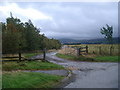
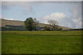
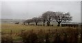
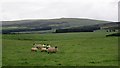
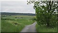
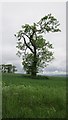
Living in PH4 1QR defines a specific lifestyle within a small residential cluster covering 4.9 hectares in Scotland. This postcode represents a compact area rather than a sprawling neighbourhood, offering a contained community environment for those seeking a defined living space. The location sits within Perth and Kinross, one of the 32 council areas in Scotland. This region encompasses the historic counties of Kinross-shire and most of Perthshire, positioning the area in central Scotland. Residents benefit from proximity to the wider council area, which borders Highland and Aberdeenshire to the north and Angus to the east. The local government administration has evolved significantly, transitioning from a joint county council formed in 1930 to a unitary council area established in 1996. This administrative history underscores the stability of the region. You are living in a setting shaped by centuries of local governance and modern boundary adjustments that include areas like Longforgan. The environment is low on planning constraints, with no designated protected woodlands, nature reserves, or Ramsar wetland sites nearby. This lack of保育 overlays means development potential remains theoretically flexible, though practical planning rules always apply. Buying a home here means entering a community defined by its specific postcode identity within the broader Perth and Kinross framework.
- Area Type
- Postcode
- Area Size
- 4.9 hectares
- Population
- Not available
- Population Density
- Not available
The property market for PH4 1QR is characterised by the containment of a small residential cluster. Without specific data on price trends or median sale costs, the market dynamics are defined by the area's physical limitations rather than financial statistics. The housing stock is situated within 4.9 hectares, indicating a high density of dwellings relative to the land available. This concentration means homes in PH4 1QR are in close proximity to one another. The area falls under the jurisdiction of Perth and Kinross Council, which manages planning permissions for the local cluster. Unlike some regions, we do not have figures on the percentage of owner-occupied versus rental properties. This absence of data prevents statements about whether the area is a primary market for movers or a long-term base for residents. However, the lack of protected planning constraints, such as AONB or woodland designations, suggests the land does not have the same strict protective status as some rural areas. Developers or sellers may consider this when listing properties, though the small size of the postcode limits large-scale new builds. Buyers should focus on the specific condition and location of homes within this compact zone. The market operates on a micro-scale, where every available flat or house carries significant weight for local inventory.
House Prices in PH4 1QR
Showing 3 properties
| Address | Type | Beds | Baths | Last Sale Price | Last Sale Date | |
|---|---|---|---|---|---|---|
| Moray Cottage, Section Of Old A 9 Off B 8081, Blackford, PH4 1QR | Detached | - | - | - | - | |
| Knowehead Farm, U 189 From The Junction Of The A 9 South Of Blackford To The Railway Line By Muiralehouse Farm, Blackford, PH4 1QR | Detached | - | - | - | - | |
| Whyack, C 468 From The Junction Of The A 9 T West Of Blackford To The Council Boundary Near Harperstone, Blackford, PH4 1QR | Detached | - | - | - | - |
Energy Efficiency in PH4 1QR
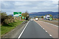
Daily life in PH4 1QR centres on accessing nearby amenities within practical reach of the small residential cluster. Residents can rely on Gleneagles Railway Station for rail connections, serving as the key transport hub for the area. This station provides the primary link to the wider transport network, allowing you to commute beyond the 4.9 hectares. For essential shopping, the area has two retail options: Spar and Co-op Auchterarder. These stores form the backbone of local daily commerce, offering groceries and basics without needing a trip to a larger town centre. The proximity of these venues means you can run errands efficiently while living in PH4 1QR. The scarcity of noted amenities underscores the village lifestyle, where residents depend on these specific outlets rather than large shopping centres. Dining and leisure options are not explicitly listed in the immediate neighbourhood data, suggesting the community relies on the broader Perth and Kinross region for entertainment. You will find that the 4.9 hectare zone prioritises function over extensive leisure infrastructure. The character of the area is defined by this reliance on the nearby railway and two primary grocery stores. Living here means integrating your routine around the schedule of Gleneagles station and the hours of the Spar and Co-op. It is a straightforward lifestyle where convenience is defined by distance to these specific named venues.
Amenities
Schools
| Rank | School | Type | Entry gender | Ages |
|---|
Explore more schools in this area
Go to Schools tabDemographics
Available demographic data for PH4 1QR is currently limited to the postcode level, meaning specific population figures, age profiles, and household compositions are not included in the provided information. Consequently, we cannot state exact percentages for home ownership or detail the diversity of the community. However, the area's classification as a specific postcode covering a small residential cluster suggests a tight-knit local population. Without data on the age profile, one cannot confirm if young professionals or families dominate the scene. The absence of deprivation statistics prevents a clear assessment of income levels or social mobility within the cluster. Residents typically rely on the broader context of Perth and Kinross to understand the wider demographic landscape. Schools near AQ4 1QR would be accessed based on proximity to the council area, but specific catchment details require further local inquiry. The community character is inferred from the housing locations rather than census data in this instance. For a precise picture of household types or ethnic diversity, official Scotland census reports would be required. Until then, the focus remains on the physical nature of the cluster itself. This approach ensures factual accuracy regarding the available information without speculating on missing social metrics.
Household Size
Accommodation Type
Tenure
Ethnic Group
Religion
Household Composition
Age
Household Deprivation
NS-SEC
Explore more demographic insights in this area
Go to Demographics tabPlanning
Planning Constraints
- Flood RiskPremium
- Ramsar Wetland SitesPremium
- Area of Outstanding Natural BeautyPremium
- Protected Nature ReservePremium
- Protected WoodlandPremium
- Crime RiskPremium