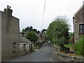
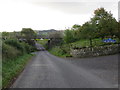
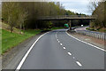
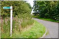
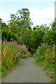
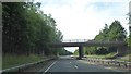
Area Overview for PH3 1FR
Photos of PH3 1FR
Area Information
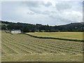
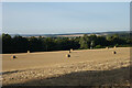
Living in PH3 1FR means residing in a specific postcode area covering a small residential cluster within the Perth and Kinross council region of Scotland. This location spans just 1.8 hectares, creating an intimate sense of place for those seeking a compact home environment. The area sits within the historic landscape of central Scotland, bordered by counties such as Angus, Dundee, and Fife, yet it retains its own distinct residential character. You will find yourself in a setting defined by local history, specifically drawing from the traditions of Perthshire and Kinross-shire which merged decades ago to form the current administrative area. Daily life here is shaped by proximity to other towns like Dunning and Auchterarder, rather than urban sprawl. The geographic coordinates place this postcode near the eastern boundary of the wider council area, offering residents a quiet foothold in a region known for its scenic valleys and established heritage. Whether you are navigating the local streets or travelling further afield, the small footprint of this postcode ensures a focused living environment.
- Area Type
- Postcode
- Area Size
- 1.8 hectares
- Population
- Not available
- Population Density
- Not available
The property market in PH3 1FR is characterised by its small scale, as this specific postcode covers only 1.8 hectares of residential land. Detailed data regarding home ownership percentages, the specific mix of semi-detached or terraced homes, and rental versus owner-occupied ratios is not available for this location. Consequently, buyers looking at homes in PH3 1FR should recognise that this area functions as a small residential cluster rather than a large estate with diverse housing options. Without information on average sale prices or the predominant accommodation types, you cannot make a direct comparison between this postcode and neighbouring areas. The market here is defined by its limited physical footprint, meaning inventory will be scarce. If you are searching for properties in this cluster, expect a narrow selection due to the restricted area size. Prospective buyers must adapt their expectations to this reality, understanding that the housing stock is fixed by the geographical constraints of the postcode. The lack of statistical data on property types suggests a homogeneous environment where few different styles of home exist side by side.
House Prices in PH3 1FR
Showing 11 properties
| Address | Type | Beds | Baths | Last Sale Price | Last Sale Date | |
|---|---|---|---|---|---|---|
| 6 Millview Close, Auchterarder, PH3 1FR | Detached | 4 | 2 | - | - | |
| 1 Millview Close, Auchterarder, PH3 1FR | Detached | 4 | - | - | - | |
| 5 Millview Close, Auchterarder, PH3 1FR | Detached | - | - | - | - | |
| 8 Millview Close, Auchterarder, PH3 1FR | Detached | 4 | 2 | - | - | |
| 10 Millview Close, Auchterarder, PH3 1FR | Detached | - | - | - | - | |
| 9 Millview Close, Auchterarder, PH3 1FR | Detached | - | - | - | - | |
| 3 Millview Close, Auchterarder, PH3 1FR | house | - | - | - | - | |
| 7 Millview Close, Auchterarder, PH3 1FR | Detached | - | - | - | - | |
| 4 Millview Close, Auchterarder, PH3 1FR | Detached | - | - | - | - | |
| 12 Millview Close, Auchterarder, PH3 1FR | Detached | - | - | - | - |
Energy Efficiency in PH3 1FR
Your lifestyle in PH3 1FR relies heavily on amenities that are within practical reach, as the local settlement itself hosts only a few essential services. Retail options are limited to three nearby outlets, specifically the Co-op in Auchterarder, a Spar, and Budgens in Dunning. These superstores provide the necessary daily shopping requirements, though you will need to travel short distances to access them rather than finding them immediately on your doorstep. For commuters, rail connectivity is available via Gleneagles Railway Station, a notable station close enough to support train travel into larger cities. This means your daily routine might involve a brief drive to catch a train, integrating regional transport into your weekly schedule. There are no parks, leisure centres, or libraries listed within the immediate amenity data for this postcode, so you should plan for cultural activities or recreation in neighbouring towns like Dunning or Auchterarder. The lifestyle here is fundamentally shaped by these reachable facilities, offering convenience but requiring residents to venture out for everything beyond basic groceries and occasional train trips. Living here means accepting that your amenities are defined by what lies just beyond the immediate residential cluster.
Amenities
Schools
| Rank | School | Type | Entry gender | Ages |
|---|
Explore more schools in this area
Go to Schools tabDemographics
The community within PH3 1FR is defined by the specific characteristics of this small residential cluster, though detailed age profiles and household type breakdowns are not provided for this specific location. Without specific figures on deprivation levels or diversity metrics for this postcode, the genuine character of the neighbourhood is best understood through its functional size and administrative context. You should approach understanding who lives here by considering the limitations of the available data rather than assuming broad generalisations. The absence of granular demographic statistics means you cannot確認 the exact mix of families, singles, or retirees within these 1.8 hectares. Any assessment of the local population must rely on the known boundaries of the postcode and the broader regional context of Perth and Kinross. For those researching schools near PH3 1FR, the lack of specific local data suggests you may need to look at wider district averages. Similarly, details regarding home ownership levels and accommodation types remain unrecorded for this specific entry. Ultimately, the demographic picture of PH3 1FR is shaped by its status as a small, defined cluster where residents likely know one another due to the limited spatial area.
Household Size
Accommodation Type
Tenure
Ethnic Group
Religion
Household Composition
Age
Household Deprivation
NS-SEC
Explore more demographic insights in this area
Go to Demographics tabPlanning
Planning Constraints
- Flood RiskPremium
- Ramsar Wetland SitesPremium
- Area of Outstanding Natural BeautyPremium
- Protected Nature ReservePremium
- Protected WoodlandPremium
- Crime RiskPremium