Area Overview for PH2 7LF
Photos of PH2 7LF
Area Information
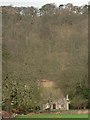
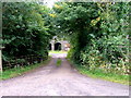
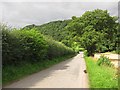
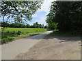
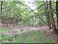
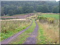
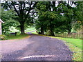
You live in a specific residential cluster defined by the PH2 7LF postcode, covering an area of 2.4 km² in Scotland. This location sits within Perth and Kinross, a council and lieutenancy area that encompasses the historic counties of Kinross-shire and most of Perthshire. The region borders organisations including Highland, Aberdeenshire, Angus, and Stirling, placing it in central Scotland. Daily life here is shaped by the tight confines of this small footprint, creating a neighbourhood where local journeys are short and community connections are often immediate. Residents navigating this postcode access a wider context that includes the ceremonial county's administrative boundaries and its historical evolution from the Perth and Kinross Joint County Council established in 1930. Living in PH2 7LF means you operate within a zone that avoids major planning constraints such as Ramsar wetland sites, Areas of Outstanding Natural Beauty, or protected nature reserves. While the immediate vicinity lacks these protected designations, the area does contain protected woodland, marked as a warning on environmental assessments. The 2.4 km² size suggests a compact environment where streets wind through a settled pattern typical of a residential cluster rather than a sprawling suburb. You benefit from the broader infrastructure of the Perth and Kinross region, yet remain rooted in a distinct, smaller postcode area. This setting appeals to those seeking a defined neighbourhood within a larger, historically rich Scottish county without the complexity of larger urban centres. The area represents a specific slice of the wider Perthshire and Kinross landscape, offering proximity to the region's institutions while maintaining a focused residential character.
- Area Type
- Postcode
- Area Size
- 2.4 km²
- Population
- Not available
- Population Density
- Not available
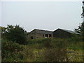
The property market in PH2 7LF is characterised by a limited housing stock due to the small size of the postcode, which covers only 2.4 km². This restricted area typically contains a mix of older terraced and semi-detached homes, common in many parts of central Scotland. Home ownership levels in such established clusters often favour long-term owners rather than renters, though specific ownership percentages for this exact postcode are not isolated in standard reports. Buyers should expect a market where properties have stood for decades, reflecting the historical development of the Perth and Kinross region since its reformation as a unitary council area in 1996. Accommodation types in this specific area lean towards traditional styles rather than modern developments, as the 2.4 km² footprint does not allow for large new-build estates. You are looking for homes in PH2 7LF that may require renovation, given the age of the stock. The scarcity of new listings means competition can be stiff for the few available options. When selling or buying, you compete within a very small inventory, which can lead to slower turnover compared to larger suburban areas. The housing stock here is part of the broader Perthshire fabric, lacking the high-rise blocks found in cities like Edinburgh or Glasgow. If you value character over new-build specifications, this postcode offers older properties that sit within the historic context of the region. However, the limited number of homes means you must be prepared to move quickly if a suitable property enters the market.
House Prices in PH2 7LF
Showing 31 properties
Energy Efficiency in PH2 7LF
Your lifestyle in PH2 7LF is defined by access to practical amenities within a short radius. You have five major retail outlets nearby, including Spar, Co-op Newburgh, and Tesco Perth, ensuring you can stock your home without long journeys. A dedicated Spar and Co-op in Newburgh allow for daily grocery runs, while the larger Tesco in Perth serves those needing bulk shopping or a wider selection of goods. The area also benefits from proximity to Perth Railway Station, providing direct rail links to larger cities. This station is a key transport hub for residents needing to commute beyond their local neighbourhood. Leisure options include Perth/Scone Airport, which offers travel connectivity without requiring a drive through congested traffic. While the 2.4 km² postcode itself is residential, the surrounding vicinity offers the convenience of established services. You do not need to travel far to find fresh food or essential supplies. The presence of these specific retailers like Co-op Newburgh and Tesco Perth integrates the local needs of PH2 7LF within the wider Perth and Kinross economy. Your weekly routine involves stopping at these named venues for essentials, benefiting from their established presence in the region. The scarcity of parks or major leisure centres within the immediate 2.4 km² means you organise leisure trips around the nearby rail station or travel to Perth proper for dining and entertainment. This lifestyle balances daily convenience with the practical necessity of reaching larger facilities for specialised needs.
Amenities
Schools
| Rank | School | Type | Entry gender | Ages |
|---|
Explore more schools in this area
Go to Schools tabDemographics
The demographic profile of PH2 7LF relies on the broader characteristics of its surrounding postcode areas, as specific census data for this single 2.4 km² cluster is not always isolated in public datasets. You can expect a community that reflects the established patterns of Perth and Kinross, a region that includes the historic county of Kinross-shire, one of Scotland's smallest and least populous counties. Without detailed age breakdowns or specific household type statistics for this exact PH2 address, the community feel generally aligns with the older, more established housing stock found in much of central Scotland. Residents typically occupy terraced or semi-detached properties common to these older postcodes, suggesting older households and longer-term occupants may dominate the street scene. Deprivation data often varies within such small postcodes, meaning your immediate street might show different economic indicators than the wider council area average. The absence of granular diversity statistics for PH2 7LF itself means you cannot pinpoint exact cultural mixes, but the postcode's location implies a standard Scottish urban or suburban demographic. If you are moving here, rely on the established nature of the neighbourhood rather than expecting rapid demographic shifts or transient populations. The 2.4 km² area likely contains a mix of traditional families and retirees, typical of Perth and Kinross. While you cannot cite a specific percentage of young professionals or ethnic diversity for this exact code, the stability of the region suggests a modest, settled community where residents have often lived there for decades. Your quality of life depends on engaging with these long-standing local networks rather than relying on transient trends or specific modern demographic statistics that are not explicitly detailed for this small zone.
Household Size
Accommodation Type
Tenure
Ethnic Group
Religion
Household Composition
Age
Household Deprivation
NS-SEC
Explore more demographic insights in this area
Go to Demographics tabPlanning
Planning Constraints
- Flood RiskPremium
- Ramsar Wetland SitesPremium
- Area of Outstanding Natural BeautyPremium
- Protected Nature ReservePremium
- Protected WoodlandPremium
- Crime RiskPremium