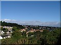
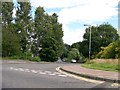
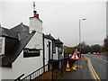
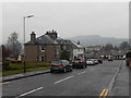
Area Overview for PH2 0ES
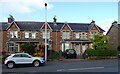
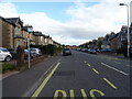
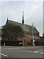
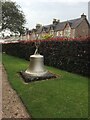
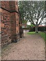
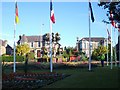
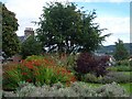
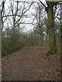
Photos of PH2 0ES
Area Information
Ph2 0ES represents a specific postcode area covering a small residential cluster in Perth, Scotland. You will find that this location spans 4576 square metres, which defines its status as a tight-knit neighbourhood rather than a sprawling district. The area sits within the broader PH2 postcode, serving as a defined point of address for those seeking homes in this specific part of Perth. Daily life here centres on immediate proximity to the city centre and surrounding infrastructure. This is a place where residents navigate a compact landscape, ensuring that essential services and transport links remain within easy reach without the need for lengthy commutes. The distinct size of the neighbourhood creates a sense of intimacy, limiting the typical sprawl found in larger suburban developments. Prospective buyers will note that the physical footprint is small, concentrating the local community into a manageable environment. This density often means that local events and street interactions happen with frequency. The area type description highlights its function as a residential hub, prioritising living spaces over commercial expansions. When you consider living in PH2 0ES, you are choosing a location that blends urban convenience with a contained residential setting. The cluster nature of the postcode ensures that your future home remains close to key community anchors. It is a straightforward choice for those who prefer a defined neighbourhood without extensive travel times.
- Area Type
- Postcode
- Area Size
- 4576 m²
- Population
- Not available
- Population Density
- Not available
The property market within PH2 0ES is characterised by the definition of the area as a small residential cluster covering 4576 square metres. This specific footprint suggests that the housing stock consists of closely grouped homes typical of a tight neighbourhood rather than a sprawling development. While detailed ownership percentages or rental yield data are not provided in the available records, the nature of the postcode indicates a focus on residential accommodation. The area type description confirms that the land is dedicated to housing, implying that the majority of the 4576 square metres supports living environments. Potential buyers should understand that this is a defined residential zone where properties are likely to be clustered together. The absence of specific data on the ratio of owner-occupied homes to private rentals prevents a full market analysis, but the context points towards stable residential use. Homes in this postcode are situated near the broader Perth infrastructure, which often supports a mix of long-term residents and commuters. The compact size of the area means that property transactions may involve a smaller, more specific pool of listings compared to larger districts. When viewing homes in PH2 0ES, you are entering a market defined by its limited geographic spread. The density of the cluster influences how properties are marketed and how quickly they may move depending on local demand.
House Prices in PH2 0ES
Showing 18 properties
| Address | Type | Beds | Baths | Last Sale Price | Last Sale Date | |
|---|---|---|---|---|---|---|
| 5 Queens Court, Perth, PH2 0ES | Flat | 2 | 1 | - | - | |
| 16 Queens Court, Perth, PH2 0ES | Flat | 2 | 1 | - | - | |
| 2 Queens Court, Perth, PH2 0ES | Flat | 2 | 1 | - | - | |
| 17 Queens Court, Perth, PH2 0ES | Flat | - | - | - | - | |
| 1 Queens Court, Perth, PH2 0ES | Flat | - | - | - | - | |
| 3 Queens Court, Perth, PH2 0ES | Flat | - | - | - | - | |
| 4 Queens Court, Perth, PH2 0ES | Flat | - | - | - | - | |
| 6 Queens Court, Perth, PH2 0ES | Flat | - | - | - | - | |
| 18 Queens Court, Perth, PH2 0ES | Flat | - | - | - | - | |
| 13 Queens Court, Perth, PH2 0ES | Flat | - | - | - | - |
Energy Efficiency in PH2 0ES
Living in PH2 0ES places you within practical reach of several key amenities that enhance daily convenience. The retail options nearby include Co-op Perth, Tesco Perth, and Aldi Craigie, providing five distinct shopping venues within easy access. You can purchase groceries and household essentials from these well-known chains without long journeys. For transportation, the nearby rail network includes Perth Railway Station, which connects you to national transport links. This rail access supports your daily commute or travels outside the Perth area. Additionally, Perth/Scone Airport is listed as a notable amenity, offering convenient air travel if your lifestyle requires it. These amenities sit within the immediate neighbourhood of the 4576 square metre residential cluster. The presence of multiple retailers ensures that you do not need to leave the city immediately for daily shopping needs. The rail station provides a structured way to reach the wider national network, while the airport supports occasional international travel requirements. Residents benefit from having these services clustered close to their homes in PH2 0ES. The area offers a practical blend of local retail, public transport, and air travel options. You will find that the combination of Co-op, Tesco, and the nearby station creates a supportive environment for your weekly routine.
Amenities
Schools
| Rank | School | Type | Entry gender | Ages |
|---|
Explore more schools in this area
Go to Schools tabDemographics
Information regarding age profiles, household types, or specific diversity statistics for PH2 0ES is not available in the current records. Without data on the local population's age distribution or the mix of single-person households versus families, it is impossible to construct a precise demographic picture using verified figures. Similarly, there is no disclosed information about the percentage of young professionals or retirees calling this specific postcode home. Attempts to describe the community's composition would therefore rely on assumptions rather than facts. The absence of these specific metrics means we cannot comment on the generational mix or family structures present in the area. Regarding deprivation levels, no statistics are provided for this postcode area. Consequently, we cannot assess how housing value, income levels, or access to opportunities might fluctuate across PH2 0ES compared to national averages. Lack of available data prevents any claim about whether this is an area of high or low socio-economic status. While crime risk data is available for areas in England, the current system does not supply similar figures for Scotland. This gap means we cannot offer insights into local safety trends or reported incidents within the residential cluster. The demographic landscape of PH2 0ES remains undefined based on the figures currently at hand.
Household Size
Accommodation Type
Tenure
Ethnic Group
Religion
Household Composition
Age
Household Deprivation
NS-SEC
Explore more demographic insights in this area
Go to Demographics tabPlanning
Planning Constraints
- Flood RiskPremium
- Ramsar Wetland SitesPremium
- Area of Outstanding Natural BeautyPremium
- Protected Nature ReservePremium
- Protected WoodlandPremium
- Crime & SafetyPremium