Area Overview for PH18 5TD
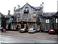
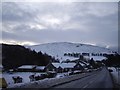
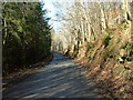
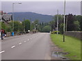
Photos of PH18 5TD
Area Information
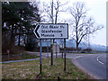
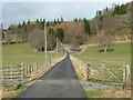
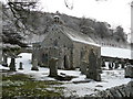
PH18 5TD is a specific postcode area covering a small residential cluster in Scotland. This compact zone spans 3087 square metres, making it a defined pocket within the broader Perth and Kinross council area. Living in PH18 5TD means residing in a location that forms part of the historic counties of Kinross-shire and Perthshire. The area sits within central Scotland, bordered by Highland, Aberdeenshire, Angus, Dundee, Fife, Clackmannanshire, Stirling, and Argyll and Bute. While the postcode is small, it connects residents to the wider Tayside region. The joint administrative history of Perth and Kinross dates back to 1930, with the unitary council area establishing itself in 1996. Life here is situated near the eastern boundary of Perth and Kinross. You are accessing a setting defined by its precise geographical boundaries and deep historical roots in Scottish local governance. Understanding the area's scale helps you appreciate its place within the larger ceremonial and administrative landscape of the Highlands and central lowlands.
- Area Type
- Postcode
- Area Size
- 3087 m²
- Population
- Not available
- Population Density
- Not available
The property market profile for PH18 5TD relies on general data for Scotland and Perth and Kinross, as specific statistics for this tiny postcode are not included. You should note that the area holds a Floored Score of 29, which does not directly indicate housing type but reflects a metric within the broader assessment of the location. There is no specific data on the percentage of owner-occupied versus rental homes in this precise PM18 5TD cluster. Similarly, details on accommodation types, such as the number of terraced homes, estates, or apartment blocks, are not available for this specific grid square. The available information confirms the area's size and its status within the Perth and Kinross unitary council area, but it does not provide a breakdown of residential stock. Consequently, you cannot determine from the provided facts whether this neighbourhood is characterised by Victorian tenements, modern developments, or traditional single-family homes. House purchasing in this cluster requires reliance on wider regional trends rather than hyper-local market figures.
House Prices in PH18 5TD
Showing 8 properties
| Address | Type | Beds | Baths | Last Sale Price | Last Sale Date | |
|---|---|---|---|---|---|---|
| 2 Blackwood Place, Bridge Of Tilt, PH18 5TD | house | 2 | 1 | - | - | |
| 3 Blackwood Place, Bridge Of Tilt, PH18 5TD | Terraced | 3 | 1 | - | - | |
| 5 Blackwood Place, Bridge Of Tilt, PH18 5TD | house | - | - | - | - | |
| 1 Blackwood Place, Bridge Of Tilt, PH18 5TD | house | - | - | - | - | |
| 6 Blackwood Place, Bridge Of Tilt, PH18 5TD | Terraced | - | - | - | - | |
| 8 Blackwood Place, Bridge Of Tilt, PH18 5TD | house | - | - | - | - | |
| 7 Blackwood Place, Bridge Of Tilt, PH18 5TD | house | - | - | - | - | |
| 4 Blackwood Place, Bridge Of Tilt, PH18 5TD | Terraced | - | - | - | - |
Energy Efficiency in PH18 5TD
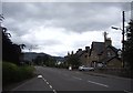
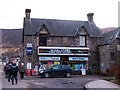
Living in PH18 5TD places you within reach of specific practical amenities, though options remain limited to two retail locations and two railway stations. The nearest shops include a Spar and a Co-op located in Pitlochry. These venues serve as your primary source for groceries and daily essentials within the immediate neighbourhood radius. For your travel needs, two rail stations are available: Blair Atholl Railway Station and Pitlochry Railway Station. Access to these stations connects you to the wider rail network, allowing you to travel to Perth, Dundee, and Glasgow. The proximity of Pitlochry is significant, as it offers a larger town centre environment compared to the small residential cluster of this postcode. Your lifestyle revolves around these two key hubs, where you can manage shopping and commuting needs without traveling far from your home.
Amenities
Schools
| Rank | School | Type | Entry gender | Ages |
|---|
Explore more schools in this area
Go to Schools tabDemographics
The demographic data for PH18 5TD is not included in the provided information. Consequently, there are no specific figures available to describe the age profile, household types, or diversity of the community within this postcode. Without access to census data or local authority statistics for this specific small area, it is impossible to state whether the residents are predominantly retired, young families, or working professionals. Information regarding home ownership levels or the presence of students in the immediate 3087 square metre cluster is also absent from the current dataset. Therefore, any attempt to detail the social composition of the neighbourhood would rely on speculation rather than fact. Buyers looking for insights into the social fabric of PH18 5TD must look beyond this specific postcode level, as the available data only confirms the physical location and historical context of the area.
Household Size
Accommodation Type
Tenure
Ethnic Group
Religion
Household Composition
Age
Household Deprivation
NS-SEC
Explore more demographic insights in this area
Go to Demographics tabPlanning
Planning Constraints
- Flood RiskPremium
- Ramsar Wetland SitesPremium
- Area of Outstanding Natural BeautyPremium
- Protected Nature ReservePremium
- Protected WoodlandPremium
- Crime RiskPremium