Area Overview for PH16 5LS
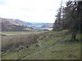
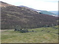
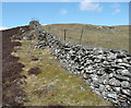
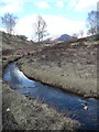
Photos of PH16 5LS


Area Information
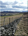
PH16 5LS sits within the historic ceremonial area of Perth and Kinross, covering a compact residential cluster of just 2.0 km². You will find yourself in central Scotland, bordered by Highland and Aberdeenshire to the north and Fife to the east. This postcode represents a specific, small-scale location rather than a broad town or village district. The area forms part of the larger administrative region that was established as a unitary council in 1996, combining the legacy of Perthshire and Kinross-shire. Daily life here is defined by space and locality, distinct from the denser urban environments of Edinburgh or Glasgow. Residents access the broader attractions of Perth and Kinross while living in a contained environment. There are no major commercial hubs or industrial zones immediately adjacent to this specific postcode. The landscape is shaped by the administrative boundaries set in 1975 and refined by 1994 legislation. You are buying into a quiet corner of a larger historic county. The area does not feature the dense population clusters found in larger councils. Instead, it offers a focused residential experience where neighbours are likely closer together. The size of the land means you are not lost in a sprawl. You enjoy proximity to established services without the pressure of high-density living arrangements common elsewhere. This specific parcel defines a tranquil slice of Scottish housing. The demographic profile of PH16 5LS is not detailed in the current analysis. You cannot determine the average age of residents, the split between families and single occupants, or the percentage of people who own their homes based on the available information. Similarly, there is no data on household composition or the diversity of the population within this 2 km² zone. Deprivation indices are also unavailable for this specific postcode. This lack of specific demographic figures means you must look at broader regional trends for context rather than local statistics. You cannot claim to know the income levels or educational attainment of your neighbours using present data. The absence of these numbers prevents a detailed picture of the community's social fabric. Buyers should understand that the area functions as a residential space without the granularity of population studies. You rely on the physical setting and proximity to amenities rather than census-driven insights to gauge the lifestyle. The community exists, but the specific metrics defining its makeup are not provided. This gap in data applies to all social indicators ranging from tenure rates to age brackets. It is a limitation of the current information set. You will need to visit the neighbourhood to understand the people who live here personally. Statistics for this exact location simply do not exist in the source material. The property market in PH16 5LS is characterised by a very limited stock due to the postcode's small size. The available data does not provide specific figures on home ownership percentages or the mix of rental and owner-occupied properties. You cannot determine whether the area leans towards new builds or established forestry housing without further records. This scarcity of data points suggests a local market driven more by absolute numbers than percentage splits of tenure. The housing stock likely reflects a residential cluster typical of smaller postcode areas in Perth and Kinross. There is no information on whether the majority of homes are flats or single-family dwellings. Buyers looking at this location should account for the fixed land area of 2.0 km² when assessing availability. The market here is not defined by broad statistical trends but by the specific properties currently listed. You cannot rely on standard metrics like average sale prices or turnover rates as they are absent. The area does not support a large volume of transactions that would generate robust market statistics. Potential buyers must treat this as a niche location within the larger Perth and Kinross housing landscape. The lack of property type breakdowns means you must inspect individual listings to understand the accommodation available. A significant portion of the housing stock may be within the protected woodland noted in assessments. This constraint affects how many residential units can legally exist on the land. The market is quiet, reflected in the absence of detailed transaction data. Connectivity for residents of PH16 5LS is generally reliable for personal devices but moderate for fixed-line internet. You can expect fair to good mobile coverage throughout the area, indicated by a score of 81. This level of signal strength should support most daily communication and smartphone navigation needs. The fixed broadband infrastructure holds a lower quality score of 57. This rating suggests you may experience slower speeds or interruptions compared to suburban areas with excellent fibre connections. If you work from home, you might find the internet connection requires careful setup or backup plans. Streaming or large file downloads could be impacted by this moderate broadband performance. However, the mobile network offers solid granary for remote work communication tools. You have access to two railway stations within practical reach: Blair Atholl Railway Station and Pitlochry Railway Station. These rail links provide direct connections to Perth and beyond, integrating you into the wider Scottish transport network. You are not isolated from main line travel despite the residential nature of the postcode. The combination of decent mobile signals and accessible rail services creates a functional balance for commuters. Walking to shops is convenient given the cluster's small footprint. The digital experience is mixed, offering strong personal connectivity but variable home internet reliability. Daily life in PH16 5LS revolves around a compact range of amenities located within walking or short driving distance. You have access to two primary retail options: Spar and the Co-op in Pitlochry. These shops provide essential grocery needs without the need to travel far into Perth city centre. For rail travel, two stations serve the immediate vicinity: Blair Atholl Railway Station and Pitlochry Railway Station. This dual station access offers flexibility for your commute or leisure trips. The area integrates seamlessly with the wider Pitlochry townscape while maintaining its own residential identity. You do not need a car for minor errands, though one becomes essential for broader exploration. Specific leisure venues like cinemas or major shopping malls are not listed in the immediate amenity data. Your lifestyle is anchored by these specific local services. The proximity to Pitlochry means you benefit from the town's cultural offerings while living in a smaller district. The 2 km² size ensures these amenities are never far away. You will find the Co-op and Spar close enough for regular visits. Rail passengers can easily reach Blair Atholl or Pitlochry for their travel needs. This setup supports a practical, community-focused way of life without urban chaos. Your safety and environmental security in PH16 5LS are underpinned by several passing environmental assessments. The area passes with a low flood risk level, holding a score of 2.57 on a zero-to-one hundred scale. This low score indicates minimal threat from flooding events. You face no planning restrictions related to Ramsar wetland sites or Areas of Outstanding Natural Beauty. Both of these categories show a score of zero, confirming their total absence from your property's immediate surroundings. This means standard construction and development rules apply without special heritage constraints. However, you must note a warning regarding protected woodland. The area contains a footprint of protected woodland with a score of 4.26. This constraint may limit future extensions or landscaping in certain zones. You should check specific boundaries during your viewing to ensure no conflict. There is no available crime risk data for this specific postcode. Crime statistics are currently only calculated for areas in England, leaving a gap in local safety reporting. You must rely on general local knowledge rather than automated crime maps. The environmental outlook is largely positive, barring the specific woodland restrictions. What is the character of the PH16 5LS community and who typically lives here?The community is a small residential cluster covering just 2.0 km² within Perth and Kinross. You cannot access specific age or household type data, but the area functions as a focused living space. It sits near Pitlochry, blending rural tranquility with local town access. The population is defined by proximity to amenities rather than high-density urban living. How good is the transport and digital connection for working from home?Mobile coverage is strong with a score of 81, supporting most devices well. However, fixed broadband is moderate at a score of 57. You may find internet speeds sufficient for communication but perhaps slower for heavy downloads. Two rail stations, Blair Atholl and Pitlochry, are nearby for train travel. Are there any environmental or planning risks I should be aware of?Flood risk is low with a score of 2.57, and there are no Ramsar sites or AONBs. You must note a warning score of 4.26 for protected woodland. This restriction could affect building extensions or garden work. There is no crime data available as statistics are not published for Scotland. What shops and services are available within practical reach?You have two retail options: Spar and Co-op Pitlochry. For transport, Blair Atholl Railway Station and Pitlochry Railway Station are accessible within practical reach. These services integrate you into the wider network without needing to travel far into the city.
- Area Type
- Postcode
- Area Size
- 2.0 km²
- Population
- Not available
- Population Density
- Not available
The property market in PH16 5LS is characterised by a very limited stock due to the postcode's small size. The available data does not provide specific figures on home ownership percentages or the mix of rental and owner-occupied properties. You cannot determine whether the area leans towards new builds or established forestry housing without further records. This scarcity of data points suggests a local market driven more by absolute numbers than percentage splits of tenure. The housing stock likely reflects a residential cluster typical of smaller postcode areas in Perth and Kinross. There is no information on whether the majority of homes are flats or single-family dwellings. Buyers looking at this location should account for the fixed land area of 2.0 km² when assessing availability. The market here is not defined by broad statistical trends but by the specific properties currently listed. You cannot rely on standard metrics like average sale prices or turnover rates as they are absent. The area does not support a large volume of transactions that would generate robust market statistics. Potential buyers must treat this as a niche location within the larger Perth and Kinross housing landscape. The lack of property type breakdowns means you must inspect individual listings to understand the accommodation available. A significant portion of the housing stock may be within the protected woodland noted in assessments. This constraint affects how many residential units can legally exist on the land. The market is quiet, reflected in the absence of detailed transaction data. Connectivity for residents of PH16 5LS is generally reliable for personal devices but moderate for fixed-line internet. You can expect fair to good mobile coverage throughout the area, indicated by a score of 81. This level of signal strength should support most daily communication and smartphone navigation needs. The fixed broadband infrastructure holds a lower quality score of 57. This rating suggests you may experience slower speeds or interruptions compared to suburban areas with excellent fibre connections. If you work from home, you might find the internet connection requires careful setup or backup plans. Streaming or large file downloads could be impacted by this moderate broadband performance. However, the mobile network offers solid granary for remote work communication tools. You have access to two railway stations within practical reach: Blair Atholl Railway Station and Pitlochry Railway Station. These rail links provide direct connections to Perth and beyond, integrating you into the wider Scottish transport network. You are not isolated from main line travel despite the residential nature of the postcode. The combination of decent mobile signals and accessible rail services creates a functional balance for commuters. Walking to shops is convenient given the cluster's small footprint. The digital experience is mixed, offering strong personal connectivity but variable home internet reliability. Daily life in PH16 5LS revolves around a compact range of amenities located within walking or short driving distance. You have access to two primary retail options: Spar and the Co-op in Pitlochry. These shops provide essential grocery needs without the need to travel far into Perth city centre. For rail travel, two stations serve the immediate vicinity: Blair Atholl Railway Station and Pitlochry Railway Station. This dual station access offers flexibility for your commute or leisure trips. The area integrates seamlessly with the wider Pitlochry townscape while maintaining its own residential identity. You do not need a car for minor errands, though one becomes essential for broader exploration. Specific leisure venues like cinemas or major shopping malls are not listed in the immediate amenity data. Your lifestyle is anchored by these specific local services. The proximity to Pitlochry means you benefit from the town's cultural offerings while living in a smaller district. The 2 km² size ensures these amenities are never far away. You will find the Co-op and Spar close enough for regular visits. Rail passengers can easily reach Blair Atholl or Pitlochry for their travel needs. This setup supports a practical, community-focused way of life without urban chaos. Your safety and environmental security in PH16 5LS are underpinned by several passing environmental assessments. The area passes with a low flood risk level, holding a score of 2.57 on a zero-to-one hundred scale. This low score indicates minimal threat from flooding events. You face no planning restrictions related to Ramsar wetland sites or Areas of Outstanding Natural Beauty. Both of these categories show a score of zero, confirming their total absence from your property's immediate surroundings. This means standard construction and development rules apply without special heritage constraints. However, you must note a warning regarding protected woodland. The area contains a footprint of protected woodland with a score of 4.26. This constraint may limit future extensions or landscaping in certain zones. You should check specific boundaries during your viewing to ensure no conflict. There is no available crime risk data for this specific postcode. Crime statistics are currently only calculated for areas in England, leaving a gap in local safety reporting. You must rely on general local knowledge rather than automated crime maps. The environmental outlook is largely positive, barring the specific woodland restrictions. What is the character of the PH16 5LS community and who typically lives here?The community is a small residential cluster covering just 2.0 km² within Perth and Kinross. You cannot access specific age or household type data, but the area functions as a focused living space. It sits near Pitlochry, blending rural tranquility with local town access. The population is defined by proximity to amenities rather than high-density urban living. How good is the transport and digital connection for working from home?Mobile coverage is strong with a score of 81, supporting most devices well. However, fixed broadband is moderate at a score of 57. You may find internet speeds sufficient for communication but perhaps slower for heavy downloads. Two rail stations, Blair Atholl and Pitlochry, are nearby for train travel. Are there any environmental or planning risks I should be aware of?Flood risk is low with a score of 2.57, and there are no Ramsar sites or AONBs. You must note a warning score of 4.26 for protected woodland. This restriction could affect building extensions or garden work. There is no crime data available as statistics are not published for Scotland. What shops and services are available within practical reach?You have two retail options: Spar and Co-op Pitlochry. For transport, Blair Atholl Railway Station and Pitlochry Railway Station are accessible within practical reach. These services integrate you into the wider network without needing to travel far into the city.
House Prices in PH16 5LS
Showing 7 properties
Energy Efficiency in PH16 5LS
Daily life in PH16 5LS revolves around a compact range of amenities located within walking or short driving distance. You have access to two primary retail options: Spar and the Co-op in Pitlochry. These shops provide essential grocery needs without the need to travel far into Perth city centre. For rail travel, two stations serve the immediate vicinity: Blair Atholl Railway Station and Pitlochry Railway Station. This dual station access offers flexibility for your commute or leisure trips. The area integrates seamlessly with the wider Pitlochry townscape while maintaining its own residential identity. You do not need a car for minor errands, though one becomes essential for broader exploration. Specific leisure venues like cinemas or major shopping malls are not listed in the immediate amenity data. Your lifestyle is anchored by these specific local services. The proximity to Pitlochry means you benefit from the town's cultural offerings while living in a smaller district. The 2 km² size ensures these amenities are never far away. You will find the Co-op and Spar close enough for regular visits. Rail passengers can easily reach Blair Atholl or Pitlochry for their travel needs. This setup supports a practical, community-focused way of life without urban chaos. Your safety and environmental security in PH16 5LS are underpinned by several passing environmental assessments. The area passes with a low flood risk level, holding a score of 2.57 on a zero-to-one hundred scale. This low score indicates minimal threat from flooding events. You face no planning restrictions related to Ramsar wetland sites or Areas of Outstanding Natural Beauty. Both of these categories show a score of zero, confirming their total absence from your property's immediate surroundings. This means standard construction and development rules apply without special heritage constraints. However, you must note a warning regarding protected woodland. The area contains a footprint of protected woodland with a score of 4.26. This constraint may limit future extensions or landscaping in certain zones. You should check specific boundaries during your viewing to ensure no conflict. There is no available crime risk data for this specific postcode. Crime statistics are currently only calculated for areas in England, leaving a gap in local safety reporting. You must rely on general local knowledge rather than automated crime maps. The environmental outlook is largely positive, barring the specific woodland restrictions. What is the character of the PH16 5LS community and who typically lives here?The community is a small residential cluster covering just 2.0 km² within Perth and Kinross. You cannot access specific age or household type data, but the area functions as a focused living space. It sits near Pitlochry, blending rural tranquility with local town access. The population is defined by proximity to amenities rather than high-density urban living. How good is the transport and digital connection for working from home?Mobile coverage is strong with a score of 81, supporting most devices well. However, fixed broadband is moderate at a score of 57. You may find internet speeds sufficient for communication but perhaps slower for heavy downloads. Two rail stations, Blair Atholl and Pitlochry, are nearby for train travel. Are there any environmental or planning risks I should be aware of?Flood risk is low with a score of 2.57, and there are no Ramsar sites or AONBs. You must note a warning score of 4.26 for protected woodland. This restriction could affect building extensions or garden work. There is no crime data available as statistics are not published for Scotland. What shops and services are available within practical reach?You have two retail options: Spar and Co-op Pitlochry. For transport, Blair Atholl Railway Station and Pitlochry Railway Station are accessible within practical reach. These services integrate you into the wider network without needing to travel far into the city.
Amenities
Schools
| Rank | School | Type | Entry gender | Ages |
|---|
Explore more schools in this area
Go to Schools tabDemographics
The demographic profile of PH16 5LS is not detailed in the current analysis. You cannot determine the average age of residents, the split between families and single occupants, or the percentage of people who own their homes based on the available information. Similarly, there is no data on household composition or the diversity of the population within this 2 km² zone. Deprivation indices are also unavailable for this specific postcode. This lack of specific demographic figures means you must look at broader regional trends for context rather than local statistics. You cannot claim to know the income levels or educational attainment of your neighbours using present data. The absence of these numbers prevents a detailed picture of the community's social fabric. Buyers should understand that the area functions as a residential space without the granularity of population studies. You rely on the physical setting and proximity to amenities rather than census-driven insights to gauge the lifestyle. The community exists, but the specific metrics defining its makeup are not provided. This gap in data applies to all social indicators ranging from tenure rates to age brackets. It is a limitation of the current information set. You will need to visit the neighbourhood to understand the people who live here personally. Statistics for this exact location simply do not exist in the source material. The property market in PH16 5LS is characterised by a very limited stock due to the postcode's small size. The available data does not provide specific figures on home ownership percentages or the mix of rental and owner-occupied properties. You cannot determine whether the area leans towards new builds or established forestry housing without further records. This scarcity of data points suggests a local market driven more by absolute numbers than percentage splits of tenure. The housing stock likely reflects a residential cluster typical of smaller postcode areas in Perth and Kinross. There is no information on whether the majority of homes are flats or single-family dwellings. Buyers looking at this location should account for the fixed land area of 2.0 km² when assessing availability. The market here is not defined by broad statistical trends but by the specific properties currently listed. You cannot rely on standard metrics like average sale prices or turnover rates as they are absent. The area does not support a large volume of transactions that would generate robust market statistics. Potential buyers must treat this as a niche location within the larger Perth and Kinross housing landscape. The lack of property type breakdowns means you must inspect individual listings to understand the accommodation available. A significant portion of the housing stock may be within the protected woodland noted in assessments. This constraint affects how many residential units can legally exist on the land. The market is quiet, reflected in the absence of detailed transaction data. Connectivity for residents of PH16 5LS is generally reliable for personal devices but moderate for fixed-line internet. You can expect fair to good mobile coverage throughout the area, indicated by a score of 81. This level of signal strength should support most daily communication and smartphone navigation needs. The fixed broadband infrastructure holds a lower quality score of 57. This rating suggests you may experience slower speeds or interruptions compared to suburban areas with excellent fibre connections. If you work from home, you might find the internet connection requires careful setup or backup plans. Streaming or large file downloads could be impacted by this moderate broadband performance. However, the mobile network offers solid granary for remote work communication tools. You have access to two railway stations within practical reach: Blair Atholl Railway Station and Pitlochry Railway Station. These rail links provide direct connections to Perth and beyond, integrating you into the wider Scottish transport network. You are not isolated from main line travel despite the residential nature of the postcode. The combination of decent mobile signals and accessible rail services creates a functional balance for commuters. Walking to shops is convenient given the cluster's small footprint. The digital experience is mixed, offering strong personal connectivity but variable home internet reliability. Daily life in PH16 5LS revolves around a compact range of amenities located within walking or short driving distance. You have access to two primary retail options: Spar and the Co-op in Pitlochry. These shops provide essential grocery needs without the need to travel far into Perth city centre. For rail travel, two stations serve the immediate vicinity: Blair Atholl Railway Station and Pitlochry Railway Station. This dual station access offers flexibility for your commute or leisure trips. The area integrates seamlessly with the wider Pitlochry townscape while maintaining its own residential identity. You do not need a car for minor errands, though one becomes essential for broader exploration. Specific leisure venues like cinemas or major shopping malls are not listed in the immediate amenity data. Your lifestyle is anchored by these specific local services. The proximity to Pitlochry means you benefit from the town's cultural offerings while living in a smaller district. The 2 km² size ensures these amenities are never far away. You will find the Co-op and Spar close enough for regular visits. Rail passengers can easily reach Blair Atholl or Pitlochry for their travel needs. This setup supports a practical, community-focused way of life without urban chaos. Your safety and environmental security in PH16 5LS are underpinned by several passing environmental assessments. The area passes with a low flood risk level, holding a score of 2.57 on a zero-to-one hundred scale. This low score indicates minimal threat from flooding events. You face no planning restrictions related to Ramsar wetland sites or Areas of Outstanding Natural Beauty. Both of these categories show a score of zero, confirming their total absence from your property's immediate surroundings. This means standard construction and development rules apply without special heritage constraints. However, you must note a warning regarding protected woodland. The area contains a footprint of protected woodland with a score of 4.26. This constraint may limit future extensions or landscaping in certain zones. You should check specific boundaries during your viewing to ensure no conflict. There is no available crime risk data for this specific postcode. Crime statistics are currently only calculated for areas in England, leaving a gap in local safety reporting. You must rely on general local knowledge rather than automated crime maps. The environmental outlook is largely positive, barring the specific woodland restrictions. What is the character of the PH16 5LS community and who typically lives here?The community is a small residential cluster covering just 2.0 km² within Perth and Kinross. You cannot access specific age or household type data, but the area functions as a focused living space. It sits near Pitlochry, blending rural tranquility with local town access. The population is defined by proximity to amenities rather than high-density urban living. How good is the transport and digital connection for working from home?Mobile coverage is strong with a score of 81, supporting most devices well. However, fixed broadband is moderate at a score of 57. You may find internet speeds sufficient for communication but perhaps slower for heavy downloads. Two rail stations, Blair Atholl and Pitlochry, are nearby for train travel. Are there any environmental or planning risks I should be aware of?Flood risk is low with a score of 2.57, and there are no Ramsar sites or AONBs. You must note a warning score of 4.26 for protected woodland. This restriction could affect building extensions or garden work. There is no crime data available as statistics are not published for Scotland. What shops and services are available within practical reach?You have two retail options: Spar and Co-op Pitlochry. For transport, Blair Atholl Railway Station and Pitlochry Railway Station are accessible within practical reach. These services integrate you into the wider network without needing to travel far into the city.
Household Size
Accommodation Type
Tenure
Ethnic Group
Religion
Household Composition
Age
Household Deprivation
NS-SEC
Explore more demographic insights in this area
Go to Demographics tabPlanning
Planning Constraints
- Flood RiskPremium
- Ramsar Wetland SitesPremium
- Area of Outstanding Natural BeautyPremium
- Protected Nature ReservePremium
- Protected WoodlandPremium
- Crime RiskPremium