Area Overview for PH16 5EN
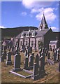
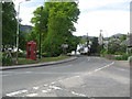
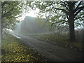
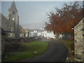
Photos of PH16 5EN


Area Information
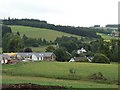
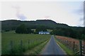
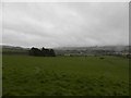
PH16 5EN is a small residential cluster located in central Scotland within the Perth and Kinross council area. This specific postcode covers 6.2 hectares, indicating a concentrated living area where homes are situated close to one another. The location sits within the historic counties of Perthshire and Kinross-shire, regions that combined to form the current unitary council in 1996. Neighbouring this small postcode, the historic county boundaries include Perthshire, which has been administered by a sheriff since medieval times. For anyone considering living in PH16 5EN, the area offers a compact footprint typical of residential clusters rather than sprawling suburbs. The surroundings encompass parts of the broader Perth and Kinross lieutenancy area, bordered by Highland and Aberdeenshire to the north and Dundee to the east. Despite the small geographical size of 6.2 hectares, the area provides a defined community setting for residents. Daily life here involves navigating a localised environment where distance between properties is naturally short. Buyers should understand that this postcode represents a specific slice of the larger Perth and Kinross landscape, characterised by its residential density and historical context. The area does not contain any designated Ramsar wetland sites, areas of outstanding natural beauty, or protected woodlands within its immediate boundaries. This means planning constraints related to these specific designations are unlikely to impact current residential developments. The location remains part of the central Scotland region, offering proximity to larger towns while maintaining a distinctly local character. Living in PH16 5EN means engaging with a community defined by its small scale and historical significance within the wider Scottish administrative structure.
- Area Type
- Postcode
- Area Size
- 6.2 hectares
- Population
- Not available
- Population Density
- Not available
The property market for PH16 5EN is defined primarily by its size and classification as a postcode rather than a distinct town or large village. Specific data regarding the number of homes listed, average sale prices, or years on market for properties in this 6.2-hectare area are not included in the current records. Consequently, it is not possible to state whether this area is predominantly an owner-occupied market or if rental activity dominates the local landscape. Without statistics on home ownership percentages, buyers cannot determine how many residents purchase their dwellings versus renting them. The absence of accommodation type data means there is no information on whether the housing stock consists mostly of flats, terraced houses, detached homes, or mixed developments. No figures are provided on the ratio of existing properties to new builds within this specific cluster. Potential buyers looking at homes in PH16 5EN must rely on general knowledge of the Perth and Kinross region, as granular market data for this postcode is unavailable. The area's small size suggests a tight-knit housing stock where individual properties might be known through local channels rather than broad market reports. Without price indicators or tenure statistics, the financial aspect of purchasing in this location remains unclear in this report. Future market analysis would require specific transaction records for this postcode to provide a factual overview of inflation, volume, or demand trends.
House Prices in PH16 5EN
Showing 17 properties
| Address | Type | Beds | Baths | Last Sale Price | Last Sale Date | |
|---|---|---|---|---|---|---|
| 8 Duff Avenue, Moulin, PH16 5EN | Bungalow | - | - | - | - | |
| 9 Duff Avenue, Moulin, PH16 5EN | Semi-detached | - | - | - | - | |
| Dinarn, 10 Duff Avenue, Moulin, PH16 5EN | Bungalow | - | - | - | - | |
| 12 Duff Avenue, Moulin, PH16 5EN | Semi-detached | - | - | - | - | |
| Woodside Barn, 11 Duff Avenue, Moulin, PH16 5EN | Bungalow | - | - | - | - | |
| 4A Duff Avenue, Moulin, PH16 5EN | Detached | - | - | - | - | |
| 2 Duff Avenue, Moulin, PH16 5EN | Bungalow | - | - | - | - | |
| Vrackie View, 5 Duff Avenue, Moulin, PH16 5EN | Bungalow | - | - | - | - | |
| 3 Duff Avenue, Moulin, PH16 5EN | Detached | - | - | - | - | |
| 6 Duff Avenue, Moulin, PH16 5EN | Semi-detached | - | - | - | - |
Energy Efficiency in PH16 5EN
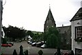
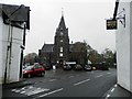
Residents of PH16 5EN have practical access to several amenities within close reach, despite the small size of the 6.2-hectare area. Retail options are limited but functional, with three notable stores identified nearby. A Co-op in Pitlochry is located within practical reach, alongside two Spar outlets. These shops provide essential shopping needs for anyone living in PH16 5EN, though they do not offer the extensive variety of a large high street. Transport connections are supported by two railway stations within easy access. Pitlochry Railway Station and Blair Atholl Railway Station serve as key hubs for residents requiring rail travel beyond their immediate local area. Access to these stations facilitates journeys to central Scotland or beyond, reducing reliance on private vehicles for longer trips. The presence of these two stations indicates that the area is integrated into the wider transport network of Perth and Kinross. There is no data on public parks, leisure centres, or dining venues immediately adjacent to this specific postcode, but the nearby Pitlochry station suggests proximity to local recreational facilities in the surrounding town. Buyers interested in the lifestyle aspects of PH16 5EN should consider how the distance to Pitlochry and Blair Atholl fits their daily commute or leisure schedule. The area does not contain designated protected nature reserves or areas of outstanding natural beauty, meaning development and green space priorities follow standard local planning rules rather than strict conservation constraints.
Amenities
Schools
| Rank | School | Type | Entry gender | Ages |
|---|
Explore more schools in this area
Go to Schools tabDemographics
This section currently omits specific demographic data for PH16 5EN. The available records do not provide information regarding the age profile, household types, or diversity levels within this particular postcode. Without figures on age distribution, it is impossible to describe whether the community comprises families, young professionals, or retirees. Similarly, there is no data available on home ownership levels or the specific mix of accommodation types for this 6.2-hectare cluster. Information regarding deprivation data and quality-of-life indices linked to specific household metrics is also absent from the current records. Consequently, any attempt to detail the social composition of residents in PH16 5EN would rely on speculation rather than fact. Buyers seeking to understand the community's demographic makeup must look to broader local authority data or census reports that cover specific postcodes with such granularity. The national census provides some insight into Scotland's general population, but precise neighbourhood-level breakdowns for this small area are not included in the provided dataset. Therefore, this review refrains from making claims about the nationality, age, or family structures of the people living here. The lack of detailed statistics prevents a clear picture of who constitutes the local population. Potential residents should be aware that comprehensive social data for PH16 5EN is not currently available for analysis.
Household Size
Accommodation Type
Tenure
Ethnic Group
Religion
Household Composition
Age
Household Deprivation
NS-SEC
Explore more demographic insights in this area
Go to Demographics tabPlanning
Planning Constraints
- Flood RiskPremium
- Ramsar Wetland SitesPremium
- Area of Outstanding Natural BeautyPremium
- Protected Nature ReservePremium
- Protected WoodlandPremium
- Crime RiskPremium