Area Overview for PH15 2HT
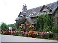
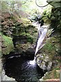
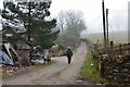
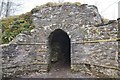
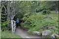
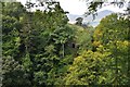
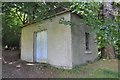
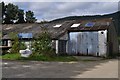
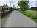
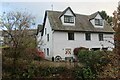
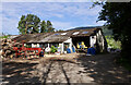
Photos of PH15 2HT

Area Information
The postcode PH15 2HT identifies a compact residential cluster within the wider Perth and Kinross council area in central Scotland. You will find this small pocket situated near the historic counties of Kinross-shire and Perthshire, regions that merged administratively in 1930 to form a unitary council in 1996. This specific location spans just 9438 square metres, creating a tight-knit neighbourhood rather than a sprawling suburb. Life here operates at a human scale, where the boundaries of Dundee and Perthshire often overlap in the landscape around you. The area sits at coordinates 56.459819, -3.136195, placing it logically within the Dundee region while retaining the character of its surrounding countryside. Residents of PH15 2HT likely value privacy due to the limited landmass covered by the postcode. The setting reflects a tranquil environment distinct from the busy city centres of East Anglia or elsewhere in the UK. You are living in an area defined by its specific grid reference and its historical roots in ancient sheriffdoms and county councils. The neighbourhood represents a slice of central Scotland rich in heritage where the modern world meets centuries of local governance.
- Area Type
- Postcode
- Area Size
- 9438 m²
- Population
- Not available
- Population Density
- Not available
The housing stock for PH15 2HT falls under the classification of a specific postcode area covering a small residential cluster. Available data does not supply the home ownership percentage, so you cannot determine if most residents in this postcode own their property or are tenants. There is also no breakdown of accommodation types to indicate whether you are looking at semidetached houses, apartments, or detached dwellings within these 9438 square metres. This lack of specific inventory details makes it difficult to gauge whether the current market favours first-time buyers seeking flats or families looking for larger homes. You cannot assess the spread of prices or the condition of homes near school grounds because the property composition is undisclosed. The market picture remains incomplete; high-level trends for Perth and Kinross exist, but the micro-market for PH15 2HT lacks the specific file types needed to describe the average dwelling. Prospective buyers must rely on general knowledge of the region rather than specific property data for this exact code.
House Prices in PH15 2HT
Showing 12 properties
| Address | Type | Beds | Baths | Last Sale Price | Last Sale Date | |
|---|---|---|---|---|---|---|
| 12 Ballinlaggan, Acharn, PH15 2HT | Semi-detached | 3 | 1 | - | - | |
| 8 Ballinlaggan, Acharn, PH15 2HT | Terraced | 4 | 2 | - | - | |
| 10 Ballinlaggan, Acharn, PH15 2HT | house | 5 | - | - | - | |
| 5 Ballinlaggan, Acharn, PH15 2HT | Bungalow | - | - | - | - | |
| 4 Ballinlaggan, Acharn, PH15 2HT | house | - | - | - | - | |
| 3 Ballinlaggan, Acharn, PH15 2HT | house | - | - | - | - | |
| 11 Ballinlaggan, Acharn, PH15 2HT | Bungalow | - | - | - | - | |
| 6 Ballinlaggan, Acharn, PH15 2HT | Bungalow | - | - | - | - | |
| 9 Ballinlaggan, Acharn, PH15 2HT | house | - | - | - | - | |
| 1 Ballinlaggan, Acharn, PH15 2HT | Flat | - | - | - | - |
Energy Efficiency in PH15 2HT
Amenities
Schools
| Rank | School | Type | Entry gender | Ages |
|---|
Explore more schools in this area
Go to Schools tabDemographics
You will not find granular demographic breakdowns such as age profiles or household types for PH15 2HT in the available records. The data does not provide specific figures on how many families with young children reside in this small postcode or what percentage of residents own their homes versus rent. Without these specific numbers, it is impossible to claim exactly who constitutes the daily community in this cluster. Similarly, there is no information regarding ethnic diversity or educational attainment levels for people living within these precise coordinates. The absence of deprivational data means you cannot assess local income inequalities or access to services based on standard metrics. While the broader Perth and Kinross area contains diverse populations, the specific PH15 2HT cluster lacks the statistical depth to define its unique demographic identity at this moment. Homebuyers must approach the social fabric of this area without the benefit of detailed census tabulations provided in this dataset. The community feel remains an inference rather than a calculated statistic for this particular location.
Household Size
Accommodation Type
Tenure
Ethnic Group
Religion
Household Composition
Age
Household Deprivation
NS-SEC
Explore more demographic insights in this area
Go to Demographics tabPlanning
Planning Constraints
- Flood RiskPremium
- Ramsar Wetland SitesPremium
- Area of Outstanding Natural BeautyPremium
- Protected Nature ReservePremium
- Protected WoodlandPremium
- Crime RiskPremium