Area Overview for PH14 9QJ
Photos of PH14 9QJ
Area Information
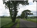
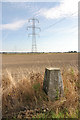
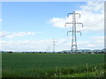
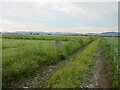
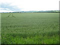
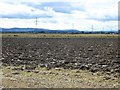
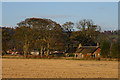
PH14 9QJ represents a specific residential cluster within the wider Perth and Kinross region of Scotland. This area covers 56.2 hectares of land, indicating a compact settlement rather than a sprawling suburb. Living in PH14 9QJ means inhabiting a postcode designated as a small residential cluster, which suggests a tightly knit environment. The location falls under the council administration of Perth and Kinross, an area that encompasses the historic counties of Kinross-shire and most of Perthshire. You are situated in central Scotland, adjacent to the Dundee area near the eastern boundary of the larger council region. The geography here is defined by its integration into the broader administrative landscape of the lieutenancy area. Daily life involves navigating this specific patch of land while being connected to the administrative history that defines Perth and Kinross. Residents benefit from the established infrastructure of the region without necessarily being located in the largest town centres. The area's identity is rooted in its status as a distinct part of the unitary council area formed in 1996. Understanding the boundaries and size of PH14 9QJ helps you appreciate the scale of your immediate surroundings versus the wider region you access.
- Area Type
- Postcode
- Area Size
- 56.2 hectares
- Population
- Not available
- Population Density
- Not available
The property market in PH14 9QJ is governed by the physical reality of a specific residential cluster within the Perth and Kinross boundaries. Housing stock here consists of homes fitted within the 56.2 hectares that define this postcode. A significant distinction for buyers is that 66.4% of local authority housing in the broader region is in the private rented sector, indicating a strong rental presence that influences local demand. This statistic suggests that while you may find homes for purchase, the rental market is robust and competitive within the immediate surroundings. The area likely features a mix of property types, but the clarity of scale is limited to the postcode level data. You are looking at a market where ownership and tenancy rates balance out based on regional averages. If you are seeking a home, understanding that the broader area leans towards private renting means competition for owned properties may be lower, or conversely, available stock is scarcer. The housing stock serves residents of this small cluster, meaning choices might be fewer than in larger towns like Dundee or Perth. Buyers should consider this specific area as a component of the wider Tayside property landscape, where prices are influenced by the connectivity to nearby amenities and transport hubs.
House Prices in PH14 9QJ
Showing 4 properties
Energy Efficiency in PH14 9QJ
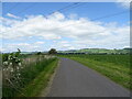
Your daily life in PH14 9QJ revolves around a set of amenities located within a practical radius of the residential cluster. Retail options include Spar, appearing twice in the immediate vicinity, alongside M&S Bullionfield BP, ensuring basic shopping and fueling needs are met without long drives. The commercial presence is concentrated with five retail outlets serving the local population. For those who prefer public transport, Invergowrie Railway Station offers a direct rail connection to wider regional services. Travelers seeking air connectivity have two options close by: Dundee Airport and Dundee City Airport. These airports provide links to major UK cities, reducing the need for road journeys for business or leisure trips. The convenience of these facilities is a significant asset for living in PH14 9QJ. You do not need to travel far for essential services, with five retail outlets and transport hubs all designated as nearby amenities. The cluster's size ensures that these amenities are genuinely reachable for most residents. While the area may lack extensive leisure parks or large shopping centres, the core necessities are present. This configuration supports a lifestyle that values local accessibility over urban exploration.
Amenities
Schools
| Rank | School | Type | Entry gender | Ages |
|---|
Explore more schools in this area
Go to Schools tabDemographics
The demographic profile of PH14 9QJ reflects the specific composition of households residing in this residential cluster. While the broader Perth and Kinross area has a diverse population, this small postcode cluster hosts a distinct group of residents with specific housing needs. You can expect a mix of accommodation types typical of a small residential zone, though exact figures for flat versus house proportions are specific to this postcode. The community makeup includes owner-occupiers and potential renters, mirroring the regional trend where 66.4% of local authority housing is in the private rented sector, though ownership rates vary within specific clusters. The nature of the community is shaped by the 56.2 hectares of land available for habitation. No separate deprivation index score is provided for this specific postcode, so you must consider the general context of the region rather than localised statistics. Family units and single occupants likely coexist within the housing stock. The age profile and household types remain consistent with the patterns seen across the largest towns in the council area, such as Dundee or Perth. Understanding these demographic realities helps you gauge the neighbourly dynamics and the type of people who call PH14 9QJ home.
Household Size
Accommodation Type
Tenure
Ethnic Group
Religion
Household Composition
Age
Household Deprivation
NS-SEC
Explore more demographic insights in this area
Go to Demographics tabPlanning
Planning Constraints
- Flood RiskPremium
- Ramsar Wetland SitesPremium
- Area of Outstanding Natural BeautyPremium
- Protected Nature ReservePremium
- Protected WoodlandPremium
- Crime & SafetyPremium