Area Overview for PH13 9LR
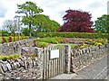
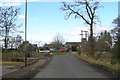
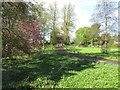
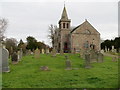
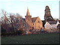
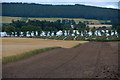
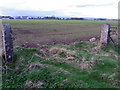
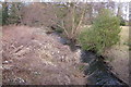
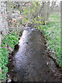
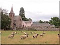
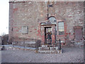
Photos of PH13 9LR
Area Information
PH13 9LR represents a specific postcode area covering a small residential cluster within the wider Perth and Kinross council region. This location sits in central Scotland, an historic area defined by the merger of Perthshire and Kinross-shire. The area spans 4.2 hectares, creating a dense pocket of housing designed for practical urban or suburban living rather than expansive countryside sprawl. Residents here benefit from the central Scottish context, bordered by major regions such as Dundee, Fife, and Stirling. Life in this cluster is defined by its proximity to established towns like Coupar Angus, where many households likely access local services. The location avoids significant planning constraints, with no coverage of Ramsar wetland sites, Areas of Outstanding Natural Beauty, protected nature reserves, or protected woodland. This absence of restrictions suggests straightforward land use and development potential while maintaining a standard residential environment. You will find a setting that prioritises straightforward access over unique scenic designations, offering a pragmatic living situation within a well-structured local government area.
- Area Type
- Postcode
- Area Size
- 4.2 hectares
- Population
- Not available
- Population Density
- Not available
PH13 9LR operates as a small residential cluster without specific data detailing its unique percentage of owner-occupied homes or rental stock. The exact types of accommodation, such as flats or detached houses, are not recorded for this specific postcode. Consequently, you cannot determine if the market is primarily driven by buyers or landlords in this immediate 4.2-hectare zone. The area's character is defined by its small size, which often means property values can fluctuate based on the specific amenities accessed nearby, such as the Co-op Scotmid outlets in Coupar Angus. While the corporation area of Perth and Kinross is a large entity, this small cluster lacks distinct market statistics like median price or regeneration indices in the provided information. Buyers should treat this location as part of the general local housing market rather than a unique micro-economy. The housing stock likely consists of standard residential units suitable for the local population, existing within a framework of no protected woodland or nature reserves. Understanding the local market requires moving beyond the postcode itself to the broader district of Coupar Angus and surrounding areas.
House Prices in PH13 9LR
Showing 1 properties
| Address | Type | Beds | Baths | Last Sale Price | Last Sale Date | |
|---|---|---|---|---|---|---|
| Kirklands, Access Road From The C 18 South Eastwards To Newtyle Road, Kettins, PH13 9LR | Detached | - | - | - | - |
Energy Efficiency in PH13 9LR
Daily life in PH13 9LR revolves around essential services and local shops within easy reach. The nearest amenities are located within practical distance, offering practical retail options for residents. You can visit the Co-op Scotmid Coupar Angus 2, Co-op Scotmid Coupar Angus 1, or the Spar stores to handle your weekly shopping and household needs. These five nearby retail outlets form the core commercial environment for the postcode, ensuring you have access to groceries and everyday essentials without a long drive. While broader leisure facilities, parks, or cinemas are not listed in the immediate amenity data for this cluster, the presence of local stores creates a convenient routine for daily errands. The proximity to Coupar Angus suggests that further entertainment and dining likely exist just beyond the cluster boundaries. You will find a lifestyle focused on convenience and practicality, relying on these named stores for your regular supplies. The area avoids the constraints of protected nature reserves, meaning the immediate surroundings are dedicated to residential use and standard amenities rather than conservation zones.
Amenities
Schools
| Rank | School | Type | Entry gender | Ages |
|---|
Explore more schools in this area
Go to Schools tabDemographics
The community profile for PH13 9LR reflects the broader characteristics of its specific postcode clustering. Exact figures regarding age distribution, household types, or diversity are not provided for this specific cluster, meaning you cannot pinpoint a precise demographic slice for this 4.2-hectare zone. Without specific statistics on ownership levels or accommodation types for PH13 9LR alone, you must rely on regional trends of the Perth and Kinross area to form an informed view. This lack of granular data means the area likely mirrors the standard residential patterns found across the central Scotland region. While broader council data might show a mix of owners and renters, specific deprivation figures or school catchment details for this exact postcode remain unknown. You should approach the community as a standard residential cluster where the local population adapts to the available infrastructure. The absence of detailed census data for this specific cluster prevents hyper-specific claims about who lives there, yet the location remains a functional residential environment for families and individuals seeking housing in the central belt of Scotland.
Household Size
Accommodation Type
Tenure
Ethnic Group
Religion
Household Composition
Age
Household Deprivation
NS-SEC
Explore more demographic insights in this area
Go to Demographics tabPlanning
Planning Constraints
- Flood RiskPremium
- Ramsar Wetland SitesPremium
- Area of Outstanding Natural BeautyPremium
- Protected Nature ReservePremium
- Protected WoodlandPremium
- Crime RiskPremium