Area Overview for PH11 8LW
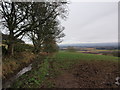
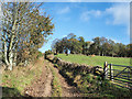
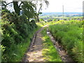
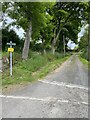
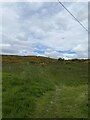
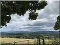
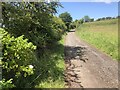
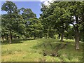
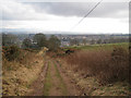
Photos of PH11 8LW


Area Information
PH11 8LW represents a small residential cluster located in Scotland, covering an area of 4.5 hectares. This postcode serves as a defined point within the broader Perth and Kinross region, which encompasses historic counties and lies in central Scotland. You are approaching a specific neighbourhood size that balances isolation with proximity to local services. Living in PH11 8LW means navigating a compact environment where every property is close to its neighbour. The area borders the wider Dundee region to the east, though you remain firmly within the administrative boundaries of Perth and Kinross. Daily life here involves a straightforward routine without the noise of major developments. You will find yourself part of a contained community where the surroundings are clearly defined by the 4.5-hectare limit. Homes in PH11 8LW offer a sense of enclosure that larger suburbs often lack. The location sits near coordinates 56.459819, -3.136195, placing it in a recognised zone for anyone looking at maps of the Dundee and Perthshire borderlands. This specific postcode does not offer a sprawling landscape but rather a precise pocket of living space. ### Community characteristics in PH11 8LW are shaped by the specific constraints of Scottish housing and local planning. The area exists within the larger Perth and Kinross council framework, where household composition varies across neighbouring zones. You will not find detailed age profiles or household breakdowns for this specific postcode within the current available records. Instead, you should look at the broader context of the region to understand the typical demographic landscape. House ownership in Scotland often shifts between council, private, and shared ownership models depending on the specific housing stock. Diversity figures are generally recorded at the local government area level rather than individual postcodes. For PH11 8LW, this means assessing who lives there requires understanding the wider Perth and Kinross population trends. Deprivation indices are also calculated at a local authority level to provide a more robust picture of living standards. Without granular data for this cluster, you cannot definitively state the average tenure or income levels for every resident. The community likely reflects the typical Scottish demographic of working families, retired couples, and young professionals seeking stability. Planning constraints indicate no protected woodlands or nature reserves that would significantly alter demographic patterns. Ultimately, you are entering a standard Scottish residential zone where community identity builds over time rather than being mandated by unique data points. ### The housing stock in PH11 8LW consists of private residential units typical of a small postcode cluster in central Scotland. You are looking at a market defined by the 4.5-hectare footprint that limits the total number of available homes. Living in this area often means choosing between affordable flats or semi-detached terraced houses common in Perthshire. The property market here does not reflect the grand scale of larger towns but operates on a micro level. Ownership tenure in Scotland often places many residents in the private sector, though social housing remains significant in older clusters. When buying homes in PH11 8LW, you will find limited inventory due to the compact size of the residential zone. This scarcity can create a focused market where existing stock holds steady value. Accommodation types are likely to be a mix of post-war builds and traditional Scottish housing styles. You do not find luxury estates or high-density developments that characterise inner-city Glasgow. Instead, the focus remains on practical living spaces designed for local needs. The area functions as part of the broader Perth and Kinross property landscape, meaning prices will track with regional trends. Buyers seeking a small footprint with immediate access to amenities will find this postcode suitable. However, the limited land area means potential for expansion or renovation is constrained by the defined boundary. ### Digital connectivity for residents of PH11 8LW presents a mixed picture that you need to consider carefully. Mobile network quality is rated as good, with a score of 81 out of 100. This suggests you can expect reliable signal for calls and basic data usage throughout the 4.5-hectare cluster. Fixed broadband quality, however, scores lower at 32 out of 100. This rating indicates a fair connection that may struggle with high-speed demands or multiple simultaneous devices. For someone working from home, this discrepancy is a critical factor in your decision to live in PH11 8LW. You may face latency issues or slower download speeds during peak usage times. The mobile coverage provides a safety net for emergencies but does not fully compensate for the slower fixed lines. Video conferencing might require patience, and large file transfers could take longer than usual. This infrastructure reflects the infrastructure status of smaller residential areas in Perth and Kinross. You are trading some digital speed for the convenience of living in a quiet, small neighbourhood. It is worth testing fibre availability directly with providers before committing to a long-term lease or purchase. Overall, you get adequate mobile service but must accept limitations on fixed broadband performance. ### Living in PH11 8LW offers practical access to essential retail services within a short walk. You will find five major retail locations nearby, creating a convenient hub for daily shopping needs. Specific venues include a Co-op Alyth, a Co-op Scotmid, and a Spar, all situated within practical reach of residents. These supermarkets provide everything from fresh groceries to household essentials, meaning you rarely need to travel far for supplies. This concentration of shops ensures that a typical day involves walking to local stores rather than navigating longer commutes. The area functions as a functional residential zone where lifestyle centres on local convenience. You do not find high-end boutiques or large supermarkets that dominate city outskirts, but the presence of three different stores covers most requirements. Dining options in the immediate vicinity are limited to these retail stores, so you may need to look slightly further afield for restaurants. Parks and leisure facilities are not explicitly listed for this cluster, suggesting a quiet domestic life focused on home and local shopping. You build your routine around the Co-op and Spar, visiting them for weekly provisions such as bread, milk, and fruit. This setup supports a low-key lifestyle where errands are quick and the walk to a shop is manageable. Residents value the ability to meet daily needs without planning extensive trips. ### Safety in PH11 8LW involves several environmental factors that you should consider when evaluating the area. Flood risk is assessed as passing with a score of 0 out of 100, indicating very low risk of flooding. This is a positive finding for anyone concerned about property damage or insurance costs. You live in an area where water-related hazards are not a primary planning concern. There are no Ramsar wetland sites within the 4.5 hectares, meaning no specially protected wetlands impose restrictions on development or usage. The area also lacks coverage as an Area of Outstanding Natural Beauty, which simplifies planning permissions for future changes. There are no protected nature reserves or preserved woodlands that would limit where you place a garden or outbuilding. Additionally, the land does not contain protected woodland features. Regarding crime risk, specific data is currently unavailable for Scottish areas like this one. You cannot rely on local crime statistics for PH11 8LW as the system only provides figures for England. This absence of data means you must rely on general Scottish crime trends and personal observation. Physical environment assessments all pass with zero risk scores, highlighting a static and safe landscape. The low flood score and lack of planning constraints suggest a stable environment for building or renovating. ### Is PH11 8LW a good area for families?The area covers 4.5 hectares and is located within Perth and Kinross. It provides low flood risk and good mobile connectivity with a score of 81. Access includes retail venues like Co-op Alyth and Spar within walking distance. However, fixed broadband scores 32 out of 100, which may limit home working capabilities. Who typically lives in this postcode?Precise demographic data for PH11 8LW is not available in the current records. The area functions as a small residential cluster serving the wider Perth and Kinross region. Housing likely includes a mix of private ownership and social tenancy typical of Scottish postcodes near the Dundee border. Are there any safety concerns in PH11 8LW?Flood risk is minimal with a score of 0 out of 100. The area has no Ramsar sites, nature reserves, or protected woodlands that complicate ownership. Crime risk data is unavailable for Scotland, so you should check local police reports for the broader Perth and Kinross area. What amenities are nearby for daily life?Residents have five nearby retail options within practical reach. These include Co-op Alyth, Co-op Scotmid, and a Spar. These shops provide groceries and essentials directly on your doorstep. You do not have nearby parks or leisure centres listed for this specific cluster.
- Area Type
- Postcode
- Area Size
- 4.5 hectares
- Population
- Not available
- Population Density
- Not available
The housing stock in PH11 8LW consists of private residential units typical of a small postcode cluster in central Scotland. You are looking at a market defined by the 4.5-hectare footprint that limits the total number of available homes. Living in this area often means choosing between affordable flats or semi-detached terraced houses common in Perthshire. The property market here does not reflect the grand scale of larger towns but operates on a micro level. Ownership tenure in Scotland often places many residents in the private sector, though social housing remains significant in older clusters. When buying homes in PH11 8LW, you will find limited inventory due to the compact size of the residential zone. This scarcity can create a focused market where existing stock holds steady value. Accommodation types are likely to be a mix of post-war builds and traditional Scottish housing styles. You do not find luxury estates or high-density developments that characterise inner-city Glasgow. Instead, the focus remains on practical living spaces designed for local needs. The area functions as part of the broader Perth and Kinross property landscape, meaning prices will track with regional trends. Buyers seeking a small footprint with immediate access to amenities will find this postcode suitable. However, the limited land area means potential for expansion or renovation is constrained by the defined boundary. ### Digital connectivity for residents of PH11 8LW presents a mixed picture that you need to consider carefully. Mobile network quality is rated as good, with a score of 81 out of 100. This suggests you can expect reliable signal for calls and basic data usage throughout the 4.5-hectare cluster. Fixed broadband quality, however, scores lower at 32 out of 100. This rating indicates a fair connection that may struggle with high-speed demands or multiple simultaneous devices. For someone working from home, this discrepancy is a critical factor in your decision to live in PH11 8LW. You may face latency issues or slower download speeds during peak usage times. The mobile coverage provides a safety net for emergencies but does not fully compensate for the slower fixed lines. Video conferencing might require patience, and large file transfers could take longer than usual. This infrastructure reflects the infrastructure status of smaller residential areas in Perth and Kinross. You are trading some digital speed for the convenience of living in a quiet, small neighbourhood. It is worth testing fibre availability directly with providers before committing to a long-term lease or purchase. Overall, you get adequate mobile service but must accept limitations on fixed broadband performance. ### Living in PH11 8LW offers practical access to essential retail services within a short walk. You will find five major retail locations nearby, creating a convenient hub for daily shopping needs. Specific venues include a Co-op Alyth, a Co-op Scotmid, and a Spar, all situated within practical reach of residents. These supermarkets provide everything from fresh groceries to household essentials, meaning you rarely need to travel far for supplies. This concentration of shops ensures that a typical day involves walking to local stores rather than navigating longer commutes. The area functions as a functional residential zone where lifestyle centres on local convenience. You do not find high-end boutiques or large supermarkets that dominate city outskirts, but the presence of three different stores covers most requirements. Dining options in the immediate vicinity are limited to these retail stores, so you may need to look slightly further afield for restaurants. Parks and leisure facilities are not explicitly listed for this cluster, suggesting a quiet domestic life focused on home and local shopping. You build your routine around the Co-op and Spar, visiting them for weekly provisions such as bread, milk, and fruit. This setup supports a low-key lifestyle where errands are quick and the walk to a shop is manageable. Residents value the ability to meet daily needs without planning extensive trips. ### Safety in PH11 8LW involves several environmental factors that you should consider when evaluating the area. Flood risk is assessed as passing with a score of 0 out of 100, indicating very low risk of flooding. This is a positive finding for anyone concerned about property damage or insurance costs. You live in an area where water-related hazards are not a primary planning concern. There are no Ramsar wetland sites within the 4.5 hectares, meaning no specially protected wetlands impose restrictions on development or usage. The area also lacks coverage as an Area of Outstanding Natural Beauty, which simplifies planning permissions for future changes. There are no protected nature reserves or preserved woodlands that would limit where you place a garden or outbuilding. Additionally, the land does not contain protected woodland features. Regarding crime risk, specific data is currently unavailable for Scottish areas like this one. You cannot rely on local crime statistics for PH11 8LW as the system only provides figures for England. This absence of data means you must rely on general Scottish crime trends and personal observation. Physical environment assessments all pass with zero risk scores, highlighting a static and safe landscape. The low flood score and lack of planning constraints suggest a stable environment for building or renovating. ### Is PH11 8LW a good area for families?The area covers 4.5 hectares and is located within Perth and Kinross. It provides low flood risk and good mobile connectivity with a score of 81. Access includes retail venues like Co-op Alyth and Spar within walking distance. However, fixed broadband scores 32 out of 100, which may limit home working capabilities. Who typically lives in this postcode?Precise demographic data for PH11 8LW is not available in the current records. The area functions as a small residential cluster serving the wider Perth and Kinross region. Housing likely includes a mix of private ownership and social tenancy typical of Scottish postcodes near the Dundee border. Are there any safety concerns in PH11 8LW?Flood risk is minimal with a score of 0 out of 100. The area has no Ramsar sites, nature reserves, or protected woodlands that complicate ownership. Crime risk data is unavailable for Scotland, so you should check local police reports for the broader Perth and Kinross area. What amenities are nearby for daily life?Residents have five nearby retail options within practical reach. These include Co-op Alyth, Co-op Scotmid, and a Spar. These shops provide groceries and essentials directly on your doorstep. You do not have nearby parks or leisure centres listed for this specific cluster.
House Prices in PH11 8LW
Showing 15 properties
| Address | Type | Beds | Baths | Last Sale Price | Last Sale Date | |
|---|---|---|---|---|---|---|
| 8 Glenisla View, Alyth, PH11 8LW | Detached | 4 | 3 | - | - | |
| 9 Glenisla View, Alyth, PH11 8LW | Bungalow | 2 | 1 | - | - | |
| 12 Glenisla View, Alyth, PH11 8LW | Detached | 3 | 2 | - | - | |
| 2 Glenisla View, Alyth, PH11 8LW | Bungalow | 3 | 2 | - | - | |
| 16 Glenisla View, Alyth, PH11 8LW | Bungalow | 3 | 2 | - | - | |
| 14 Glenisla View, Alyth, PH11 8LW | Detached | 5 | 2 | - | - | |
| 6 Glenisla View, Alyth, PH11 8LW | Detached | - | - | - | - | |
| 11 Glenisla View, Alyth, PH11 8LW | Detached | - | - | - | - | |
| 4 Glenisla View, Alyth, PH11 8LW | Detached | - | - | - | - | |
| 3 Glenisla View, Alyth, PH11 8LW | Detached | - | - | - | - |
Energy Efficiency in PH11 8LW
Living in PH11 8LW offers practical access to essential retail services within a short walk. You will find five major retail locations nearby, creating a convenient hub for daily shopping needs. Specific venues include a Co-op Alyth, a Co-op Scotmid, and a Spar, all situated within practical reach of residents. These supermarkets provide everything from fresh groceries to household essentials, meaning you rarely need to travel far for supplies. This concentration of shops ensures that a typical day involves walking to local stores rather than navigating longer commutes. The area functions as a functional residential zone where lifestyle centres on local convenience. You do not find high-end boutiques or large supermarkets that dominate city outskirts, but the presence of three different stores covers most requirements. Dining options in the immediate vicinity are limited to these retail stores, so you may need to look slightly further afield for restaurants. Parks and leisure facilities are not explicitly listed for this cluster, suggesting a quiet domestic life focused on home and local shopping. You build your routine around the Co-op and Spar, visiting them for weekly provisions such as bread, milk, and fruit. This setup supports a low-key lifestyle where errands are quick and the walk to a shop is manageable. Residents value the ability to meet daily needs without planning extensive trips. ### Safety in PH11 8LW involves several environmental factors that you should consider when evaluating the area. Flood risk is assessed as passing with a score of 0 out of 100, indicating very low risk of flooding. This is a positive finding for anyone concerned about property damage or insurance costs. You live in an area where water-related hazards are not a primary planning concern. There are no Ramsar wetland sites within the 4.5 hectares, meaning no specially protected wetlands impose restrictions on development or usage. The area also lacks coverage as an Area of Outstanding Natural Beauty, which simplifies planning permissions for future changes. There are no protected nature reserves or preserved woodlands that would limit where you place a garden or outbuilding. Additionally, the land does not contain protected woodland features. Regarding crime risk, specific data is currently unavailable for Scottish areas like this one. You cannot rely on local crime statistics for PH11 8LW as the system only provides figures for England. This absence of data means you must rely on general Scottish crime trends and personal observation. Physical environment assessments all pass with zero risk scores, highlighting a static and safe landscape. The low flood score and lack of planning constraints suggest a stable environment for building or renovating. ### Is PH11 8LW a good area for families?The area covers 4.5 hectares and is located within Perth and Kinross. It provides low flood risk and good mobile connectivity with a score of 81. Access includes retail venues like Co-op Alyth and Spar within walking distance. However, fixed broadband scores 32 out of 100, which may limit home working capabilities. Who typically lives in this postcode?Precise demographic data for PH11 8LW is not available in the current records. The area functions as a small residential cluster serving the wider Perth and Kinross region. Housing likely includes a mix of private ownership and social tenancy typical of Scottish postcodes near the Dundee border. Are there any safety concerns in PH11 8LW?Flood risk is minimal with a score of 0 out of 100. The area has no Ramsar sites, nature reserves, or protected woodlands that complicate ownership. Crime risk data is unavailable for Scotland, so you should check local police reports for the broader Perth and Kinross area. What amenities are nearby for daily life?Residents have five nearby retail options within practical reach. These include Co-op Alyth, Co-op Scotmid, and a Spar. These shops provide groceries and essentials directly on your doorstep. You do not have nearby parks or leisure centres listed for this specific cluster.
Amenities
Schools
| Rank | School | Type | Entry gender | Ages |
|---|
Explore more schools in this area
Go to Schools tabDemographics
Community characteristics in PH11 8LW are shaped by the specific constraints of Scottish housing and local planning. The area exists within the larger Perth and Kinross council framework, where household composition varies across neighbouring zones. You will not find detailed age profiles or household breakdowns for this specific postcode within the current available records. Instead, you should look at the broader context of the region to understand the typical demographic landscape. House ownership in Scotland often shifts between council, private, and shared ownership models depending on the specific housing stock. Diversity figures are generally recorded at the local government area level rather than individual postcodes. For PH11 8LW, this means assessing who lives there requires understanding the wider Perth and Kinross population trends. Deprivation indices are also calculated at a local authority level to provide a more robust picture of living standards. Without granular data for this cluster, you cannot definitively state the average tenure or income levels for every resident. The community likely reflects the typical Scottish demographic of working families, retired couples, and young professionals seeking stability. Planning constraints indicate no protected woodlands or nature reserves that would significantly alter demographic patterns. Ultimately, you are entering a standard Scottish residential zone where community identity builds over time rather than being mandated by unique data points. ### The housing stock in PH11 8LW consists of private residential units typical of a small postcode cluster in central Scotland. You are looking at a market defined by the 4.5-hectare footprint that limits the total number of available homes. Living in this area often means choosing between affordable flats or semi-detached terraced houses common in Perthshire. The property market here does not reflect the grand scale of larger towns but operates on a micro level. Ownership tenure in Scotland often places many residents in the private sector, though social housing remains significant in older clusters. When buying homes in PH11 8LW, you will find limited inventory due to the compact size of the residential zone. This scarcity can create a focused market where existing stock holds steady value. Accommodation types are likely to be a mix of post-war builds and traditional Scottish housing styles. You do not find luxury estates or high-density developments that characterise inner-city Glasgow. Instead, the focus remains on practical living spaces designed for local needs. The area functions as part of the broader Perth and Kinross property landscape, meaning prices will track with regional trends. Buyers seeking a small footprint with immediate access to amenities will find this postcode suitable. However, the limited land area means potential for expansion or renovation is constrained by the defined boundary. ### Digital connectivity for residents of PH11 8LW presents a mixed picture that you need to consider carefully. Mobile network quality is rated as good, with a score of 81 out of 100. This suggests you can expect reliable signal for calls and basic data usage throughout the 4.5-hectare cluster. Fixed broadband quality, however, scores lower at 32 out of 100. This rating indicates a fair connection that may struggle with high-speed demands or multiple simultaneous devices. For someone working from home, this discrepancy is a critical factor in your decision to live in PH11 8LW. You may face latency issues or slower download speeds during peak usage times. The mobile coverage provides a safety net for emergencies but does not fully compensate for the slower fixed lines. Video conferencing might require patience, and large file transfers could take longer than usual. This infrastructure reflects the infrastructure status of smaller residential areas in Perth and Kinross. You are trading some digital speed for the convenience of living in a quiet, small neighbourhood. It is worth testing fibre availability directly with providers before committing to a long-term lease or purchase. Overall, you get adequate mobile service but must accept limitations on fixed broadband performance. ### Living in PH11 8LW offers practical access to essential retail services within a short walk. You will find five major retail locations nearby, creating a convenient hub for daily shopping needs. Specific venues include a Co-op Alyth, a Co-op Scotmid, and a Spar, all situated within practical reach of residents. These supermarkets provide everything from fresh groceries to household essentials, meaning you rarely need to travel far for supplies. This concentration of shops ensures that a typical day involves walking to local stores rather than navigating longer commutes. The area functions as a functional residential zone where lifestyle centres on local convenience. You do not find high-end boutiques or large supermarkets that dominate city outskirts, but the presence of three different stores covers most requirements. Dining options in the immediate vicinity are limited to these retail stores, so you may need to look slightly further afield for restaurants. Parks and leisure facilities are not explicitly listed for this cluster, suggesting a quiet domestic life focused on home and local shopping. You build your routine around the Co-op and Spar, visiting them for weekly provisions such as bread, milk, and fruit. This setup supports a low-key lifestyle where errands are quick and the walk to a shop is manageable. Residents value the ability to meet daily needs without planning extensive trips. ### Safety in PH11 8LW involves several environmental factors that you should consider when evaluating the area. Flood risk is assessed as passing with a score of 0 out of 100, indicating very low risk of flooding. This is a positive finding for anyone concerned about property damage or insurance costs. You live in an area where water-related hazards are not a primary planning concern. There are no Ramsar wetland sites within the 4.5 hectares, meaning no specially protected wetlands impose restrictions on development or usage. The area also lacks coverage as an Area of Outstanding Natural Beauty, which simplifies planning permissions for future changes. There are no protected nature reserves or preserved woodlands that would limit where you place a garden or outbuilding. Additionally, the land does not contain protected woodland features. Regarding crime risk, specific data is currently unavailable for Scottish areas like this one. You cannot rely on local crime statistics for PH11 8LW as the system only provides figures for England. This absence of data means you must rely on general Scottish crime trends and personal observation. Physical environment assessments all pass with zero risk scores, highlighting a static and safe landscape. The low flood score and lack of planning constraints suggest a stable environment for building or renovating. ### Is PH11 8LW a good area for families?The area covers 4.5 hectares and is located within Perth and Kinross. It provides low flood risk and good mobile connectivity with a score of 81. Access includes retail venues like Co-op Alyth and Spar within walking distance. However, fixed broadband scores 32 out of 100, which may limit home working capabilities. Who typically lives in this postcode?Precise demographic data for PH11 8LW is not available in the current records. The area functions as a small residential cluster serving the wider Perth and Kinross region. Housing likely includes a mix of private ownership and social tenancy typical of Scottish postcodes near the Dundee border. Are there any safety concerns in PH11 8LW?Flood risk is minimal with a score of 0 out of 100. The area has no Ramsar sites, nature reserves, or protected woodlands that complicate ownership. Crime risk data is unavailable for Scotland, so you should check local police reports for the broader Perth and Kinross area. What amenities are nearby for daily life?Residents have five nearby retail options within practical reach. These include Co-op Alyth, Co-op Scotmid, and a Spar. These shops provide groceries and essentials directly on your doorstep. You do not have nearby parks or leisure centres listed for this specific cluster.
Household Size
Accommodation Type
Tenure
Ethnic Group
Religion
Household Composition
Age
Household Deprivation
NS-SEC
Explore more demographic insights in this area
Go to Demographics tabPlanning
Planning Constraints
- Flood RiskPremium
- Ramsar Wetland SitesPremium
- Area of Outstanding Natural BeautyPremium
- Protected Nature ReservePremium
- Protected WoodlandPremium
- Crime RiskPremium