Area Overview for PH11 8JD
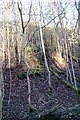
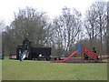
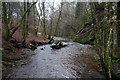
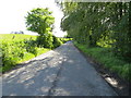
Photos of PH11 8JD


Area Information
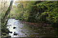
Living in the PH11 8JD postcode area offers a quiet residential experience within the broader Perth and Kinross council region. This specific cluster covers just 3.3 hectares, creating a compact neighbourhood where daily routines are manageable and local ties often run deep. The location sits in central Scotland, part of the historic counties that now form the unitary council area established in 1996. Residents benefit from being close to the administrative and ceremonial boundaries of Perth and Kinross while remaining a small, distinct community. You will find yourself in a tight-knit setting where the physical space is limited but functional. The area does not encompass any protected nature reserves, Ramsar wetland sites, Areas of Outstanding Natural Beauty, or protected woodlands. This lack of planning constraints means the immediate environment is defined primarily by housing developments rather than large-scale conservation zones. Life here revolves around the immediate vicinity, relying on nearby towns for larger facilities. The postcode serves as a gateway to the diverse landscape of central Scotland, balancing the historic depth of the region with modern living practicalities.
- Area Type
- Postcode
- Area Size
- 3.3 hectares
- Population
- Not available
- Population Density
- Not available
You cannot rely on detailed property market statistics for the PH11 8JD postcode because the available data only describes it as a specific residential cluster covering 3.3 hectares. There are no recorded figures for the percentage of owner-occupiers, the proportion of privately rented homes, or the specific breakdown of accommodation types such as flats and houses for this location. The data description explicitly limits the area to a small residential cluster, implying that granular housing stock analysis at this postcode level is not currently available. Buyers looking specifically for homes in PH11 8JD will find that market indicators like average sales prices, time on market, or transaction volumes are not provided for this specific cluster. While the wider Perth and Kinross region has a established property market, the micro-dataset for this 3.3-hectare zone does not include the volumes of property types or ownership percentages required to paint a detailed financial picture. You will need to broaden your search to the immediate surrounding areas or the larger council ward to gain a clear understanding of ownership trends and housing stock composition.
House Prices in PH11 8JD
Showing 11 properties
| Address | Type | Beds | Baths | Last Sale Price | Last Sale Date | |
|---|---|---|---|---|---|---|
| 3 Strathmore View, Alyth, PH11 8JD | Bungalow | 3 | 1 | - | - | |
| 16 Strathmore View, Alyth, PH11 8JD | Bungalow | 2 | - | - | - | |
| 14 Strathmore View, Alyth, PH11 8JD | Bungalow | - | - | - | - | |
| 2 Strathmore View, Alyth, PH11 8JD | Detached | - | - | - | - | |
| 6 Strathmore View, Alyth, PH11 8JD | Detached | - | - | - | - | |
| 1 Strathmore View, Alyth, PH11 8JD | Detached | - | - | - | - | |
| 8 Strathmore View, Alyth, PH11 8JD | Detached | - | - | - | - | |
| 18 Strathmore View, Alyth, PH11 8JD | Detached | - | - | - | - | |
| 4 Strathmore View, Alyth, PH11 8JD | Bungalow | - | - | - | - | |
| 10 Strathmore View, Alyth, PH11 8JD | Bungalow | - | - | - | - |
Energy Efficiency in PH11 8JD
Your daily life in PH11 8JD relies heavily on nearby amenities, as the postcode itself is a small residential cluster lacking major shopping precincts within its 3.3-hectare boundary. The nearest retail convenience is found within practical reach at Co-op Alyth, Co-op Scotmid, and Spar. These three specific retailers handle your essential grocery needs, from fresh produce to household essentials, ensuring the basics are accessible without a long commute. While there are no parks, sports centres, or leisure complexes listed in the immediate data for this specific code, the presence of these cooperative stores suggests a self-sufficient local trading area. You will need to travel slightly further into the wider Perth and Kinross region for cinemas, major supermarkets, or dedicated leisure facilities. The character of life here is defined by this reliance on the immediate cluster of shops rather than extensive local leisure infrastructure. It is a functional, convenient setup for storing essentials but requires outings for more varied entertainment options.
Amenities
Schools
| Rank | School | Type | Entry gender | Ages |
|---|
Explore more schools in this area
Go to Schools tabDemographics
The demographic profile of the PH11 8JD postcode is directly tied to its description as a small residential cluster. Because this area covers only 3.3 hectares, population density figures and detailed age breakdowns are not independently tracked for this specific code in the available data. You cannot find specific statistics on household types, home ownership levels, or diversity metrics for this postcode alone in the current records. Similarly, there is no available information regarding income gaps or deprivation levels for this cluster. Deprivation data is typically calculated for larger wards or council areas, and it is not broken down to this micro-scale postcode level. Consequently, you must look to the wider Perth and Kinross region for general trends on community composition and economic status. The absence of specific demographic data suggests that this postcode represents a smaller housing development or a newly defined zone where granular social statistics have yet to be compiled or published.
Household Size
Accommodation Type
Tenure
Ethnic Group
Religion
Household Composition
Age
Household Deprivation
NS-SEC
Explore more demographic insights in this area
Go to Demographics tabPlanning
Planning Constraints
- Flood RiskPremium
- Ramsar Wetland SitesPremium
- Area of Outstanding Natural BeautyPremium
- Protected Nature ReservePremium
- Protected WoodlandPremium
- Crime RiskPremium