Area Overview for PH11 8FL
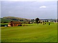
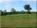
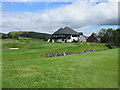
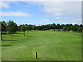
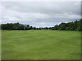
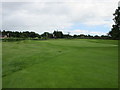
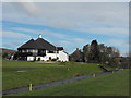
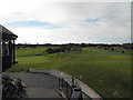
Photos of PH11 8FL
Area Information
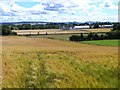
Living in PH11 8FL means residing within a specific postcode area that forms part of the sprawling Perth and Kinross council region in central Scotland. This residential cluster occupies a small footprint of 2,827 square metres, offering a contained environment for those seeking a defined locality. The area is situated far from the urban sprawl of Dundee, situated instead within the historic counties of Perthshire and Kinross-shire. Residents of PH11 8FL are located near the eastern boundary of the Perth and Kinross ceremonial area, placing them at coordinates 56.459819, -3.136195. This positioning grants access to the broader heritage of the region, which includes the ancient Sheriffdom of Perthshire and the distinct history of Kinross-shire. Daily life here is shaped by the quiet, rural character of Tayside, away from the noise of major cities like Stirling or St Andrews.
- Area Type
- Postcode
- Area Size
- 2827 m²
- Population
- Not available
- Population Density
- Not available
The property market in PH11 8FL is defined by the physical constraints of a small residential cluster covering just 2,827 square metres. You will not find information in the current data regarding home ownership percentages, specific housing stock types, or whether the area functions primarily as a rental market. The absence of data on house prices, transaction volumes, or accommodation categories makes it impossible to describe the typical home bought or let within this postcode. Therefore, you cannot determine if the properties here are predominantly owner-occupied flats or detached houses based on the provided figures. This lack of granular market intelligence means a general outlook on buyer intent or investment potential cannot be established for PH11 8FL alone. Knowledgeable buyers looking at homes in this immediate vicinity must consider the broader context of Perth and Kinross rather than relying on specific metrics for this small, undefined cluster.
House Prices in PH11 8FL
Showing 3 properties
| Address | Type | Beds | Baths | Last Sale Price | Last Sale Date | |
|---|---|---|---|---|---|---|
| 10 Old Course Road, Alyth, PH11 8FL | Detached | - | - | - | - | |
| 8 Old Course Road, Alyth, PH11 8FL | Bungalow | - | - | - | - | |
| Osprey Court Care Home, Old Course Road, Alyth, PH11 8FL | hospital_care_home | - | - | - | - |
Energy Efficiency in PH11 8FL
Your access to daily amenities in PH11 8FL is limited to the practical reach of local retailers, with no specific data on parks, schools, or leisure facilities available for this specific postcode. However, five retail outlets are identified within practical reach for residents. You can visit Co-op Scotmid, Co-op Alyth, and Spar for your everyday shopping needs. These supermarkets form the core of the available commercial options in the immediate vicinity. Beyond these named stores, the data lists a retail count but provides no information on independent shops, dining venues, or community centres. There is no recorded data on nearby green spaces, playing fields, or designated playgrounds within the 2,827 square metre area. Residents relying on local leisure facilities must look beyond the immediate boundaries of PH11 8FL, as the provided information confirms only the presence of these three co-operative and chain grocery stores servicing the residential cluster.
Amenities
Schools
| Rank | School | Type | Entry gender | Ages |
|---|
Explore more schools in this area
Go to Schools tabDemographics
The demographic profile of PH11 8FL is constrained by the limited size of the postcode area, which covers only 2,827 square metres. Specific data regarding household composition, such as the percentage of owners versus renters, the average age of residents, or the number of families with children, is not included in the available records for this specific cluster. Without these figures, it remains impossible to define the community's precise age profile or diversity levels. Similarly, deprivation metrics for the area are not available. Consequently, you cannot determine if the neighbourhood leans towards affluent or struggling households based on current data. While the broader Perth and Kinross region has its own statistical breakdowns, those general figures do not apply to this specific small postcode. Potential buyers must rely on the physical description of the area rather than census statistics to form an opinion of the local population.
Household Size
Accommodation Type
Tenure
Ethnic Group
Religion
Household Composition
Age
Household Deprivation
NS-SEC
Explore more demographic insights in this area
Go to Demographics tabPlanning
Planning Constraints
- Flood RiskPremium
- Ramsar Wetland SitesPremium
- Area of Outstanding Natural BeautyPremium
- Protected Nature ReservePremium
- Protected WoodlandPremium
- Crime RiskPremium