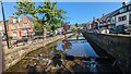
Area Overview for PH11 8DG
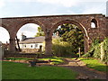
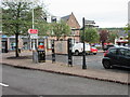
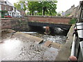
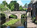
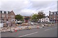
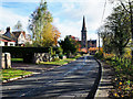
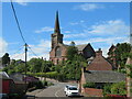
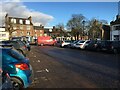
Photos of PH11 8DG


Area Information
PH11 8DG is a specific postcode area located in Scotland that covers a small residential cluster. The entire zone occupies just 4818 square metres, creating a very compact living environment. This density distinguishes the location from larger suburban or rural communities where development is more spread out. Living in PH11 8DG means you will experience a neighbourhood where properties are situated close together, fostering an intimate sense of place. The area functions as a tight-knit housing pocket rather than a sprawling district with extensive infrastructure. You navigate quickly from one home to another, making local movement efficient for daily chores or quick visits between neighbours. The small footprint dictates a high concentration of residences in a limited geographical space. This compactness often results in a quiet atmosphere despite the density, as there is simply less land for vehicular traffic or large public gatherings. Residents of this small area enjoy the convenience of not needing to travel far for immediate needs, though the limited space may restrict large-scale community events or extensive green space development within the postcode boundary itself.
- Area Type
- Postcode
- Area Size
- 4818 m²
- Population
- Not available
- Population Density
- Not available
The property market in PH11 8DG is defined by the nature of this small residential cluster. You are looking at a housing stock concentrated within a very specific and limited postcode area. The market operates on a micro-scale, where the sheer number of available homes is restricted by the area's size. Buying a home here means securing a property in a community that is historically established as a residential zone. The lack of diverse property type data suggests a uniformity in the accommodation available, which is common for such compact clusters. You will find that homes in PH11 8DG are situated close to one another, creating a distinct neighbourhood feel. The market is not characterised by a mix of luxury apartments, large villas, or industrial conversions; instead, it focuses on the standard residential units found in this part of Scotland. This consistency can appeal to buyers who prefer a predictable environment where they understand the scope of the local housing stock before committing. Prices are influenced by the specific demand for this postcode, but the limited supply inherent in small clusters can make individual transactions significant for local residents. The market movement here is slower due to the fewer number of properties transacting annually. You need to act quickly if you have your heart set on a specific address within this boundary, as the selection of homes in PH11 8DG is inherently constrained by its physical dimensions.
House Prices in PH11 8DG
Showing 11 properties
| Address | Type | Beds | Baths | Last Sale Price | Last Sale Date | |
|---|---|---|---|---|---|---|
| 8 Bamff Court, Alyth, PH11 8DG | Semi-detached | 2 | 1 | - | - | |
| 1 Bamff Court, Alyth, PH11 8DG | Terraced | 3 | 1 | - | - | |
| 4 Bamff Court, Alyth, PH11 8DG | Terraced | 2 | 1 | - | - | |
| 10 Bamff Court, Alyth, PH11 8DG | Semi-detached | 2 | 1 | - | - | |
| 2 Bamff Court, Alyth, PH11 8DG | Terraced | - | - | - | - | |
| 12 Bamff Court, Alyth, PH11 8DG | house | - | - | - | - | |
| 6 Bamff Court, Alyth, PH11 8DG | house | - | - | - | - | |
| 14 Bamff Court, Alyth, PH11 8DG | Terraced | - | - | - | - | |
| 3 Bamff Court, Alyth, PH11 8DG | Terraced | - | - | - | - | |
| 16 Bamff Court, Alyth, PH11 8DG | house | - | - | - | - |
Energy Efficiency in PH11 8DG
Lifestyle in PH11 8DG centres around the immediate accessibility of retail amenities within practical reach. Residents have excellent access to a selection of grocery stores and convenience shops. You will find five notable retail options close by, including Co-op Alyth, Co-op Scotmid, and Spar. These supermarkets provide the essentials for your daily shopping without requiring a long journey. Living in PH11 8DG means you can stock your pantry, pick up household goods, and manage personal needs quickly. The presence of these named retailers ensures that the small residential cluster is not isolated from local commerce. You do not need to travel far into larger towns to find basic goods, as the local shops cater directly to the community. The ease of access to these stores enhances the convenience factor of residing in this postcode. Shopping trips are manageable and frequent, fitting easily into a busy schedule. The proximity of these specific venues contributes to a self-contained lifestyle where daily necessities are just around the corner. You can plan your week around the opening hours of Co-op Alyth and Spar, knowing that essential supplies are readily available. This local retail network forms the backbone of the daily routine for households in PH11 8DG.
Amenities
Schools
| Rank | School | Type | Entry gender | Ages |
|---|
Explore more schools in this area
Go to Schools tabDemographics
The demographic profile of PH11 8DG reflects the characteristics of a small residential cluster in Scotland. The community is defined by its compact nature rather than by a complex mix of age groups or diverse household types. Specifically, the area contains residents who have settled within this 4818 square metre zone, creating a stable local population. There is no high degree of diversity in housing tenure or accommodation styles visible within this specific postcode boundary. The residents here likely form a cohesive group due to the limited physical size of their neighbourhood. This homogeneity suggests a community where neighbours know one another well, given the small scale of the development. The lack of varied household data indicates a uniform living arrangement typical of small residential clusters rather than mixed-use districts. Consequently, the social fabric of PH11 8DG is built on shared proximity rather than a broad spectrum of socioeconomic backgrounds or family structures. You interact with neighbours who share a similar experience of living in a dense, small-scale environment. The demographic makeup remains consistent and predictable, offering a sense of stability for those seeking a quiet community. There are no significant influxes of new residents or sudden shifts in population characteristics that would alter the character of the area.
Household Size
Accommodation Type
Tenure
Ethnic Group
Religion
Household Composition
Age
Household Deprivation
NS-SEC
Explore more demographic insights in this area
Go to Demographics tabPlanning
Planning Constraints
- Flood RiskPremium
- Ramsar Wetland SitesPremium
- Area of Outstanding Natural BeautyPremium
- Protected Nature ReservePremium
- Protected WoodlandPremium
- Crime RiskPremium