Area Overview for PH11 8DB
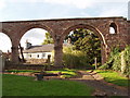
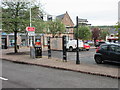
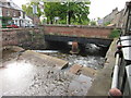
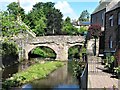
Photos of PH11 8DB


Area Information
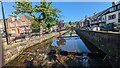
PH11 8DB is a small residential cluster covering an area of 9,372 square metres. You will find this postcode in Scotland, situated where practical daily life revolves around immediate neighbourhood interests. Living in PH11 8DB means inhabiting a compact space where residents rely on amenities just steps or a short drive away. This specific postcode represents a defined slice of the local housing market, catering to those who prefer a contained living environment. The area is distinct for its focus on immediate accessibility rather than sprawling Entwicklungs. Daily routines here are shaped by proximity to local services, making it suitable for individuals or families who value convenience above extensive long-distance travel. You can expect a setting where the boundaries of your home are closely linked to the services directly available to you. This small scale ensures that the community feels tight-knit, with residents aware of their surroundings and the facilities that support them.
- Area Type
- Postcode
- Area Size
- 9372 m²
- Population
- Not available
- Population Density
- Not available
Information regarding the property market in PH11 8DB is strictly limited to the physical size of the postcode area. You cannot access data on home ownership percentages, rental yields, or average property prices for this location. The area encompasses 9,372 square metres, which defines the geographic scope of the residential cluster but offers no insight into the price per square foot or the value of specific homes. There are no figures to indicate whether this is primarily an owner-occupied zone or a rental estate. The housing stock composition, such as the prevalence of terraced flats, detached houses, or modern apartments, is not detailed in the available data. Buyers looking at homes in PH11 8DB must rely on individual property listings for specific details. The market characteristics for this postcode are not quantified by the current records. This lack of market data means you cannot assess investment potential or rental demand based on aggregated statistics. Any analysis of the property market here would require access to sales history and inventory lists which are not part of this summary.
House Prices in PH11 8DB
Showing 22 properties
| Address | Type | Beds | Baths | Last Sale Price | Last Sale Date | |
|---|---|---|---|---|---|---|
| The Old Bakery, 1 Bank Street, Alyth, PH11 8DB | Semi-detached | 3 | 3 | - | - | |
| Ellenbank, 8 Bank Street, Alyth, PH11 8DB | Detached | 3 | 2 | - | - | |
| The Apartment, Old Smiddy, Bank Street, Alyth, PH11 8DB | Flat | - | 1 | - | - | |
| Old Bank House Cottage, Bank Street, Alyth, PH11 8DB | Detached | 3 | 1 | - | - | |
| Coach House, Bank Street, Alyth, PH11 8DB | Semi-detached | 3 | 1 | - | - | |
| Culeave, 12 Bank Street, Alyth, PH11 8DB | Terraced | - | - | - | - | |
| 19 Bank Street, Alyth, PH11 8DB | Terraced | - | - | - | - | |
| 3 Bank Street, Alyth, PH11 8DB | Detached | - | - | - | - | |
| 17 Bank Street, Alyth, PH11 8DB | house | - | - | - | - | |
| 2 Bank Street, Alyth, PH11 8DB | Semi-detached | - | - | - | - |
Energy Efficiency in PH11 8DB
Your lifestyle in PH11 8DB centres on immediate practical convenience within a small radius. Retail options are available through five nearby venues that serve essential grocery needs. You can visit Co-op Alyth, Co-op Scotmid, and a Spar branch for your daily shopping requirements. These outlets ensure you do not need to travel far for fresh produce or household essentials. The proximity of these three stores defines your retail experience in the area. There are no parks or leisure facilities listed among the nearest amenities in the provided data. Your weekend activities will depend on travel to locations outside the immediate 9,372 square metre cluster. Dining options are restricted to the convenience stores and local shops mentioned. This setup suits a self-sufficient lifestyle where errands are quick and direct. You value the ability to grab essentials without a significant commute. The area functions as a residential hub supported by basic retail infrastructure. Larger leisure complexes or extensive dining districts are not within the immediate practical reach of PH11 8DB residents.
Amenities
Schools
| Rank | School | Type | Entry gender | Ages |
|---|
Explore more schools in this area
Go to Schools tabDemographics
Demographic data for PH11 8DB is not provided in the current records regarding age profiles, household types, or diversity. Consequently, you cannot determine the specific composition of the community based on available statistics. Without figures on household sizes or ownership levels, it is impossible to describe whether families, singles, or empty nesters dominate this postcode. The absence of this information prevents a detailed analysis of who actually lives here. Similarly, data regarding accommodation types within this specific cluster is not included in the provided profile. You can only confirm that the area covers a residential cluster, but the specific building styles or tenancy arrangements remain unknown. Places like this often serve a mixed population until census data becomes available. Until then, any attempt to describe the demographics would be pure speculation. Residents here may vary widely, but without concrete numbers, the social fabric of PH11 8DB remains a general residential zone.
Household Size
Accommodation Type
Tenure
Ethnic Group
Religion
Household Composition
Age
Household Deprivation
NS-SEC
Explore more demographic insights in this area
Go to Demographics tabPlanning
Planning Constraints
- Flood RiskPremium
- Ramsar Wetland SitesPremium
- Area of Outstanding Natural BeautyPremium
- Protected Nature ReservePremium
- Protected WoodlandPremium
- Crime RiskPremium