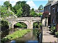
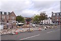
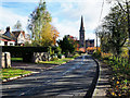
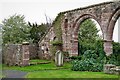
Area Overview for PH11 8BN
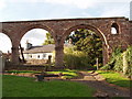
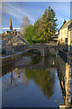
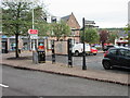
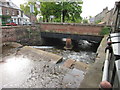
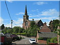
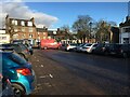
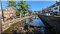
Photos of PH11 8BN

Area Information
PH11 8BN represents a very specific residential cluster within the broader Perth and Kinross council area. This postcode covers exactly 1.4 hectares, meaning you are looking at a compact neighbourhood rather than a sprawling district. As a named postcode in Scotland, it sits within the historic counties of Kinross-shire and Perthshire, areas that combined to form the local administrative unit in 1996. Living in this area means settling into a small, tightly defined community where every street likely has its own character. The distinct nature of a 1.4 hectare boundary suggests a high density of nearby neighbours compared to larger rural parcels. You will find yourself in central Scotland, bordered by regions such as Angus and Stirling, which shapes the local commuter patterns and travel times. This small footprint defines the daily rhythm of life here, where distances are short and the environment feels intimate. Potential buyers should appreciate that PH11 8BN is not just a location on a map but a precise residential zone with defined limits.
- Area Type
- Postcode
- Area Size
- 1.4 hectares
- Population
- Not available
- Population Density
- Not available
The property market for PH11 8BN is characterised by a very limited scale due to the postcode covering only 1.4 hectares. Specific figures regarding home ownership percentages or the predominant types of accommodation are not available in the current dataset. We cannot confirm whether this cluster consists mainly of newly built flats, Victorian terraces, or bungalows without further evidence. Buyers should understand that in such a small residential area, market dynamics are often dictated by individual sales rather than broad trends seen in larger towns. The housing stock is likely homogenous, given the tight geographical boundaries. Without data on rental yields or average sale prices, it is difficult to advise on investment potential. You might find that historic county boundaries, such as the former Kinross-shire, influence the architectural style of homes here, even if specific house types are unwritten. The scarcity of data means you must approach valuation compare sales across a wider radius.
House Prices in PH11 8BN
Showing 6 properties
| Address | Type | Beds | Baths | Last Sale Price | Last Sale Date | |
|---|---|---|---|---|---|---|
| Rochell, 5 Kinpurnie Drive, Alyth, PH11 8BN | Bungalow | 2 | 1 | - | - | |
| Iona, 1 Kinpurnie Drive, Alyth, PH11 8BN | Bungalow | 1 | 1 | - | - | |
| 3 Kinpurnie Drive, Alyth, PH11 8BN | Retail | 3 | 1 | - | - | |
| 4 Kinpurnie Drive, Alyth, PH11 8BN | Bungalow | 3 | 1 | - | - | |
| 6 Kinpurnie Drive, Alyth, PH11 8BN | Detached | - | - | - | - | |
| 2 Kinpurnie Drive, Alyth, PH11 8BN | Bungalow | - | - | - | - |
Energy Efficiency in PH11 8BN
Amenities
Schools
| Rank | School | Type | Entry gender | Ages |
|---|
Explore more schools in this area
Go to Schools tabDemographics
Detailed demographic data covering age profiles, household types, and deprivation indices is not available for this specific postcode in the current records. Without specific figures, we cannot definitively state whether families or singles dominate the population of PH11 8BN. Similarly, while the broader Perth and Kinross area contains a mix of residents, the exact breakdown of owner-occupiers versus renters for this tiny 1.4 hectare site remains unquantified in the provided information. Homeownership levels and accommodation types typically fluctuate significantly between neighbouring postcodes, so assuming a uniform demographic picture would be inaccurate. You will need to conduct further local research to uncover the true social make-up of the cluster. Deprivation data, which impacts quality of life, is also not included here, making it impossible to gauge financial pressures on local residents. The lack of published statistics means this section relies on general observations of small Scottish residential clusters rather than hard numbers. Consequently, any specific claims about the community composition remain speculative until more granular data becomes available.
Household Size
Accommodation Type
Tenure
Ethnic Group
Religion
Household Composition
Age
Household Deprivation
NS-SEC
Explore more demographic insights in this area
Go to Demographics tabPlanning
Planning Constraints
- Flood RiskPremium
- Ramsar Wetland SitesPremium
- Area of Outstanding Natural BeautyPremium
- Protected Nature ReservePremium
- Protected WoodlandPremium
- Crime RiskPremium