Area Overview for PH10 7JH
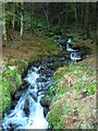
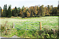
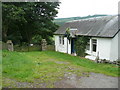
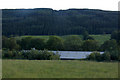
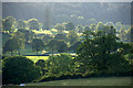
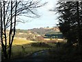
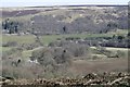
Photos of PH10 7JH
Area Information
Living in PH10 7JH offers a chance to settle into a specific residential cluster within the broader Perth and Kinross council area. This postcode covers 46.3 hectares of land, presenting a compact yet distinct community setting in central Scotland. The area sits within the historic counties that form modern-day Perth and Kinross, a region bordered by Highland, Aberdeenshire, Angus, Dundee, Fife, Clackmannanshire, Stirling, and Argyll and Bute. For a prospective buyer, understanding this location requires seeing it as part of the larger Dundee and Angus region context, particularly near the eastern boundary where the area coordinates align with the wider ceremonial county. Daily life here is defined by the intimate scale of the postcode zone. You are looking at a small area rather than a sprawling urban district. The character of PH10 7JH is one of focused residential living, detached from the larger municipal bustle of the main towns but benefitting from the stability of the surrounding administrative framework. This specific cluster provides a quiet backdrop for home ownership. Buyers interested in this south-eastern Scottish location find themselves within a jurisdiction that has undergone significant historical changes, transitioning from a joint county council in 1930 to a unitary authority in 1996. The distinctive nature of PH10 7JH comes from its precise definition as a small residential group. It is not a generic suburb but a pin-point location in the wider Tayside region history. When you consider homes in this postcode, you are choosing a setting with clear boundaries and a defined footprint. The area does not need large-scale introduction because its function as a residential zone is its primary identity. It serves as a practical entry point for those seeking a slice of Perth and Kinross without the density of the major urban centres.
- Area Type
- Postcode
- Area Size
- 46.3 hectares
- Population
- Not available
- Population Density
- Not available
The property market in PH10 7JH is defined by the physical limits of the land rather than extensive sales statistics. The postcode covers a total of 46.3 hectares, which constitutes a small residential cluster where housing stock is inevitably limited. Because specific data on the number of homes for sale or recent transaction values is missing, the market activity cannot be quantified beyond the geographical reality of the area size. You are looking at a niche market confined to a specific postcode sector rather than a broad housing zone. Home ownership levels and accommodation types are not detailed for this location. This means you cannot tell if the 46.3 hectares are predominantly filled with terraced houses, large detached properties, or a mix of flats. The absence of these figures suggests a homogeneity or a static population that does not show in the data records. For a buyer, this indicates a stable environment where the majority of the housing stock likely remains in long-term hands. When examining homes in PH10 7JH, the primary constraint is the sheer size of the area. A small footprint implies fewer homes and potentially less variety compared to a larger suburb. The market here operates within the boundaries of a residential cluster that serves the wider Perth and Kinross region. Buyers must expect a focused selection that reflects the area's small physical scale. The market does not offer the high turnover typical of major urban centres because the supply is intrinsically tied to this 46.3-hectare plot of land.
House Prices in PH10 7JH
Showing 4 properties
| Address | Type | Beds | Baths | Last Sale Price | Last Sale Date | |
|---|---|---|---|---|---|---|
| Tennis Court 74M From Cally House 38M From Unnamed Road, A 924, PH10 7JH | Leisure | - | - | - | - | |
| Cally Lodge, A 924 From The Access Road At Cally Lodge To The A 93, Bridge Of Cally, PH10 7JH | Detached | 4 | - | - | - | |
| Cally House, A 924 From The Access Road At Cally Lodge To The A 93, Bridge Of Cally, PH10 7JH | Detached | - | - | - | - | |
| Keepers Cottage Cally Estate, A 924 From The Access Road At Cally Lodge To The A 93, Bridge Of Cally, PH10 7JH | Cottage | 2 | 2 | - | - |
Energy Efficiency in PH10 7JH
Lifestyle in PH10 7JH centres on the practical amenities accessible within practical reach, as you will need to travel to neighbouring towns for most shopping and leisure activities. The immediate retail options near this postcode are limited but functional, with five notable venues serving residents in the wider cluster. You can access Co-op Rattray for essential groceries and daily supplies. For broader shopping needs, Sainsburys Blairgowrie and Co-op Blairgowrie provide larger supermarket options with extended ranges. These facilities are the primary commercial anchors for the area. While no specific parks, leisure centres, or dining venues are listed within the immediate proximity data, the nearby retail outlets suggest a lifestyle dependent on short car journeys or local public transport links to Blairgowrie and Rattray. The character of daily life involves planning trips to these specific named shops rather than finding everything within walking distance of your home in PH10 7H. The 46.3-hectare footprint reinforces the need to travel for non-essential services. Residents must integrate their routines around the availability of Co-op Rattray and the Blairgowrie stores. There are no listed cinemas, gyms, or entertainment venues within the immediate amenity data, meaning cultural activities will likely take place in Perth, Dundee, or Kinross. The narrative of living here is one of convenience for essentials and commuting for leisure. You should factor in travel time to Sainsburys Blairgowrie when estimating your daily routine.
Amenities
Schools
| Rank | School | Type | Entry gender | Ages |
|---|
Explore more schools in this area
Go to Schools tabDemographics
Understanding the community in PH10 7JH begins with the scope of the land and its usage. The available data does not provide specific statistics on population density, age profiles, or household diversity for this exact postcode. Without figures for the number of residents or the breakdown of family structures, you cannot assess the current demographic weight of the cluster. Similarly, there is no information regarding the diversity of the people who call this 46.3-hectare area home. Property data reveals no specific metrics for home ownership levels within PH10 7JH itself. Consequently, you cannot determine if the majority of residents own their homes or rent them from landlords. The lack of accommodation type data means there is no record of how many flats exist alongside detached or semi-detached houses in this specific zone. Deprivation indices are also unavailable for this location, leaving the economic standing of the local population undefined by official measures. This absence of granular demographic data does not diminish the validity of the area; it simply means the statistical picture is incomplete. Buyers looking at homes in PH10 7JH must rely on general knowledge of Perth and Kinross rather than specific census figures for this small estate. The community feel remains a matter of local observation rather than documented percentage. While the area forms part of the larger region with its own history and identity, the specific human statistics for PH10 7JH are not recorded in the current information. Your understanding of the neighbourhood will depend on direct engagement with residents rather than statistical summaries.
Household Size
Accommodation Type
Tenure
Ethnic Group
Religion
Household Composition
Age
Household Deprivation
NS-SEC
Explore more demographic insights in this area
Go to Demographics tabPlanning
Planning Constraints
- Flood RiskPremium
- Ramsar Wetland SitesPremium
- Area of Outstanding Natural BeautyPremium
- Protected Nature ReservePremium
- Protected WoodlandPremium
- Crime RiskPremium