Area Overview for PH10 6QE
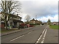
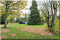
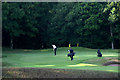
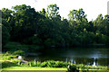
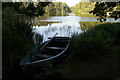
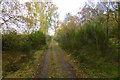
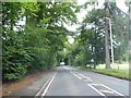
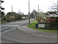
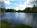
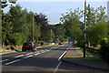
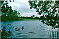
Photos of PH10 6QE

Area Information
Living in PH10 6QE means residing within a very specific residential cluster located in Perth and Kinross, Scotland. This postcode covers an area of just 3361 square metres, creating a tightly defined neighbourhood rather than a sprawling district. The location sits within a council area that encompasses the historic counties of Perthshire and Kinross-shire. Perth and Kinross lies in central Scotland, bordered by Highland and Aberdeenshire to the north and Fife to the east. The local authority was formed in 1996 under the Local Government etc. (Scotland) Act 1994. Residents of this immediate area benefit from being part of a region with deep roots dating back to medieval sheriffdoms. The history of the area includes the combination of its constituent county councils in 1930 and later reorganisations in 1975. If you are looking at homes in PH10 6QE, you are entering a small postcode area that functions as a discrete pocket within the wider local government structure. The administrative context is important for understanding boundary lines and planning decisions that affect daily life here. Your immediate surroundings are strictly defined by the 3361 square metre footprint, yet your access to the wider region spans the full ceremonial county.
- Area Type
- Postcode
- Area Size
- 3361 m²
- Population
- Not available
- Population Density
- Not available
The specific home ownership percentage and accommodation type breakdown for PH10 6QE are not provided in the available data. This lack of information prevents a definitive statement on whether the area consists mostly of owner-occupied homes or rental properties. Similarly, no data exists to confirm if the housing stock predominantly features flats, terraced houses, or detached villas within these 3361 square metres. Without these figures, it is impossible to advise on the typical tenure or architectural style of properties in this exact postcode. Buyers must treat the market here as a site-specific condition rather than a region with established statistical patterns. The absence of tenure data means you cannot assess the prevalence of buy-to-let landlords or family owners in this cluster. Any assumptions regarding the type of homes in PH10 6QE remain speculative without official records. The immediate housing market for this small residential area requires direct consultation of local estate listings to understand the actual make-up of the homes available for purchase.
House Prices in PH10 6QE
Showing 7 properties
| Address | Type | Beds | Baths | Last Sale Price | Last Sale Date | |
|---|---|---|---|---|---|---|
| 1A Whiteloch Avenue, Carsie, PH10 6QE | Semi-detached | 2 | 1 | - | - | |
| 1 Whiteloch Avenue, Carsie, PH10 6QE | Detached | 3 | 2 | - | - | |
| 7 Whiteloch Avenue, Carsie, PH10 6QE | Detached | 3 | 1 | - | - | |
| 11 Whiteloch Avenue, Carsie, PH10 6QE | Semi-detached | - | - | - | - | |
| 9 Whiteloch Avenue, Carsie, PH10 6QE | house | - | - | - | - | |
| 3 Whiteloch Avenue, Carsie, PH10 6QE | Semi-detached | - | - | - | - | |
| 5 Whiteloch Avenue, Carsie, PH10 6QE | house | - | - | - | - |
Energy Efficiency in PH10 6QE
Residents of PH10 6QE have practical access to a range of retail amenities within reach. The area has five notable retail options nearby. You can shop at Lidl Blairgowrie, Co-op Blairgowrie, and Tesco Blairgowrie for your daily groceries and household needs. These Supermarkets are situated close enough to serve as the primary shopping stops for those living in this postcode. The availability of these three major chains provides a solid foundation for daily lifestyle requirements. Beyond food shopping, there may be other small shops or services in the immediate vicinity, though specific names are limited to the three identified retailers. The presence of Tesco, Co-op, and Lidl suggests a convenience-focused trading pattern where residents can fulfil most routine shopping tasks locally. This density of retail supports a self-sufficient daily life without the need for long commutes to larger town centres. The five named amenities form the core of the commercial landscape surrounding PH10 6QE.
Amenities
Schools
| Rank | School | Type | Entry gender | Ages |
|---|
Explore more schools in this area
Go to Schools tabDemographics
Detailed information regarding the specific age profile, household types, home ownership levels, and diversity for PH10 6QE is not included in the available records. The data provided does not contain figures for deprivation or specific demographic breakdowns for this postal code. Consequently, any discussion of the community composition for this exact cluster must remain general. You cannot determine if families or single professionals predominate without further statistical sources. Likewise, the breakdown between owner-occupiers and private renters is absent from the current dataset. Deprivation indices and population density figures are also unavailable for this specific postcode. Therefore, descriptions of who lives here must rely on the broader context of the Perth and Kinross region rather than confirmed local statistics. While these gaps limit a precise picture of the demographic makeup, the area remains a defined residential zone within Scotland. Prospective buyers should be aware that specific data on household structures or socioeconomic status for this small area is not currently recorded.
Household Size
Accommodation Type
Tenure
Ethnic Group
Religion
Household Composition
Age
Household Deprivation
NS-SEC
Explore more demographic insights in this area
Go to Demographics tabPlanning
Planning Constraints
- Flood RiskPremium
- Ramsar Wetland SitesPremium
- Area of Outstanding Natural BeautyPremium
- Protected Nature ReservePremium
- Protected WoodlandPremium
- Crime RiskPremium