Area Overview for PH10 6LH
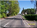
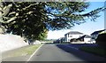
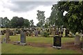
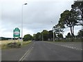
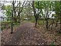
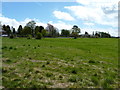
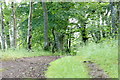
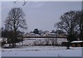
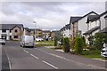
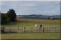
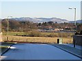
Photos of PH10 6LH
Area Information
Living in PH10 6LH means residing in a small residential cluster defined by postcode PH10 6LH in Scotland. The area covers just 2293 square metres, creating an extremely compact environment. This limited size indicates a neighbourhood with few properties and immediate proximity to surrounding streets rather than isolation. You will experience daily life in a setting where boundaries are tight and the community is likely close-knit due to the restricted physical footprint. There is little buffer zone here, as the defined land area is minimal. Residents navigate a space that functions as a specific pocket within the wider Blairgowrie region, rather than a sprawling suburb. The character of PH10 6LH is shaped by its density or lack thereof, dictated strictly by those 2293 square metres. For anyone seeking a home, this postcode represents a precise location rather than a broad district. The fixed nature of the postcode boundary ensures that every house in PH10 6LH shares the same environmental and utility characteristics. You gain a clear sense of the neighbourhood scale immediately upon arrival at your property.
- Area Type
- Postcode
- Area Size
- 2293 m²
- Population
- Not available
- Population Density
- Not available
The property market in PH10 6LH lacks specific metrics regarding home ownership percentages or accommodation types. Without data showing the proportion of owner-occupied versus rental properties, the financial structure of the neighbourhood remains unclear. Buyers cannot assess whether PH10 6LH is primarily a buy-to-let location or a family-owned estate without these figures. The absence of accommodation type statistics prevents any analysis of housing stock composition, such as the prevalence of flats or detached homes. You must treat the housing market in this area as undefined by current records. The small physical size of 2293 square metres suggests a limited number of dwellings, which may influence local supply dynamics. Despite the lack of market data, purchasing homes in PH10 6LH involves navigating the broader market conditions of the Blairgowrie postcode sector. Detailed breakdowns of tenure types are missing from the profile, leaving you to rely on general estate agent listings for guidance. The property landscape here does not reveal whether tenants dominate or owners control the majority of residences.
House Prices in PH10 6LH
Showing 2 properties
| Address | Type | Beds | Baths | Last Sale Price | Last Sale Date | |
|---|---|---|---|---|---|---|
| The Laurels, Golf Course Road, Blairgowrie, PH10 6LH | Detached | 7 | 6 | - | - | |
| Guest House, The Laurels, Golf Course Road, Blairgowrie, PH10 6LH | hotel | - | - | - | - |
Energy Efficiency in PH10 6LH
Your daily routine in PH10 6LH centres around a selection of local retail options situated within practical reach. Five retail venues serve the immediate vicinity, offering essential shopping needs without requiring travel to town centres. Lidl Blairgowrie, Co-op Blairgowrie, and Tesco Blairgowrie stand out as notable conveniences for groceries and household goods. You can rely on these three supermarkets for staple items, fresh produce, and everyday essentials. The presence of multiple major chains provides choice and competition, potentially keeping prices competitive for residents of PH10 6LH. This concentration of retail in nearby Blairgowrie means you do not need to venture far for a week's shop. The area itself contains 2293 square metres of residential space but depends on the wider town for extended leisure activities or non-food shopping. Daily life offers straightforward access to goods through the Co-operative, Lidl, and Tesco outlets. These shops form the backbone of convenience for anyone moving to this small postcode sector.
Amenities
Schools
| Rank | School | Type | Entry gender | Ages |
|---|
Explore more schools in this area
Go to Schools tabDemographics
Detailed demographic figures for age, household composition, or income in PH10 6LH are not included in the available information. Without specific statistical data on the number of households or average age, it is impossible to describe the community profile accurately. You cannot determine the level of home ownership or the mix of owner-occupiers versus tenants without corresponding numbers. The diversity of residents remains unknown due to the absence of census details for this small area. Planning constraint assessments confirm there are no Ramsar wetland sites, areas of outstanding natural beauty, protected nature reserves, or protected woodland within the boundaries of PH10 6LH. While these absence factors do not indicate risk, they also provide no insight into social demographics. Crime risk data is currently only available for areas in England, meaning you have no localised crime statistics for Scotland. Consequently, the social fabric of PH10 6LH must be understood through direct observation rather than aggregated data tables. The community feel relies on the lack of designated environmental constraints rather than population statistics.
Household Size
Accommodation Type
Tenure
Ethnic Group
Religion
Household Composition
Age
Household Deprivation
NS-SEC
Explore more demographic insights in this area
Go to Demographics tabPlanning
Planning Constraints
- Flood RiskPremium
- Ramsar Wetland SitesPremium
- Area of Outstanding Natural BeautyPremium
- Protected Nature ReservePremium
- Protected WoodlandPremium
- Crime RiskPremium