Area Overview for PH10 6DH
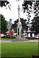
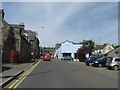
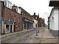
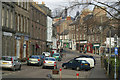
Photos of PH10 6DH


Area Information
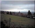
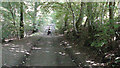
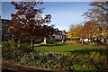
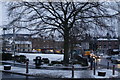
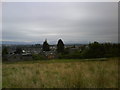
PH10 6DH defines a specific residential cluster within Perth and Kinross, Scotland. You are entering postcode territory that covers exactly 1469 square metres, a footprint small enough to feel intimate yet distinct. Living in this area means occupying a defined neighbourhood rather than a sprawling district, which often fosters a tighter sense of local identity. The postcode serves as the primary identifier for this small residential grouping, drawing a clear line around what is available to you. While the physical size is compact, the character of homes in PH10 6DH relies on the immediate surroundings to define your daily practical life. This location sits near Blairgowrie, a town that anchors many essential services for residents. Your experience here is shaped by proximity to these established amenities rather than by the sheer scale of the residential zone itself.
- Area Type
- Postcode
- Area Size
- 1469 m²
- Population
- Not available
- Population Density
- Not available
Specific data regarding the property market in PH10 6DH, including average sale prices or current stock levels, is not available in the provided information. Without these figures, we cannot state whether homes in this postcode command a premium compared to neighbouring areas or if the market is dominated by specific tenures. It is impossible to confirm the percentage of owner-occupied properties versus private rentals or social housing within this cluster. The lack of market intelligence prevents a detailed analysis of whether the area is typically bought for investment or lived in for long-term settlement. While the postcode covers a defined residential cluster, the financial and transactional reality of buying a property here remains opaque without explicit price data or sales volume records. Potential buyers should treat any valuation expectations as unverified until local registry data is consulted, as the current profile does not support concrete market assessments.
House Prices in PH10 6DH
Showing 1 properties
| Address | Type | Beds | Baths | Last Sale Price | Last Sale Date | |
|---|---|---|---|---|---|---|
| Norman Laing & Co, 27-29 Perth Street, Blairgowrie, PH10 6DH | office_workshop | - | - | - | - |
Energy Efficiency in PH10 6DH
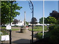
Your daily life in PH10 6DH is anchored by shopping conveniences located within practical reach. You have access to a network of five notable retail points including Co-op Blairgowrie, Sainsburys Blairgowrie, and Tesco Blairgowrie. These venues form the core of your local fabric, providing everything from fresh groceries to household essentials. No long journeys are required for basic errands, as these supermarkets and convenience stores are situated nearby. This retail cluster ensures that your shopping trips are efficient and integrated into your weekly routine. While specific details on dining, parks, or leisure centres are absent from the provided amenity categories, the retail infrastructure is robust. The presence of these three major chains means that the area supports a self-sufficient lifestyle where you can manage daily needs without venturing far beyond the postcode boundary. This retail density compensates for the small physical size of the residential zone.
Amenities
Schools
| Rank | School | Type | Entry gender | Ages |
|---|
Explore more schools in this area
Go to Schools tabDemographics
Detailed demographic statistics for PH10 6DH are not included in the current information available. Consequently, I cannot specify the average age of residents, the ratio of homeowners to renters, or the diversity of household types within this postcode. Without data on income levels or occupations, any description of who lives here remains speculative. The absence of these figures means we cannot assess the deprivation index or detail the accommodation mix, such as the prevalence of terraced houses versus detached family homes. Because the public data does not provide these specific numbers for this small area, we simply do not have the facts required to paint a complete picture of the community composition. You must rely on observational evidence from the streets themselves to understand the social fabric, as official statistical records for this specific 1469 square metre zone do not offer the granular breakdown often seen in larger council areas.
Household Size
Accommodation Type
Tenure
Ethnic Group
Religion
Household Composition
Age
Household Deprivation
NS-SEC
Explore more demographic insights in this area
Go to Demographics tabPlanning
Planning Constraints
- Flood RiskPremium
- Ramsar Wetland SitesPremium
- Area of Outstanding Natural BeautyPremium
- Protected Nature ReservePremium
- Protected WoodlandPremium
- Crime RiskPremium