Area Overview for PH10 6DF
Photos of PH10 6DF
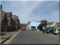
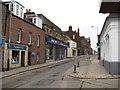
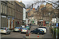
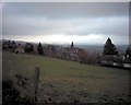
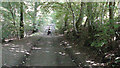
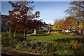
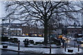
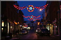
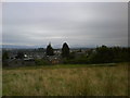
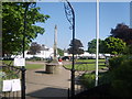
100 photos from this area
Area Information
Key information about the PH10 6DF including its size, population, and administrative classification.
- Area Type
- Postcode
- Area Size
- 4064 m²
- Population
- Not available
- Population Density
- Not available
House Prices in PH10 6DF
17
Properties
-
Average Sold Price
-
Lowest Price
-
Highest Price
Showing 17 properties
| Address | Type | Beds | Baths | Last Sale Price | Last Sale Date | |
|---|---|---|---|---|---|---|
| 59 High Street, Blairgowrie, PH10 6DF | Flat | 2 | 1 | - | - | |
| 63 High Street, Blairgowrie, PH10 6DF | Semi-detached | 3 | - | - | - | |
| 82B High Street, Blairgowrie, PH10 6DF | Flat | - | - | - | - | |
| Clelland & Boyd Opticians, 61 High Street, Blairgowrie, PH10 6DF | shop | - | - | - | - | |
| David Scott, 65 High Street, Blairgowrie, PH10 6DF | shop | - | - | - | - | |
| Blairgowrie & Rattray Development Trust, 55 High Street, Blairgowrie, PH10 6DF | retail_financial | - | - | - | - | |
| Blairgowrie Dental Care, 64 High Street, Blairgowrie, PH10 6DF | primary_healthcare | - | - | - | - | |
| Number 62, 62 High Street, Blairgowrie, PH10 6DF | shop | - | - | - | - | |
| The Original Factory Shop, 68 High Street, Blairgowrie, PH10 6DF | shop | - | - | - | - | |
| Glenclean Laundry, 60A High Street, Blairgowrie, PH10 6DF | retail_financial | - | - | - | - |
Page 1 of 2
Energy Efficiency in PH10 6DF
Amenities
Schools
| Rank | School | Type | Entry gender | Ages |
|---|
Explore more schools in this area
Go to Schools tabDemographics
Household Size
N/A
most common
Accommodation Type
N/A
most common
Tenure
N/A
majority
Ethnic Group
N/A
most common
Religion
N/A
most common
Household Composition
N/A
most common
Age
N/A
median
N/A
most common
Household Deprivation
N/A
with no deprivation
NS-SEC
N/A
in Lower managerial occupations
Explore more demographic insights in this area
Go to Demographics tabPlanning
Planning Constraints
- Flood RiskPremium
- Ramsar Wetland SitesPremium
- Area of Outstanding Natural BeautyPremium
- Protected Nature ReservePremium
- Protected WoodlandPremium
- Crime RiskPremium