Area Overview for Murthly
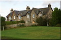
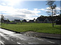
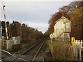
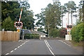
Photos of Murthly

Area Information
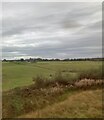
Living in Murthly means calling home a distinct built-up area situated within Scotland. This community occupies a compact span of 43.6 hectares, offering a sense of scale that differs significantly from larger cities. As a small settlement, the pace of life here is likely calibrated to the rhythms of a traditional town rather than a metropolitan hub. You are entering an environment where the housing stock blends with the natural surroundings, creating a lived-in atmosphere typical of the region. Prospective buyers looking for a established locale will find Murthly fits that description perfectly. The area represents a residential pocket within the wider Scottish landscape. You will experience daily life without the congestion of major transport arteries or the sprawl of urban development. Its identity is rooted in its specific location and local history. This is a place defined by its boundaries and its connection to nearby larger centres. Homebuyers should consider what a 43.6-hectare footprint offers for recreational space and community cohesion. The area provides a defined entity rather than a scattered collection of villages. It stands as a recognised settlement on the property map.
- Area Type
- Built Up Area 250
- Area Size
- 43.6 hectares
- Population
- Not available
- Population Density
- Not available
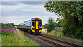
Your daily routine in Murthly will involve convenient access to essential retail and transport hubs. Several Spar supermarkets and a Co-op Dunkeld are located within practical reach, ensuring you can grab groceries or fresh produce without travelling far. These five named retailers provide the basic necessities for household management. For commuters, the Dunkeld and Birnam Railway Station serves as a vital link to wider transport networks. This railway station offers regular services for those needing to travel to Perth, Edinburgh, or London. Its proximity means you can easily integrate outside work or visit attractions in the region. The area layout supports a lifestyle where essential trips are short and manageable. You will find that the nearest amenities are integrated into the existing town structure rather than requiring significant detours. The presence of these specific venues defines the convenience of living here. Residents enjoy the balance of local availability and regional access without the stress of heavy traffic.
Amenities
Schools
| Rank | School | Type | Entry gender | Ages |
|---|
Explore more schools in this area
Go to Schools tabDemographics
Understanding the community in Murthly requires looking at the specific characteristics of its residents and households. The data provides precise metrics to describe the population here. You will find that the area consists of a specific number of households, each reflecting a unique demographic profile. The average age of the population in Murthly offers a clear picture of who lives within these boundaries. Information regarding the proportion of empty dwellings, students, and single residents is available and quantifies the social fabric. Deprivation statistics are measured using the Index of Multiple Deprivation (IMD), which ranks Murthly against all other areas in Scotland. This ranking reflects five domains including income, employment, health, education, and crime. The specific rank for Murthly can be determined by comparing its score against the national baseline. For a homebuyer, this figure indicates the relative economic standing of the neighbourhood. A higher rank suggests better access to resources and services, while a lower rank points to areas requiring more support. The community is defined by these measurable factors that shape the quality of life for everyone residing here.
Household Size
Accommodation Type
Tenure
Ethnic Group
Religion
Household Composition
Age
Household Deprivation
NS-SEC
Explore more demographic insights in this area
Go to Demographics tabPlanning
Planning Constraints
- Crime RiskPremium