Area Overview for Blairgowrie and Rattray
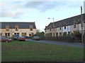
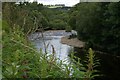
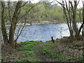
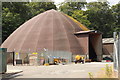
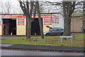
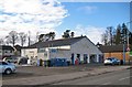
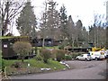
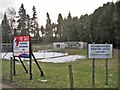
Photos of Blairgowrie and Rattray


Area Information
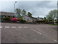
Blairgowrie and Rattray is a built-up area covering 4.2 km² within Scotland. It represents a compact community where daily life revolves around a tight-knit local environment. Residents here experience a distinct rhythm shaped by the physical limits of the neighbourhood. The area functions as a self-contained hub for those seeking a grounded existence outside the major urban centres of Dundee or Perth. Living in Blairgowrie and Rattray means navigating a landscape defined by its small footprint yet offering essential services within walking or short driving distance. The settlement style is practical, catering to families and individuals who prioritise a slower pace over cosmopolitan energy. You will find a location where the community identity is strong because the area is small enough for neighbours to know one another. Homes in Blairgowrie and Rattray are situated in an environment that balances rural tranquility with accessible town centre conveniences. This built-up area offers a specific type of Scottish small-town character that appeals to those looking to settle permanently rather than commute from a distant city. Your daily routine here will depend on the compact nature of the location, where everything from retail shopping to community engagement is located in close proximity to your home.
- Area Type
- Built Up Area 250
- Area Size
- 4.2 km²
- Population
- Not available
- Population Density
- Not available
Your lifestyle in Blairgowrie and Rattray is supported by a cluster of retail amenities within practical reach. You have access to five major retail locations nearby, ensuring your shopping needs are met without needing to travel to larger cities. specific venues like Tesco Blairgowrie, Co-op Blairgowrie, and Sainsburys Blairgowrie form the backbone of local commerce. These supermarkets provide a comprehensive range of daily essentials, allowing you to manage your household finances efficiently on the high street. The area does not boast a wide variety of independent specialty shops or chain icons immediately visible, relying instead on these large formats for volume. Dining options are limited outside of the supermarkets, meaning your leisure food choices are centred on convenience stores and casual takeaways. There are no mentioned leisure centres, cinemas, or dedicated sports facilities in the immediate vicinity of Blairgowrie and Rattray. Your social life will likely involve dining at the local pubs or cafes, with formal entertainment requiring a trip to nearby cities like Dundee. The convenience of living in Blairgowrie and Rattray lies in having your food and household goods delivered to your door by these nearby chains. You will find a functional lifestyle where practicality overrides luxury shopping or vibrant nightlife. The presence of these specific retailers defines the accessibility and mundane rhythm of your daily errands.
Amenities
Schools
| Rank | School | Type | Entry gender | Ages |
|---|
Explore more schools in this area
Go to Schools tabDemographics
The community makeup of Blairgowrie and Rattray reflects the typical profile of established Scottish built-up areas. Accommodation data indicates a significant proportion of the population lives in three-storey terraced housing. This architectural style dominates the streetscape and suggests a historical development pattern focused on density and urbanisation. You will see a mix of established homes within this 4.2 km² boundary. The demographic structure here mirrors traditional market towns where multi-generational families and long-term residents form the backbone of society. While specific age statistics are not provided in the current records, the housing stock implies a stable population base rather than a transient migrant community. The area does not show marks of extreme diversity in terms of global migration, consistent with many inland Scottish settlements. Instead, the social fabric is woven from local roots and a shared history of living within this specific town boundary. Deprivation metrics are not currently available for this location, preventing a direct comparison with wealthier urban fringe areas. However, the prevalence of terraced housing often correlates with mid-range property values suitable for average income earners. Your experience of living in Blairgowrie and Rattray will be defined by the enduring character of these homes and the stability of the households they accommodate.
Household Size
Accommodation Type
Tenure
Ethnic Group
Religion
Household Composition
Age
Household Deprivation
NS-SEC
Explore more demographic insights in this area
Go to Demographics tabPlanning
Planning Constraints
- Crime RiskPremium