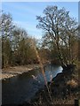
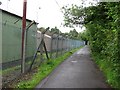
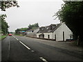
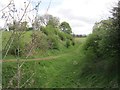
Area Overview for Almondbank
Photos of Almondbank


Area Information
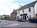
Almondbank stands as a built-up area within Perth and Kinross, serving as an established residential zone rather than a isolated village. The community occupies a footprint of 74.5 hectares, offering a defined space for households to settle. Living in Almondbank provides access to the wider urban infrastructure of Perth while maintaining a designated local identity. This status distinguishes the area from purely rural locations, ensuring residents benefit from town services without total dependence on them. Daily life here involves navigating a space where residential density meets practical access to major roads and key transport links. You will find yourself surrounded by a neighbourhood that functions as part of the greater Perth urban area. The area's classification means it has the necessary density for its own specific community rhythm. Prospective buyers should view Almondbank as a settled locality with clear boundaries and recognised amenities nearby. Homes in Almondbank offer a specific lifestyle choice distinct from city centre flats or remote countryside properties. The location provides a stable environment where infrastructure planning has already taken place.
- Area Type
- Built Up Area 250
- Area Size
- 74.5 hectares
- Population
- Not available
- Population Density
- Not available
Daily living in Almondbank offers direct access to essential amenities within practical reach. Five retail outlets serve the local community, including Tesco Perth, M&S Inveralmond Perth SF, and Aldi North. These supermarkets provide the daily necessities for most households without requiring long journeys into the city centre. You also have one railway station nearby, Perth Railway Station, which connects you to the broader rail network. Commuters can access this station for travel to other parts of Scotland. Furthermore, Perth/Scone Airport is listed as a nearby airport, giving you access to regional and international flight options. This transport triangle of retail, rail, and air travel structures the daily rhythm of life here. Residents do not face extreme isolation regarding shopping or travel logistics. The presence of these specific venues means you can handle routine errands conveniently. However, the count of five retail locations suggests a standard but not luxurious shopping environment. You must plan your shopping trips around the opening hours of these specific stores. The convenience of these amenities is balanced by the known limitations of local fibre internet speeds.
Amenities
Schools
| Rank | School | Type | Entry gender | Ages |
|---|
Explore more schools in this area
Go to Schools tabDemographics
The demographic profile of Almondbank reflects the typical characteristics of built-up residential zones in this region. Specific data regarding age distribution, household composition, and ethnic diversity is not currently part of the available records for this location. Without these figures, you cannot determine the average age of your neighbours or the mix of family types in the area. You must rely on your own research to gauge the community feel if these specific statistics are absent from public records. Similarly, there is no information on social deprivation levels or income distribution within the boundaries of Almondbank. This means you cannot assess whether the area leans towards higher or lower socio-economic groups using standard indices. The lack of detailed demographic breakdowns prevents a granular picture of who lives here. While you know it is a built-up area of 74.5 hectares, the internal social composition remains undefined in the provided information. Homebuyers may need to visit local schools or community centres directly to understand the actual population dynamics. Until official census data is released for Almondbank specifically, any assumptions about the residents must be made cautiously.
Household Size
Accommodation Type
Tenure
Ethnic Group
Religion
Household Composition
Age
Household Deprivation
NS-SEC
Explore more demographic insights in this area
Go to Demographics tabPlanning
Planning Constraints
- Crime RiskPremium