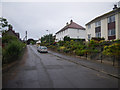
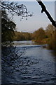
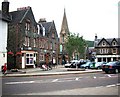
Area Overview for Aberfeldy
Photos of Aberfeldy


Area Information
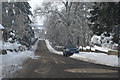
Aberfeldy is a compact built-up area in Scotland, spanning 96.4 hectares. Its size suggests a close-knit community, typical of smaller Scottish towns. While specific population figures are not provided, the area’s retail offerings—such as Co-op Aberfeldy and Spar—hint at a localised economy catering to residents’ daily needs. The town’s character is defined by its practical scale, balancing accessibility with a sense of place. For those considering living in Aberfeldy, the proximity to essential shops and the surrounding natural environment may appeal to those seeking a quieter lifestyle. The digital landscape shows mixed connectivity: broadband is rated poor (28/100), which may impact remote work, but mobile coverage is strong (81/100), ensuring reliable communication on the move. This blend of infrastructure and local amenities positions Aberfeldy as a viable option for buyers prioritising convenience over sprawling urban settings.
- Area Type
- Built Up Area 250
- Area Size
- 96.4 hectares
- Population
- Not available
- Population Density
- Not available
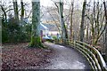
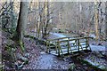
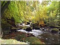
Living in Aberfeldy offers a straightforward lifestyle with essential amenities within practical reach. The Co-op Aberfeldy and Spar provide basic retail needs, supporting daily errands without the need for long journeys. While dining and leisure options are not detailed, the presence of these shops suggests a focus on convenience over variety. Parks and green spaces are not mentioned, but the area’s built-up status may include local parks or open areas for recreation. The character of Aberfeldy appears to prioritise functionality, with amenities designed for immediate use rather than expansive leisure opportunities. This setup suits residents who value simplicity and proximity to necessities, though those seeking vibrant cultural or entertainment options may find the area limited in scope.
Amenities
Schools
| Rank | School | Type | Entry gender | Ages |
|---|
Explore more schools in this area
Go to Schools tabDemographics
Household Size
Accommodation Type
Tenure
Ethnic Group
Religion
Household Composition
Age
Household Deprivation
NS-SEC
Explore more demographic insights in this area
Go to Demographics tabPlanning
Planning Constraints
- Crime RiskPremium