Area Overview for Lossiemouth
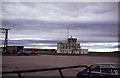
Photos of Lossiemouth


Area Information
Lossiemouth is a built-up area in the north-east of Scotland covering 4.4 km². This compact footprint means daily life here revolves around a self-contained community rather than sprawling suburbs. You will find a residents' environment that balances residential living with significant industrial presence due to its location. The area stands apart from purely rural or tourist zones because it sits adjacent to strategic infrastructure. Living in Lossiemouth offers a specific character defined by its proximity to the Royal Air Force base. You do not need to travel far to reach major transport links or commercial hubs. The town functions as a practical base for workers requiring access to Elgin Airport or RAF Lossiemouth. Homes in Lossiemouth cater to a population that values connectivity over rural isolation. Your daily commute to wider Moray or east Scotland becomes manageable with the area's strategic layout. The town's identity is rooted in its utility as a logistical and transport corridor. This practical nature defines the housing stock and the surrounding neighbourhood. You are stepping into an area built for function rather than elaborate historical preservation. The small size of the territory concentrates local services within a short walking distance. Residents navigate a setting where the built environment interacts directly with major facilities.
- Area Type
- Built Up Area 250
- Area Size
- 4.4 km²
- Population
- Not available
- Population Density
- Not available
Daily life in Lossiemouth revolves around a small selection of essential amenities that are within practical reach of all residents. Retail options are immediate, with three notable shops including Co-op Lossiemouth, Co-op Lossiemouth, and Budgens Bishopmill. These locations provide you with groceries and everyday essentials without needing to travel far. The presence of an airport nearby defines the local landscape. RAF Lossiemouth stands as a major landmark that shapes the area's economy and routine. For those requiring rail access, Elgin Railway Station serves as the primary point of connection. You can reach the station conveniently to access wider rail networks beyond the immediate region. This combination of retail and transport nodes means your daily needs are concentrated into a compact zone. You do not need to drive to access a supermarket or catch a train. The amenity count reflects a limited but focused choice of services. Residents of Lossiemouth enjoy a lifestyle where basic conveniences are integrated into the local geography. The proximity to these specific venues ensures that your daily errands remain efficient and close to home.
Amenities
Schools
| Rank | School | Type | Entry gender | Ages |
|---|
Explore more schools in this area
Go to Schools tabDemographics
Specific demographic statistics for Lossiemouth are not included in the current dataset. Without concrete figures on age distribution, household types, or home ownership levels, we cannot describe the precise community makeup. We also lack information on deprivation metrics that would contextualise local quality of life indicators. The absence of these data points means we cannot confirm whether families or young professionals dominate the population. While the town serves military and industrial needs, we cannot verify the percentage of owner-occupiers versus renters. Accommodation types remain unquantified in the available information, so we cannot determine if semi-detached houses or flats form the majority. You cannot assess the level of diversity or tenancy rates without specific numbers. Trade data is similarly missing, preventing an analysis of income levels or career profiles of residents. We know the physical extent is 4.4 km², but social demographics require years of census data that is currently unavailable here. Any description of the people living here would be speculative without evidence. The data simply does not provide the granularity needed to discuss household structures or educational attainment. You must rely on general observations of the area's function rather than statistical profiles of its inhabitants.
Household Size
Accommodation Type
Tenure
Ethnic Group
Religion
Household Composition
Age
Household Deprivation
NS-SEC
Explore more demographic insights in this area
Go to Demographics tabPlanning
Planning Constraints
- Crime RiskPremium