Area Overview for Forres
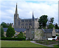
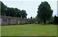
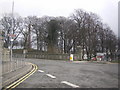
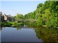
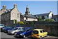
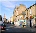
Photos of Forres


Area Information
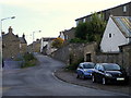
Forres is a built-up area situated in Scotland, covering a total of 4.0 km². Living in Forres involves dipping into a space defined by its urban character as a town within the Highlands. The town functions as a practical base for daily life, blending residential streets with the services needed for everyday living. You can expect a compact environment where local shops and transport links are within practical reach, allowing residents to manage their routine needs without constant travel. The location of Forres offers a specific type of Scottish town life, distinct from larger cities yet providing essential infrastructure. Community members rely on the town centre and surrounding neighbourhoods for their primary interactions and activities. This area serves as a functional hub where the scale of 4.0 km² supports a concentration of homes and facilities. Residents find themselves in a setting that balances the quiet of the Scottish landscape with the accessibility of town amenities. The identity of the area is rooted in its status as a town, offering a stable environment for those seeking a settled home life in the region.
- Area Type
- Built Up Area 250
- Area Size
- 4.0 km²
- Population
- Not available
- Population Density
- Not available
Daily life in Forres is supported by a range of amenities within practical reach of residents. You have access to five retail outlets, including specific options like Morrisons Daily, Spar, and Morrisons Daily Forres 81. These shops provide for your grocery and household shopping requirements without needing a journey to Inverness or Elgin. For travel connections, Forres Railway Station sits nearby, offering rail links for longer trips. Additionally, RAF Kinloss is located close by, which may serve as a transport node or airport facility for local engagement. The residential neighbourhoods are interspersed with these essential services, creating a convenient layout where you can manage errands locally. The presence of multiple daily goods stores means you can find what you need with minimal planning. This blend of retail and transport options defines the convenience of living in this part of Scotland. Residents enjoy the ability to walk or use short drives to reach their shops and travel hubs.
Amenities
Schools
| Rank | School | Type | Entry gender | Ages |
|---|
Explore more schools in this area
Go to Schools tabDemographics
Understanding the community requires looking at the specific profile of those calling Forres home. The exact age distribution and breakdown of household types within the town are not included in the current dataset, so those specific figures remain unavailable for this guide. Similarly, precise data on home ownership levels and the exact mix of rented versus owner-occupied properties are not provided in the information supplied. As a result, you cannot access statistical details on the diversity of the population or the specific deprivation indices that often accompany demographic profiles in Scottish towns. Without these numbers, it is impossible to state the percentage of dual-income households or the size of the elderly population with certainty. The lack of detailed demographic statistics means you must rely on the general character of the town rather than granular figures about its residents. Potential buyers should note that detailed census-style data regarding household composition and tenure is currently absent from the provided information sources. This limitation prevents a precise description of the social fabric based on quantitative measures.
Household Size
Accommodation Type
Tenure
Ethnic Group
Religion
Household Composition
Age
Household Deprivation
NS-SEC
Explore more demographic insights in this area
Go to Demographics tabPlanning
Planning Constraints
- Crime RiskPremium