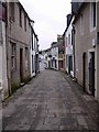
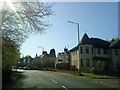
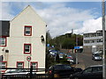
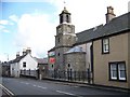
Area Overview for Strathaven
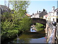
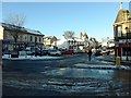
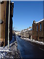
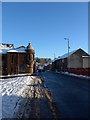
Photos of Strathaven


Area Information
Strathaven is a compact built-up area in Scotland, spanning 2.6 km². It serves as a practical, everyday community for residents seeking a balance between local convenience and connectivity. The area is anchored by its retail and transport infrastructure, with major supermarkets like Aldi, Co-op, and Sainsburys providing daily essentials. Two railway stations—Larkhall and Merryton—offer access to broader regional networks, making commuting or travel straightforward. While the population size isn’t specified, the presence of multiple retail outlets and transport hubs suggests a modest, active community. Daily life here is shaped by proximity to shops, public transport, and the surrounding Scottish landscape. The area’s modest size means residents are likely to know their neighbours, fostering a sense of local identity. For those prioritising practicality over sprawling urban sprawl, Strathaven offers a self-contained environment with clear access to key services. Its location in Scotland means it benefits from the region’s natural scenery, though the specifics of its broader surroundings remain unexplored in the data.
- Area Type
- Built Up Area 250
- Area Size
- 2.6 km²
- Population
- Not available
- Population Density
- Not available
Living in Strathaven offers a straightforward lifestyle with essential amenities within easy reach. The area’s retail sector is well-served by three major supermarkets: Aldi Strathaven, Co-op Strathaven, and Sainsburys Strathaven. These stores provide a range of groceries, household items, and services, reducing the need for long trips to larger centres. The presence of two railway stations—Larkhall and Merryton—adds to the area’s convenience, enabling residents to travel further afield with ease. While the data does not specify parks or leisure facilities, the compact nature of the area suggests that local amenities are likely to be within walking or cycling distance. The combination of retail access and public transport options means daily errands and social activities can be managed efficiently. For those who prefer a slower pace, the area’s modest size and proximity to Scottish landscapes may offer opportunities for outdoor activities, though this is not confirmed by the provided data.
Amenities
Schools
| Rank | School | Type | Entry gender | Ages |
|---|
Explore more schools in this area
Go to Schools tabDemographics
Household Size
Accommodation Type
Tenure
Ethnic Group
Religion
Household Composition
Age
Household Deprivation
NS-SEC
Explore more demographic insights in this area
Go to Demographics tabPlanning
Planning Constraints
- Crime RiskPremium