Area Overview for Motherwell
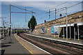
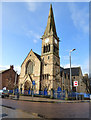
Photos of Motherwell


Area Information
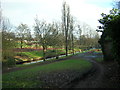
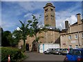
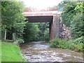
Motherwell stands as a substantial built-up area within South Lanarkshire, covering a total landmass of 11.2 km². Unlike many urban centres that sprawl indefinitely, this town maintains a defined footprint while accommodating a significant population. Residents here experience a distinct town centre life rather than an isolated rural existence or a dense metropolitan commute. The geography of Motherwell supports a variety of housing options suitable for different family structures. Daily life revolves around proximity to key services and transport links, with the town acting as a focal point for the surrounding region. Prospective homebuyers will find that living in Motherwell offers a compact environment where destinations are relatively close. The area has developed into a complete community with its own identity, distinct from the larger cities of Glasgow or Edinburgh. You can expect a setting where local knowledge matters more than in a sprawling metropolis. The town's character is shaped by its size, which allows for manageable distances between homes and amenities. This balance makes it an attractive option for those seeking a established town feel with clear boundaries.
- Area Type
- Built Up Area 250
- Area Size
- 11.2 km²
- Population
- Not available
- Population Density
- Not available
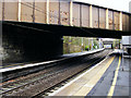
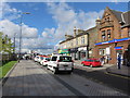
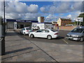
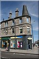
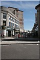
Daily life in Motherwell centres around practical accessibility to essential services and retail outlets. Residents have immediate access to major supermarket chains including Iceland Motherwell, Farmfoods North, and Aldi North. These large-format stores provide one-stop shopping for food, household goods, and groceries without the need to travel further afield. Transport connectivity remains a cornerstone of the lifestyle, with Motherwell Railway Station offering direct national rail links. You can also access Airbles Railway Station and Holytown Railway Station for interchange options across the rail network. This railway density ensures that you can reach Glasgow or Edinburgh within a manageable travel time. The town centre itself features shops and amenities within walking distance of many homes. Local parks and green spaces are integrated into the residential fabric, allowing for outdoor activities without leaving the neighbourhood. Commuters value the frequency of services that connect the town to Scotland's wider network. This combination of retail convenience and transport efficiency defines the practical rhythm of life here.
Amenities
Schools
| Rank | School | Type | Entry gender | Ages |
|---|
Explore more schools in this area
Go to Schools tabDemographics
The community makeup of Motherwell reflects the broader demographic trends found in established Scottish towns. Households in this area represent a mix of single occupants, couples without children, and families with dependents. Recent data indicates that a significant portion of residents own their homes outright or have a mortgage. Former residents note that the town attracts a steady stream of working-age families and younger professionals seeking stability. The population diversity aligns with national patterns, creating a familiar social environment for newcomers. Deprivation levels within the area follow standard regional metrics used by the Scottish government to identify support needs. This measurement helps local authorities allocate resources effectively to improve living standards. You will encounter neighbours who have lived in the same streets for decades, fostering strong local connections. The age profile suggests a balanced distribution, avoiding the extremes found in retirement communities or university towns. This stability contributes to a predictable social atmosphere where community events thrive annually.
Household Size
Accommodation Type
Tenure
Ethnic Group
Religion
Household Composition
Age
Household Deprivation
NS-SEC
Explore more demographic insights in this area
Go to Demographics tabPlanning
Planning Constraints
- Crime RiskPremium