Area Overview for ML12 6RG
Photos of ML12 6RG


Area Information
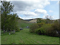
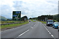
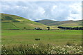
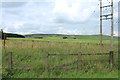
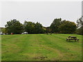
ML12 6RG is a small, defined residential postcode area in Scotland, covering 45.2 hectares. It is a compact cluster of homes, likely serving a modest number of residents with a focus on local living. The area’s size suggests a close-knit community, where daily life is centred around nearby amenities and local connections. As a Scottish postcode, it may sit within a rural or semi-rural setting, though specific geographical context is not detailed in the data. The absence of major planning constraints like protected woodlands or AONB designations indicates a relatively straightforward environment for development and habitation. For those considering living here, the area’s limited scale means a quiet, possibly family-oriented atmosphere, with minimal exposure to large-scale infrastructure or urban sprawl. The broadband score of 97 and mobile coverage of 82 suggest reliable digital connectivity, which is crucial for modern lifestyles, whether for working from home or accessing online services. This makes ML12 6RG appealing to those seeking a balance between tranquillity and functional connectivity.
- Area Type
- Postcode
- Area Size
- 45.2 hectares
- Population
- Not available
- Population Density
- Not available
House Prices in ML12 6RG
Showing 3 properties
Energy Efficiency in ML12 6RG
Amenities
Schools
| Rank | School | Type | Entry gender | Ages |
|---|
Explore more schools in this area
Go to Schools tabDemographics
Household Size
Accommodation Type
Tenure
Ethnic Group
Religion
Household Composition
Age
Household Deprivation
NS-SEC
Explore more demographic insights in this area
Go to Demographics tabPlanning
Planning Constraints
- Flood RiskPremium
- Ramsar Wetland SitesPremium
- Area of Outstanding Natural BeautyPremium
- Protected Nature ReservePremium
- Protected WoodlandPremium
- Crime RiskPremium