Area Overview for Lanark
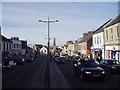
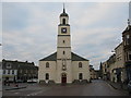
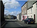
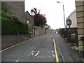
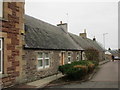
Photos of Lanark


Area Information
Living in Lanark offers a tranquil yet well-connected experience in a built-up area that covers just 3.3 km² of South Lanarkshire. This small town provides a compact living environment where distance to daily necessities is negligible. Residents enjoy the benefits of a dense settlement without the overwhelming pace of a major city. The community maintains a distinct character typical of Scottish towns, balancing historical charm with modern convenience. For those seeking homes in Lanark, the location delivers a sense of stability and quietude while keeping essential services within a short walk or drive. The area size means neighbours are often close, fostering a familiar atmosphere where local knowledge runs deep. You will find that the town centre is accessible, allowing for easy navigation of the streets and pathways that define the neighbourhood. Daily life here revolves around proximity; you do not need to travel far to encounter shops, transport hubs, or community spaces. This efficiency supports a lifestyle where you can run errands quickly and return home to a peaceful setting. The compact nature of the town ensures that everything from the railway station to local supermarkets is practically reachable. Living in Lanark suits those who value a close-knit environment where travel times to amenities remain minimal. The town stands as a functional residential hub that integrates seamlessly with the wider Strathclyde region. You experience a lifestyle characterised by practicality and ease, avoiding the lengthy commutes common in larger urban sprawls. This balance makes the location attractive for buyers who want home life to be simple and predictable.
- Area Type
- Built Up Area 250
- Area Size
- 3.3 km²
- Population
- Not available
- Population Density
- Not available
Daily life in Lanark centres around a practical array of amenities that fall within easy reach of your home. You have access to five notable retail venues, ensuring that shopping needs are met without lengthy journeys. Specific options include Morrisons Lanark, Morrisons Daily Lanark 37, and Lidl Braidfute, providing a choice between full supermarkets and convenience stores. This variety allows you to purchase everything from groceries to household essentials in a single local trip. The presence of these major retailers anchors the town centre as a functional hub for daily errands. Transport links further enhance your lifestyle by connecting you to wider opportunities. Three railway stations serve the immediate area, giving you multiple options for travel to work and leisure. Lanark Railway Station, Carstairs Railway Station, and Carluke Railway Station offer frequent departures to Glasgow and beyond. This connectivity means you can visit cultural attractions in the city or attend meetings without significant delays. The integration of rail transport with local retail creates a bustling yet manageable atmosphere for residents. You will appreciate the convenience of having immediate access to essential services alongside your home. Shops and train stations are not distant extras but integral parts of the daily routine. This layout supports a lifestyle where time spent commuting or shopping is minimised. The town offers a straightforward environment where the available amenities are sufficient for everyday living without the need to venture far. Living in Lanark provides a balanced lifestyle where practical needs are met efficiently through local retail and robust transport connections.
Amenities
Schools
| Rank | School | Type | Entry gender | Ages |
|---|
Explore more schools in this area
Go to Schools tabDemographics
The demographic profile of Lanark reflects a community where established residents form the backbone of the population. While specific age breakdowns and household type percentages are not detailed in current records, the area maintains a steady population supported by its status as a built-up zone. The presence of three railway stations suggests a significant commuter population linking Lanark to wider employment centres across Scotland. This connection typically attracts young professionals and families seeking proximity to greater industrial or business hubs. Home ownership levels in the area contribute to the stability of the community, though exact figures require specific local surveys not included in the primary dataset. The mix of accommodation generally aligns with a developing town structure, offering various options for different needs. Deprivation data is not currently available for this specific area, which prevents a granular analysis of income inequality or access to public services at the neighbourhood level. However, the availability of retail spaces and transport links indicates a functional infrastructure designed to support residents regardless of economic status. You should understand that living in Lanark means entering a community defined by its location and transport connectivity rather than by complex socio-economic stratification. The town functions as a practical residential base where daily needs are met through local provision and efficient rail links. Residents here likely value the ease of commutation and the accessibility of services over the finer points of detailed demographic statistics. The community feel remains strong, driven by the physical closeness of the 3.3 km² footprint that houses the local population.
Household Size
Accommodation Type
Tenure
Ethnic Group
Religion
Household Composition
Age
Household Deprivation
NS-SEC
Explore more demographic insights in this area
Go to Demographics tabPlanning
Planning Constraints
- Crime RiskPremium