Area Overview for Kirkmuirhill and Blackwood
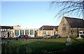
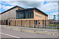
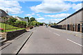
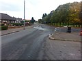
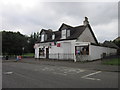
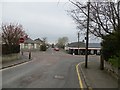
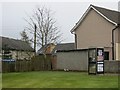
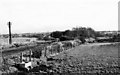
Photos of Kirkmuirhill and Blackwood
Area Information
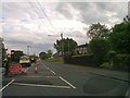
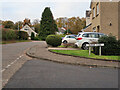
Living in Kirkmuirhill and Blackwood offers a compact yet well-connected experience within the Lanarkshire region of Scotland. This built-up area covers just 1.1 km², creating a defined urban space where residents move efficiently between home and local services. The location sits near Carluke, benefiting from a central position that balances town centre convenience with access to wider regional opportunities. You will find a neighbourhood shaped by its proximity to several key transport hubs, making daily commutes manageable for those working across Lanark or Glasgow. The area functions as a practical residential zone rather than a sprawling suburb, which means your daily journey often involves short walks or quick bus rides rather than long car drives. Homebuyers looking at Kirkmuirhill and Blackwood should appreciate the density of nearby facilities delivered within walking or cycling distance. The region supports both families and professionals through its strategic rail links and straightforward retail options. Living here means accepting a compact environment in exchange for strong connectivity and lower transport costs. You gain immediate access to supermarkets, railway stations, and community shops without crossing significant borders. This layout suits anyone who values a straightforward lifestyle where essential amenities are never far away. The neighbourhood maintains a distinct identity while remaining integrated into the broader network of Lanarkshire towns.
- Area Type
- Built Up Area 250
- Area Size
- 1.1 km²
- Population
- Not available
- Population Density
- Not available
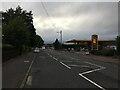
Your daily lifestyle in Kirkmuirhill and Blackwood revolves around practical amenities located within walking or short driving distance five retail outlets serve the local population efficiently. Key destinations include Spar, Co-op Blackwood, and Tesco Lesmahagow, where you can complete most weekly grocery needs without significant travel. Nearby rail access at Carluke Railway Station, Larkhall Railway Station, and Lanark Railway Station further enhances your mobility for work or leisure trips. This proximity means you spend less time commuting and more time enjoying your home surroundings. Community life benefits from the concentration of essential services within the 1.1 km² area. You can grab a quick meal at local shops or visit the railway station for refreshments while waiting for your train. The layout encourages foot travel, promoting an active lifestyle for those who prefer walking over driving. Seasonal activities and local events often utilise these central meeting points, fostering neighbourly interaction. While cultural venues may require a slightly longer journey, the immediate availability of retail and transport keeps life convenient. Living in Kirkmuirhill and Blackwood offers a balanced routine where you access necessities quickly and return to a peaceful residential environment. This simplicity suits those who value efficiency alongside a community-oriented living experience.
Amenities
Schools
| Rank | School | Type | Entry gender | Ages |
|---|
Explore more schools in this area
Go to Schools tabDemographics
The community of Kirkmuirhill and Blackwood comprises residents drawn from various backgrounds who utilise the area's functional layout. While detailed breakdowns of age distribution or ethnic diversity are not included in the current records, the area accommodates working families and commuters across the Scotland region. Household types range from lone occupants to multi-generational homes, reflecting the practical nature of the built-up zone. The population structure supports a mix of home ownership and renting, though specific ownership percentages require further verification. Accommodation within the 1.1 km² boundary serves a stable resident base that relies on local schools and community infrastructure. Deprivation levels influence the character of homes in Kirkmuirhill and Blackwood, with some properties reflecting modest means while others offer modest luxury. You will encounter a settled populace that utilises local services daily. The demographic mix ensures that schools near Kirkmuirhill and Blackwood serve children from working families seeking stability. Residents engage with local retail outlets like the Co-op Blackwood and Spar frequently for essential weekly shopping. This pattern of behaviour indicates a community that prioritises practicality over leisure complex. The area does not show an extreme skew towards either wealthy enclaves or high-deprivation zones, suggesting a typical working-class Scottish town dynamic. Understanding these community traits helps you predict neighbourly interactions and local engagement levels when moving to Kirkmuirhill and Blackwood.
Household Size
Accommodation Type
Tenure
Ethnic Group
Religion
Household Composition
Age
Household Deprivation
NS-SEC
Explore more demographic insights in this area
Go to Demographics tabPlanning
Planning Constraints
- Crime RiskPremium