Area Overview for Holytown
Photos of Holytown


Area Information
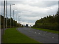
Holytown is a built-up area with a total land area of 5.6 square kilometres. This compact footprint defines a community where daily life revolves around close proximity to local facilities. The area sits within Scotland, offering a distinct setting for those seeking to live in Holytown. Residents benefit from significant access to railway infrastructure, with Holytown Railway Station, Carfin Railway Station, and Bellshill Railway Station all located within practical reach. This strong rail connection allows for easy commuting while maintaining a rooted sense of place. Local shoppers rely on a core of retail outlets including Co-op Scotmid, Co-op Scotmid, and Spar Calderbank for their weekly provisioning needs. The combination of solid transport links and immediate access to essential services creates a self-contained environment. You can manage your daily requirements without needing to travel far from your doorstep. This concentration of amenities and transport hubs makes Holytown a practical choice for families and professionals alike. The area balances urban convenience with a manageable scale, ensuring that the 5.6 square kilometre zone remains accessible for all its inhabitants.
- Area Type
- Built Up Area 250
- Area Size
- 5.6 km²
- Population
- Not available
- Population Density
- Not available
Living in Holytown offers convenient access to a practical selection of amenities located within walking or short driving distance. The area features five retail outlets, specifically including Co-op Scotmid, Co-op Scotmid, and Spar Calderbank, which serve the daily shopping requirements of residents across the 5.6 square kilometre zone. These shops provide essential groceries and household goods, ensuring that you can manage your weekly shopping without traveling far beyond your doorstep. Transport accessibility is a key aspect of the lifestyle, with five railway stations serving the community, including Holytown Railway Station, Carfin Railway Station, and Bellshill Railway Station. These stations facilitate easy commutes for students, workers, and retirees who rely on rail networks to reach destinations beyond the immediate neighbourhood. While there is no data provided for parks, leisure facilities, or dining venues, the concentration of retail and transport nodes creates a functional environment for daily living. The presence of multiple Co-op Scotmid stores highlights the practical nature of local commerce, catering to families and individuals seeking convenience. You will find that life in Holytown is structured around these key hubs, providing a straightforward and accessible routine without the need for extensive travel. The amenities available satisfy basic needs, though the range of leisure options is restricted to the scope of known retail and transport infrastructure.
Amenities
Schools
| Rank | School | Type | Entry gender | Ages |
|---|
Explore more schools in this area
Go to Schools tabDemographics
The demographic profile of Holytown reveals a snapshot of the community currently residing within its 5.6 square kilometre boundaries. While specific details regarding age groups, household compositions, and diversity figures are not included in the available records, the physical presence of residents is confirmed through the operational retail and transport networks. The existence of multiple railway stations and several retail outlets indicates a populated area with active daily routines. You are likely to encounter a range of individuals using the shared spaces, schools, and public amenities located here. The community dynamic is shaped by the density of local commerce and the availability of five distinct railway connections, suggesting a neighbourhood where people converge for travel and shopping. Without direct statistics on ownership levels or deprivation, the focus remains on the observable infrastructure that supports household life. Those looking to understand the community must look beyond raw numbers to the functioning environment of Holytown itself. The area supports a variety of living arrangements centred around these key services. Understanding the people here involves observing how they utilise the permanent fixtures of their town, such as the stations and shops that define the local rhythm.
Household Size
Accommodation Type
Tenure
Ethnic Group
Religion
Household Composition
Age
Household Deprivation
NS-SEC
Explore more demographic insights in this area
Go to Demographics tabPlanning
Planning Constraints
- Crime RiskPremium