Area Overview for G73 4HU
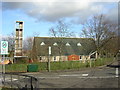
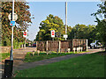
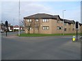
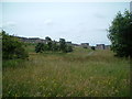
Photos of G73 4HU


Area Information
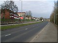
Living in G73 4HU means being part of a small, tightly knit residential cluster in Scotland. The area spans 7,146 square metres, offering a compact yet functional space for residents. Its proximity to multiple transport hubs, including rail, metro, and ferry services, makes it a convenient choice for those needing easy access to urban centres. The postcode’s digital connectivity is among the best in the country, with a broadband score of 100 and a mobile coverage score of 82, ensuring reliable internet for both work and leisure. Daily life here is shaped by the surrounding infrastructure: nearby shops, including Tesco Burnside and Morrisons Daily, provide essential retail services, while transport links like Burnside Railway Station and Glasgow Central Station Bridge Ferry Landing connect residents to broader networks. The area’s low flood risk and absence of protected natural sites suggest a practical, low-constraint environment. While it lacks large-scale amenities, its small size and strategic location make it ideal for those prioritising accessibility over expansive green spaces. The community here is likely to be small, with a focus on local connectivity and practical living.
- Area Type
- Postcode
- Area Size
- 7146 m²
- Population
- Not available
- Population Density
- Not available
The property market in G73 4HU is shaped by its compact size and strategic location. As a small residential cluster, the area likely features a mix of housing types, though specific accommodation details are not provided. The absence of protected natural sites or planning constraints may make it easier to develop or renovate properties, though this is speculative. The area’s proximity to multiple transport links, including rail and metro stations, suggests a demand for properties catering to commuters or those needing urban access. While home ownership levels are not specified, the area’s practicality and connectivity could appeal to both owner-occupiers and renters. Buyers should consider the limited size of the postcode, which may mean competition for available properties. The market is likely to reflect the broader trends of urban or suburban housing, with a focus on functional, accessible living rather than large-scale developments.
House Prices in G73 4HU
Showing 4 properties
| Address | Type | Beds | Baths | Last Sale Price | Last Sale Date | |
|---|---|---|---|---|---|---|
| 2 Upper Bourtree Gardens, Rutherglen, Glasgow, G73 4HU | Detached | 5 | 4 | - | - | |
| 1 Upper Bourtree Gardens, Rutherglen, Glasgow, G73 4HU | Detached | - | - | - | - | |
| 3 Upper Bourtree Gardens, Rutherglen, Glasgow, G73 4HU | Detached | - | - | - | - | |
| 4 Upper Bourtree Gardens, Rutherglen, Glasgow, G73 4HU | Detached | - | - | - | - |
Energy Efficiency in G73 4HU
Life in G73 4HU is defined by its proximity to essential amenities. Retail options include Tesco Burnside, Spar Burnside, and Morrisons Daily, ensuring easy access to groceries and everyday shopping. The area’s transport links, such as Burnside Railway Station and Croftfoot Railway Station, connect residents to broader networks, while ferry terminals like Broomielaw Quay offer alternative travel routes. Although the area lacks large parks or leisure facilities, its compact size means residents can reach urban centres quickly for dining, entertainment, or cultural activities. The presence of multiple retail and transport hubs suggests a practical, convenience-focused lifestyle, ideal for those who prioritise accessibility over expansive natural landscapes. The area’s small size means community interactions are likely to be close-knit, with local amenities fostering a sense of familiarity.
Amenities
Schools
| Rank | School | Type | Entry gender | Ages |
|---|
Explore more schools in this area
Go to Schools tabDemographics
The data does not provide specific demographic details such as age profiles, household types, or diversity metrics for G73 4HU. However, the area’s status as a small residential cluster suggests a compact, likely mixed-use population. The absence of protected natural areas or Ramsar wetlands may indicate a focus on urban or suburban development rather than rural living. While home ownership percentages and accommodation types are not specified, the area’s size and proximity to transport hubs suggest a mix of owner-occupied and rental properties. The lack of detailed demographic data means broader assumptions about the community’s composition, such as average age or household structure, cannot be made. Residents here are likely to value convenience and connectivity over expansive natural landscapes, given the area’s proximity to retail, transport, and urban services.
Household Size
Accommodation Type
Tenure
Ethnic Group
Religion
Household Composition
Age
Household Deprivation
NS-SEC
Explore more demographic insights in this area
Go to Demographics tabPlanning
Planning Constraints
- Flood RiskPremium
- Ramsar Wetland SitesPremium
- Area of Outstanding Natural BeautyPremium
- Protected Nature ReservePremium
- Protected WoodlandPremium
- Crime RiskPremium