Area Overview for G72 7XL
Photos of G72 7XL

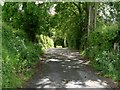
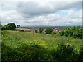
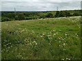
![Hallside farmland (derelict) [2] in G72 7XL](https://images.propbar.co.uk/images/geograph/48/75/4875862_120.jpg)

Area Information
G72 7XL is a small residential cluster in Scotland, covering 78 hectares of land. This postcode area is compact, making it ideal for those seeking a quiet, manageable community. The area is served by multiple railway stations, including Newton, Blantyre, and Uddingston, offering easy access to nearby towns and cities. Residents benefit from proximity to retail outlets like Tesco Cambuslang and Co-op Coatshill, ensuring daily needs are met without long commutes. While the area is small, it is strategically located near major transport routes and amenities. The low flood risk score of 7.68 and absence of protected natural sites suggest a relatively low environmental risk profile. However, the presence of protected woodland adds a layer of ecological significance. For buyers, G72 7XL offers a blend of practicality and accessibility, with homes likely suited to families or professionals seeking a balance between urban convenience and rural tranquillity.
- Area Type
- Postcode
- Area Size
- 78.0 hectares
- Population
- Not available
- Population Density
- Not available
House Prices in G72 7XL
Showing 2 properties
| Address | Type | Beds | Baths | Last Sale Price | Last Sale Date | |
|---|---|---|---|---|---|---|
| Bardyke Chemicals, Hamilton Road, Cambuslang, Glasgow, G72 7XL | Industrial | - | - | - | - | |
| Bardykes Bing, Hamilton Road, Cambuslang, Glasgow, G72 7XL | commercial | - | - | - | - |
Energy Efficiency in G72 7XL
Living in G72 7XL provides access to essential retail and dining options within walking distance. Tesco Cambuslang, Co-op Coatshill, and Spar are among the notable shops, offering a range of groceries and daily essentials. The area’s rail connections to Newton, Blantyre, and Uddingston stations open up broader leisure opportunities, such as visiting local parks, cafes, or cultural venues in nearby towns. While the data does not specify parks or recreational facilities within the postcode itself, the proximity to rail suggests residents can easily reach green spaces or community centres elsewhere. The compact nature of G72 7XL means amenities are concentrated, reducing the need for long trips. This creates a self-contained lifestyle where daily errands and social activities are conveniently accessible, though larger-scale leisure options may require venturing slightly beyond the immediate area.
Amenities
Schools
| Rank | School | Type | Entry gender | Ages |
|---|
Explore more schools in this area
Go to Schools tabDemographics
Household Size
Accommodation Type
Tenure
Ethnic Group
Religion
Household Composition
Age
Household Deprivation
NS-SEC
Explore more demographic insights in this area
Go to Demographics tabPlanning
Planning Constraints
- Flood RiskPremium
- Ramsar Wetland SitesPremium
- Area of Outstanding Natural BeautyPremium
- Protected Nature ReservePremium
- Protected WoodlandPremium
- Crime RiskPremium