Area Overview for G71 8ET
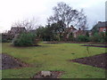
Photos of G71 8ET


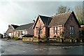
![Old Bothwell Road [2] in G71 8ET](https://images.propbar.co.uk/images/geograph/47/00/4700270_120.jpg)


Area Information
G71 8ET is a small residential postcode area in Scotland, covering just over 5,156 square metres. Its compact size suggests a tightly knit community, likely centred around local amenities and transport links. Situated in a region with practical access to nearby towns, this area may cater to commuters or those seeking a quieter lifestyle near urban hubs. The presence of protected woodland nearby adds a natural element to the landscape, though its impact on daily life is minimal given the low flood risk and absence of larger environmental designations like AONB or Ramsar sites. Residents here are likely to value the balance between residential comfort and proximity to essential services. With limited data on population specifics, the character of G71 8ET remains defined by its modest scale and the infrastructure that supports it, such as rail connections and retail options. It is a place where practicality meets the quietude of a small Scottish postcode.
- Area Type
- Postcode
- Area Size
- 5156 m²
- Population
- Not available
- Population Density
- Not available
House Prices in G71 8ET
Showing 1 properties
| Address | Type | Beds | Baths | Last Sale Price | Last Sale Date | |
|---|---|---|---|---|---|---|
| Bothwell Medical Centre, 3 Uddingston Road, Bothwell, Glasgow, G71 8ET | commercial | - | - | - | - |
Energy Efficiency in G71 8ET
Daily life in G71 8ET is shaped by its proximity to essential retail and rail services. Nearby, Co-op Bothwell, M&S Uddingston, and Lidl Uddingston offer grocery and shopping options, while the five railway stations provide easy access to surrounding towns. Though the area lacks expansive parks or leisure facilities, the presence of protected woodland hints at green spaces for walks or recreation. The compact nature of the postcode means amenities are within practical reach, fostering a sense of convenience for residents. The retail and transport infrastructure suggests a community focused on accessibility rather than sprawling development, making it suitable for those who value efficiency in their daily routines.
Amenities
Schools
| Rank | School | Type | Entry gender | Ages |
|---|
Explore more schools in this area
Go to Schools tabDemographics
Household Size
Accommodation Type
Tenure
Ethnic Group
Religion
Household Composition
Age
Household Deprivation
NS-SEC
Explore more demographic insights in this area
Go to Demographics tabPlanning
Planning Constraints
- Flood RiskPremium
- Ramsar Wetland SitesPremium
- Area of Outstanding Natural BeautyPremium
- Protected Nature ReservePremium
- Protected WoodlandPremium
- Crime RiskPremium