Area Overview for G69 0HU
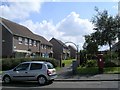
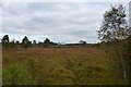
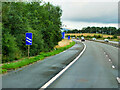
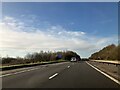
Photos of G69 0HU


Area Information
G69 0HU is a small, defined postcode area in Scotland, encompassing a tightly knit residential cluster. Its compact nature suggests a community-oriented environment, where local amenities and transport links are likely to be within walking or short driving distance. The area benefits from strong digital connectivity, with a broadband score of 85 and a mobile coverage score of 80, both of which indicate excellent service for streaming, online work, and communication. While the data does not specify population figures or historical context, the presence of multiple retail outlets and railway stations nearby—such as Co-op Blackwoods, Co-op Glenmanor, and Gartcosh Railway Station—hints at a practical, everyday-focused lifestyle. Residents here may find the area suitable for those prioritising convenience, with access to essential services and public transport. The absence of significant environmental constraints, such as protected woodlands or areas of outstanding natural beauty, suggests a straightforward planning landscape, which could appeal to buyers seeking simplicity in property development or investment.
- Area Type
- Postcode
- Area Size
- Not available
- Population
- Not available
- Population Density
- Not available
House Prices in G69 0HU
No properties found in this postcode.
Energy Efficiency in G69 0HU
Daily life in G69 0HU is shaped by its accessible amenities. The area’s retail offerings include Co-op stores at Blackwoods, Glenmanor, and Muirhead, providing essential shopping options for groceries and household items. These local stores contribute to a self-sufficient lifestyle, reducing the need for long trips to larger centres. The railway stations—Gartcosh, Stepps, and Lenzie—offer direct links to broader transport networks, enhancing mobility for work, leisure, or travel. While the data does not mention parks or recreational spaces, the lack of environmental constraints like protected woodlands or wetlands suggests potential for local green spaces or community areas. The practical reach of amenities supports a lifestyle focused on convenience, with residents able to meet daily needs without venturing far from home.
Amenities
Schools
| Rank | School | Type | Entry gender | Ages |
|---|
Explore more schools in this area
Go to Schools tabDemographics
Household Size
Accommodation Type
Tenure
Ethnic Group
Religion
Household Composition
Age
Household Deprivation
NS-SEC
Explore more demographic insights in this area
Go to Demographics tabPlanning
Planning Constraints
- Flood RiskPremium
- Ramsar Wetland SitesPremium
- Area of Outstanding Natural BeautyPremium
- Protected Nature ReservePremium
- Protected WoodlandPremium
- Crime RiskPremium