Area Overview for Forth
Photos of Forth


Area Information
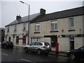
Forth is a built-up area in Scotland, covering 67 hectares. It functions as a small town or city, offering a compact living environment with access to essential services. The area is served by four railway stations, including Fauldhouse and Breich, providing connectivity to nearby towns. Within practical reach, residents have access to five retail outlets, such as Morrisons and Co-op, ensuring daily needs are met. While the population size isn’t specified, the presence of multiple amenities suggests a modest community. Daily life in Forth balances convenience with a sense of locality, where proximity to shops and transport hubs supports a practical lifestyle. The area’s size and infrastructure make it suitable for those seeking a manageable, service-rich environment without the sprawl of larger cities.
- Area Type
- Built Up Area 250
- Area Size
- 67.0 hectares
- Population
- Not available
- Population Density
- Not available
Forth’s lifestyle is shaped by its proximity to retail and transport hubs. The five retail outlets, including Morrisons Daily Forth 61 and Co-op Scotmid, provide grocery and daily shopping options, reducing the need for long trips. Three railway stations—Fauldhouse, Breich, and Carstairs—offer regular services, facilitating access to nearby towns and cities. While the area lacks detailed information on parks or leisure facilities, the availability of shops and transport suggests a practical, community-focused environment. The mix of retail and rail connectivity supports a convenient, accessible daily life, ideal for those prioritising ease of movement and local amenities.
Amenities
Schools
| Rank | School | Type | Entry gender | Ages |
|---|
Explore more schools in this area
Go to Schools tabDemographics
Household Size
Accommodation Type
Tenure
Ethnic Group
Religion
Household Composition
Age
Household Deprivation
NS-SEC
Explore more demographic insights in this area
Go to Demographics tabPlanning
Planning Constraints
- Crime RiskPremium