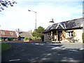
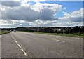
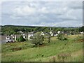
Area Overview for Crindledyke
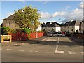
Photos of Crindledyke
Area Information
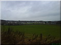
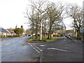
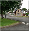
Crindledyke is a compact built-up area in Scotland, covering 58.5 hectares. Its size suggests a tight-knit community, where daily life is shaped by proximity to essential services and transport links. The area benefits from strong digital connectivity, with a broadband score of 98, indicating excellent fixed-line internet quality. This supports both remote work and seamless online activities. Nearby, five retail outlets—including Asda Newmains, Spar Certas, and Co-op Scotmid—provide everyday shopping needs. Rail access is also robust, with five stations within reach, including Hartwood, Cleland, and Wishaw, offering links to broader regional networks. While no population figures are available, the presence of multiple amenities and transport hubs suggests a mix of residents seeking convenience and accessibility. For those prioritising connectivity and practicality, Crindledyke offers a straightforward, functional living environment with minimal reliance on long commutes. The area’s character is defined by its balance of modern infrastructure and local retail, making it suitable for those who value efficiency without sacrificing proximity to services.
- Area Type
- Built Up Area 250
- Area Size
- 58.5 hectares
- Population
- Not available
- Population Density
- Not available
Living in Crindledyke offers access to a range of practical amenities within easy reach. The area is served by five retail outlets, including Asda Newmains, Spar Certas, and Co-op Scotmid, ensuring residents can purchase essentials without long trips. For transport, five railway stations—Hartwood, Cleland, and Wishaw—provide regular connections to surrounding regions, making commuting or travel straightforward. While the data does not specify parks or leisure facilities, the presence of multiple retail and transport options suggests a focus on convenience. The character of daily life here is defined by accessibility, with shops and rail links supporting both routine needs and broader mobility. This makes Crindledyke appealing to those who prioritise ease of access over large-scale recreational amenities.
Amenities
Schools
| Rank | School | Type | Entry gender | Ages |
|---|
Explore more schools in this area
Go to Schools tabDemographics
Household Size
Accommodation Type
Tenure
Ethnic Group
Religion
Household Composition
Age
Household Deprivation
NS-SEC
Explore more demographic insights in this area
Go to Demographics tabPlanning
Planning Constraints
- Crime RiskPremium