Area Overview for Cambuslang
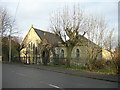
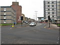
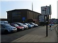
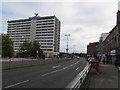
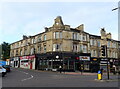
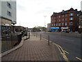
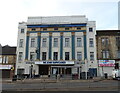
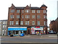
Photos of Cambuslang


Area Information
Living in Cambuslang offers a balanced experience within the built-up environment of South Lanarkshire. This distinct area covers 10.2 km², providing a defined space where residential life intersects with local infrastructure. Residents benefit from being part of a town that serves as a significant local hub rather than mere suburbia. Daily life here is characterised by access to major transport links and essential services all within practical reach. You can expect a living environment where the town centre facilities sit close to your doorstep. The location allows for easy commutes to Glasgow while maintaining a distinct local identity. Schools near Cambuslang serve the children of families residing in this community, contributing to the area's function as a family destination. As you explore homes in Cambuslang, you will find properties situated near key retail outlets and public transport nodes. The area's design accommodates a mix of dwelling types, meaning you can various accommodation styles that suit different family needs. This built-up area acts as a functional base for work, leisure, and family life, ensuring that essential amenities never feel out of reach.
- Area Type
- Built Up Area 250
- Area Size
- 10.2 km²
- Population
- Not available
- Population Density
- Not available
Daily life in Cambuslang centres on a network of amenities that are practical and convenient. You do not need to travel far to visit Farmfoods Cambuslang, Aldi Cambuslang, or Morrisons Cambuslang for your grocery shopping needs. A quick journey takes you to Baxter's Restaurant or the Cameron Centre for dining and leisure activities. Public transport hubs include Bridge Street Underground Station, St Enoch Underground Station, and West Street Underground Station for central Glasgow access. Five railway stations, including Kirkhill Railway Station and Cambuslang Railway Station, offer flexible travel plans. For those seeking water-based transport, Glasgow Central Station Bridge Ferry Landing and Broomielaw Quay Ferry Terminal provide city centre crossings. The area spans 10.2 km², allowing ample space for local exploration without excessive travel times. Living in Cambuslang ensures that retail and transport nodes are integrated into your weekly routine. Homes in Cambuslang sit close to these services, making them a practical choice for busy households.
Amenities
Schools
| Rank | School | Type | Entry gender | Ages |
|---|
Explore more schools in this area
Go to Schools tabDemographics
Cambuslang functions as a built-up area where community life revolves around its established town centre. The area is home to diverse household types, though specific breakdowns for age groups and employment rates are not included in the current profile. You will find a range of accommodation types across the 10.2 km² zone, reflecting the needs of different residents. While exact figures on home ownership versus renting are not detailed in the available statistics, the area supports both owner-occupiers and renters. The population density suits those who prefer a town setting over open countryside. Deprivation levels in the area influence the types of homes available and the services accessed by residents. Families living in Cambuslang rely on local schools and parks for daily activities. Shopping habits are shaped by the presence of major supermarkets nearby. Understanding the community here requires looking at how people utilise the local infrastructure and amenities provided by the town's development over time.
Household Size
Accommodation Type
Tenure
Ethnic Group
Religion
Household Composition
Age
Household Deprivation
NS-SEC
Explore more demographic insights in this area
Go to Demographics tabPlanning
Planning Constraints
- Crime RiskPremium