Area Overview for Allanton (South Lanarkshire)
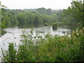
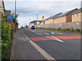
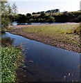
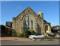
Photos of Allanton (South Lanarkshire)


Area Information
Allanton in South Lanarkshire is a compact built-up area spanning 28.1 hectares, positioned as a small but functional part of Scotland’s urban fabric. While its population figures are not specified, the area’s infrastructure suggests a mix of residential and commuter-focused living. Residents benefit from proximity to retail and rail networks, with shops like Co-op Ferniegair, Spar Leven, and Aldi Palace within practical reach. Three railway stations—Chatelherault, Airbles, and Merryton—offer regular connections to surrounding towns, facilitating daily travel. The digital landscape is robust, with a broadband score of 95 and a mobile coverage score of 82, both indicating excellent connectivity. This supports remote work and seamless online activity. Allanton’s character lies in its balance of practicality and accessibility, making it a viable choice for those seeking a small community with reliable infrastructure. Its size and amenities suggest a focus on convenience rather than sprawling development, appealing to those who value proximity to services without the density of larger cities.
- Area Type
- Built Up Area 250
- Area Size
- 28.1 hectares
- Population
- Not available
- Population Density
- Not available
Residents of Allanton have access to a range of local amenities that cater to daily needs. The retail sector includes notable stores such as Co-op Ferniegair, Spar Leven, and Aldi Palace, offering convenience for grocery shopping and everyday purchases. These shops are strategically located within practical reach, reducing the need for long journeys. The rail network further enhances accessibility, with stations like Chatelherault, Airbles, and Merryton providing links to broader transport systems. While the area may not boast expansive parks or entertainment hubs, the presence of nearby rail services and essential retail options ensures a functional lifestyle. The combination of local shops and rail connections creates a self-contained environment, where residents can meet most of their needs without venturing far. This balance of practicality and connectivity is a defining feature of life in Allanton.
Amenities
Schools
| Rank | School | Type | Entry gender | Ages |
|---|
Explore more schools in this area
Go to Schools tabDemographics
Household Size
Accommodation Type
Tenure
Ethnic Group
Religion
Household Composition
Age
Household Deprivation
NS-SEC
Explore more demographic insights in this area
Go to Demographics tabPlanning
Planning Constraints
- Crime RiskPremium