Area Overview for Gourdon
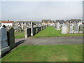
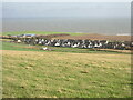
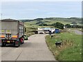
Photos of Gourdon
Area Information
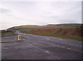
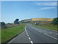
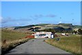
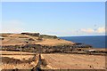
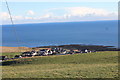
Gourdon is a built-up area in Scotland, spanning 32.5 hectares. It is a small, defined community with a compact footprint, offering a quiet alternative to larger urban centres. The area’s character is shaped by its proximity to essential retail, such as the Co-op Scotmid, which serves as a focal point for daily life. While specific population figures are not available, the presence of a single retail outlet suggests a modest local economy and a community that prioritises convenience. Gourdon’s size and layout may appeal to those seeking a low-key, self-contained environment where local amenities are within practical reach. The area’s appeal lies in its simplicity—fewer distractions, a slower pace, and a sense of cohesion that comes with a small, tightly knit population. For buyers, it represents a chance to own property in a place where the essentials are close at hand, though the lack of larger infrastructure may be a consideration for those requiring more extensive services.
- Area Type
- Built Up Area 250
- Area Size
- 32.5 hectares
- Population
- Not available
- Population Density
- Not available
Residents of Gourdon have access to a small but functional set of amenities within practical reach. The Co-op Scotmid is a notable feature, providing essential retail services and acting as a central point for daily errands. While the area lacks larger leisure or dining options, the presence of a single retail outlet indicates a focus on basic needs rather than expansive commercial hubs. The compact nature of Gourdon may appeal to those who prefer minimalism and a reduced reliance on external services. For families or individuals who enjoy self-contained living, the proximity of the Co-op Scotmid offers convenience without the complexity of larger urban centres. However, the absence of additional amenities such as parks, cafes, or recreational facilities means that residents may need to travel further for a broader range of activities. The lifestyle in Gourdon is defined by simplicity, with the essentials available nearby but more specialised services requiring a trip outside the immediate area.
Amenities
Schools
| Rank | School | Type | Entry gender | Ages |
|---|
Explore more schools in this area
Go to Schools tabDemographics
Household Size
Accommodation Type
Tenure
Ethnic Group
Religion
Household Composition
Age
Household Deprivation
NS-SEC
Explore more demographic insights in this area
Go to Demographics tabPlanning
Planning Constraints
- Crime RiskPremium