Area Overview for Banchory
Photos of Banchory

Area Information
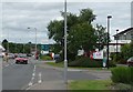
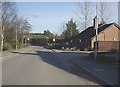
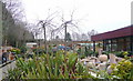
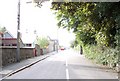
Banchory is a built-up town situated in Aberdeenshire, approximately 18 miles west of Aberdeen. It occupies an area of 3.1 square kilometres and lies on the south-facing slopes above the north bank of the River Dee. The name derives from the Gaelic *Beannchar*, meaning "blessed place," reflecting its origins as an early Christian settlement founded by St Ternan around AD 500. Archaeological finds dating to the Beaker culture, specifically between 2330 and 2040 BC, indicate human presence long before these monastic foundations. Since 2001, the town has seen rapid residential expansion, with significant forested areas replaced by new housing estates. This growth required the construction of Hill of Banchory primary school, which opened in 2006 to accommodate the rising population. The modern atmosphere blends historical heritage with contemporary development. Visitors and residents frequent local attractions such as Crathes Castle, located two miles east of the town. The area retains a character distinct from large urban centres, featuring independent retailers rather than chain supermarkets on the main street. Living in Banchory offers proximity to the Feugh River and access to outdoor activities like mountain biking and golf. The town operates as a local service centre where daily life revolves around practical amenities and community spaces while maintaining a connection to its agricultural and tourist-rich history.
- Area Type
- Built Up Area 250
- Area Size
- 3.1 km²
- Population
- Not available
- Population Density
- Not available
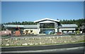
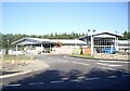
Daily life in Banchory centres on a well-served town centre equipped with essential retail outlets. Residents have practical access to Co-op Tillybrake, Morrisons Banchory, and Co-op Banchory within easy reach. These three retailers form the backbone of the local shopping experience, offering groceries and daily essentials without the need to travel extensively into Aberdeen. Beyond necessities, the area boasts notable historical landmarks that define the local lifestyle. Crathes Castle sits two miles to the east, standing as a 16th-century landmark gifted to the National Trust for Scotland in 1951. The town features recreational facilities including Banchory Golf Club, founded in 1905, alongside modern additions like a golf driving range and mountain bike trails. A skatepark near the town centre provides leisure options for younger residents. Cultural life is enriched by local institutions such as the West Parish Church, completed in 1885, and the old Ternan Kirkyard which houses a distinctive two-storey circular watch house. The main street hosts a collection of independent shops that avoid generic high-street chains. Living in Banchory allows access to the Feugh River for outdoor pursuits while maintaining proximity to specialist amenities. The combination of natural surroundings and functional retail makes the area suitable for those seeking a grounded, activity-focused lifestyle.
Amenities
Schools
| Rank | School | Type | Entry gender | Ages |
|---|
Explore more schools in this area
Go to Schools tabDemographics
The demographic profile of Banchory reflects its status as a growing residential hub within the Aberdeenshire region. Following a period of significant expansion since 2001, the population has absorbed new families and individuals drawn to the town's changing landscape. The influx of residents coincided with the development of extensive housing estates built on former forest land. To support this shift, Hill of Banchory primary school was established in 2006, indicating a community increasingly comprising families with children. The town's population growth has transformed what was previously a quieter settlement into a more dynamic marketplace. While the total population figures are not explicitly stated in the current records, the visible infrastructure changes confirm a steady increase in household numbers. The demographic shift suggests a standard mix of young families, working professionals, and potential retirees attracted to the Deeside corridor. The community character described in local research notes "a fascinating mixture of shops," which typically caters to a diverse range of needs found in typical Scottish market towns. Residents benefit from a blend of historical charm and modern conveniences included in recent developments. Living in Banchory involves participating in a community that has actively reshaped its physical environment to support new inhabitants over the last two decades.
Household Size
Accommodation Type
Tenure
Ethnic Group
Religion
Household Composition
Age
Household Deprivation
NS-SEC
Explore more demographic insights in this area
Go to Demographics tabPlanning
Planning Constraints
- Crime RiskPremium