Area Overview for AB31 5SR
Photos of AB31 5SR
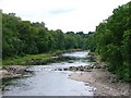
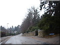
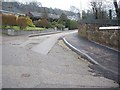
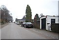
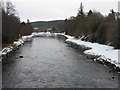
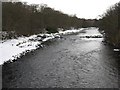

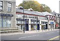
100 photos from this area
Area Information
Key information about the AB31 5SR including its size, population, and administrative classification.
- Area Type
- Postcode
- Area Size
- 4719 m²
- Population
- Not available
- Population Density
- Not available
House Prices in AB31 5SR
16
Properties
-
Average Sold Price
-
Lowest Price
-
Highest Price
Showing 16 properties
| Address | Type | Beds | Baths | Last Sale Price | Last Sale Date | |
|---|---|---|---|---|---|---|
| Mitchell's, 24 High Street, Banchory, AB31 5SR | Flat | - | - | - | - | |
| The Grant Considine Partners, The Grant Considine Partnership, 46 High Street, Banchory, AB31 5SR | Office | - | - | - | - | |
| Douglas Arms Hotel, 22 High Street, Banchory, AB31 5SR | hotel | - | - | - | - | |
| 42 High Street, Banchory, AB31 5SR | Flat | - | - | - | - | |
| Cook & Dine, 46-48 High Street, Banchory, AB31 5SR | retail_financial | - | - | - | - | |
| Tandara Cottage, 40 High Street, Banchory, AB31 5SR | house | - | - | - | - | |
| The Practice, 28 High Street, Banchory, AB31 5SR | commercial | - | - | - | - | |
| Clydesdale Bank, 38 High Street, Banchory, AB31 5SR | retail_financial | - | - | - | - | |
| Out There Active Wear, 16 High Street, Banchory, AB31 5SR | shop | - | - | - | - | |
| Carlton House Hairdressing, Suite 1, Carlton House, 32 High Street, Banchory, AB31 5SR | Office | - | - | - | - |
Page 1 of 2
Energy Efficiency in AB31 5SR
Amenities
Schools
| Rank | School | Type | Entry gender | Ages |
|---|
Explore more schools in this area
Go to Schools tabDemographics
Household Size
N/A
most common
Accommodation Type
N/A
most common
Tenure
N/A
majority
Ethnic Group
N/A
most common
Religion
N/A
most common
Household Composition
N/A
most common
Age
N/A
median
N/A
most common
Household Deprivation
N/A
with no deprivation
NS-SEC
N/A
in Lower managerial occupations
Explore more demographic insights in this area
Go to Demographics tabPlanning
Planning Constraints
- Flood RiskPremium
- Ramsar Wetland SitesPremium
- Area of Outstanding Natural BeautyPremium
- Protected Nature ReservePremium
- Protected WoodlandPremium
- Crime RiskPremium