Area Overview for AB12 5YF
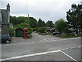
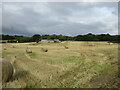
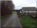
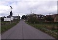
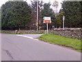
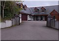
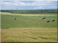
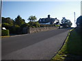
Photos of AB12 5YF


Area Information
Living in AB12 5YF places you within a specific residential cluster in north-eastern Scotland. This postcode covers a small area that forms part of the historic county of Kincardineshire, known locally as the Mearns. The region occupies a triangular area extending inland from the North Sea coast to the Cairngorms, bounded by Aberdeenshire to the north and Angus to the south-west. Administratively, the area now sits within the Aberdeenshire council area. Daily life here is defined by proximity to significant settlements including Stonehaven, Inverbervie, and Laurencekirk, which offer broader cultural and social opportunities for residents. The landscape is a mixture of cultivated land, woodland, and moor, rising towards the Grampian mountains. This setting provides picturesque scenery along the coast while maintaining a connection to the interior highlands. You are situated in a location that balances coastal access with the quiet character of rural hinterlands. The community is embedded in a region with deep historical roots, having once marked the northern limit of Roman penetration into Scotland. This history adds depth to the local character, distinguishing AB12 5YF from generic suburban developments. Modern life continues within these historic boundaries, where residents enjoy access to both the tranquility of the countryside and the amenities of nearby towns.
- Area Type
- Postcode
- Area Size
- Not available
- Population
- Not available
- Population Density
- Not available
Understanding the housing stock in AB12 5YF requires looking at the specific data available for this location. The home ownership percentage for this postcode is not provided, so you cannot determine if the area leans towards owners or tenants. The predominant type of accommodation, whether flats, terraced houses, or detached homes, is also absent from the current records. Without these key figures, it is impossible to say whether AB12 5YF is primarily a family area with larger homes or a young professional hub with smaller properties. The overall size of the residential cluster you are considering is small, which often limits market diversity within the immediate vicinity. This means the homes available may reflect a single era of construction or a specific housing need. Buyers looking at this location must accept that the property market data is sparse for this specific postcode. Nearby towns like Stonehaven or Inverbervie might offer more varied stock, but AB12 5YF itself lacks clear statistics on tenure or property types. The absence of information on average house prices or recent sales volumes further complicates market analysis for this spot. You will need to conduct independent research on individual listings to gauge the true nature of the housing available in this cluster.
House Prices in AB12 5YF
No properties found in this postcode.
Energy Efficiency in AB12 5YF
Your lifestyle in AB12 5YF is supported by a range of amenities within practical reach. Retail options are plentiful, with five locations available nearby. You can shop at Co-op Portlethen, Co-op EGMF, and Spar Harvest for daily essentials and groceries. Transport links provide access to wider networks through two railway stations. Portlethen Railway Station offers local connections, while Aberdeen Railway Station serves as the major hub for journeys across Scotland and beyond. For those considering short trips across the North Sea, Aberdeen Ferry Terminal is just one ferry service away. These transport nodes ensure you can travel to cities like Aberdeen or Stonehaven with relative ease. The combination of multiple supermarkets and rail access means everyday errands do not always require a car, though personal transport remains essential for reaching the countryside or distant specialists. The area's proximity to significant towns like Stonehaven means you can access cinemas, larger restaurants, and major retail parks without travelling far. Leisure activities and parks are integrated into the broader Kincardineshire landscape, offering green spaces for walking and recreation. The convenience of having three distinct Co-op branches and access to major hubs defines the local convenience factor. This practical layout supports a balanced life where rural living does not compromise access to city services.
Amenities
Schools
| Rank | School | Type | Entry gender | Ages |
|---|
Explore more schools in this area
Go to Schools tabDemographics
The community composition within AB12 5YF is not detailed in the available information for this specific postcode. Similarly, precise data regarding the age profile of residents, household types, and levels of diversity are not included for this location. Without specific figures, it is impossible to characterise the exact demographic mix of those living in this residential cluster. Knowing the percentage of owner-occupiers versus private renters in AB12 5YF is likewise currently unsupported by the provided dataset. Consequently, any attempt to describe the socio-economic profile would require assumptions rather than facts. The absence of deprivation indices or breakdowns for different accommodation types means you cannot assess the living conditions relative to the wider nation. While the surrounding Aberdeenshire region contains a mix of urban and rural populations, the specific makeup of AB12 5YF remains undefined in the current records. This lack of granular data prevents a detailed picture of who resides here compared to neighbouring postcodes. Buyers seeking to understand the social fabric of this specific spot must rely on broader regional trends or visit the area to form their own observations. No specific statistics exist to confirm whether families, young professionals, or retirees dominate the local population in this immediate cluster.
Household Size
Accommodation Type
Tenure
Ethnic Group
Religion
Household Composition
Age
Household Deprivation
NS-SEC
Explore more demographic insights in this area
Go to Demographics tabPlanning
Planning Constraints
- Flood RiskPremium
- Ramsar Wetland SitesPremium
- Area of Outstanding Natural BeautyPremium
- Protected Nature ReservePremium
- Protected WoodlandPremium
- Crime & SafetyPremium