Area Overview for PH39 4NU
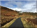
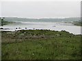
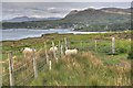
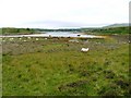
Photos of PH39 4NU
Area Information
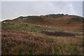
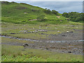
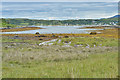
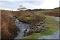
Living in PH39 4NU means occupying a specific residential cluster spread across 15.1 km² of coastline. This postcode area sits within Scotland, offering a distinct experience of rural life compared to more densely populated centres. The location is defined by its proximity to key transport links rather than a large urban centre. You will find yourself in a setting where the architecture and landscape reflect its historic maritime heritage. Daily life here revolves around practical access to services located a short distance away. The area functions as a quiet stop rather than a bustling town. You are living in a space characterised by its low density and specific geographic constraints. The absence of a large population centre means your daily routine will involve travelling to neighbouring settlements for major purchases or cultural events. This layout suits those who value tranquility and prefer a car-based lifestyle. However, you must accept that convenience comes from proximity to Arisaig and other rail links rather than everything being within walking distance. The environment offers a sense of isolation that many homeowners seek, yet it requires you to be comfortable with a smaller radius of activity. You will be settling into an environment where nature and tradition shape the everyday experience of modern Scottish living.
- Area Type
- Postcode
- Area Size
- 15.1 km²
- Population
- Not available
- Population Density
- Not available
The property market in PH39 4NU operates under the constraints of a small residential cluster with limited housing inventory. You will find homes in this postcode area are primarily situated to serve the immediate local needs of a few families and commuters. The market does not offer the variety seen in larger towns, so selection is narrow. Most properties are likely to be family homes or traditional dwellings suited to the landscape. There is no data provided on the percentage of owner-occupiers versus renters, but you should assume high owner-occupancy rates typical of such remote locations. Buyers looking for homes in PH39 4NU must be prepared to act quickly when a suitable property becomes available. The small number of homes means competition can be intense for the right floor plan or condition. You are entering a market where price per square metre varies significantly based on proximity to the Arisaig Ferry Landing and the railway line. Renovation costs may be higher due to the logistical challenges of accessing building materials in this remote 15.1 km² zone. Investing here is a commitment to a specific lifestyle rather than a speculative financial move. Your investment ties you to a community with established rhythms and limited economic turnover.
House Prices in PH39 4NU
Showing 33 properties
| Address | Type | Beds | Baths | Last Sale Price | Last Sale Date | |
|---|---|---|---|---|---|---|
| MORROCH HOUSE, RHUE ROAD, Arisaig, PH39 4NU | Unknown | - | - | - | - | |
| Former Taigh Dobhran, Rhue Road, Arisaig, PH39 4NU | Detached | 4 | 2 | - | - | |
| Taigh Dobhran, Rhue Road, Arisaig, PH39 4NU | house | - | - | - | - | |
| Oran Na Mara, Rhue Road, Arisaig, PH39 4NU | Detached | - | - | - | - | |
| Eshaness, Rhue Road, Arisaig, PH39 4NU | house | - | - | - | - | |
| Doctors Surgery, Rhue Road, Arisaig, PH39 4NU | commercial | - | - | - | - | |
| Land Sea And Island Centre, B 8008 Arisaig Garramor House Access Road, Arisaig, PH39 4NU | Leisure | - | - | - | - | |
| Hazelgrove, Rhue Road, Arisaig, PH39 4NU | Detached | - | - | - | - | |
| The Glen House, Rhue Road, Arisaig, PH39 4NU | Detached | - | - | - | - | |
| The Cabin, Rhue Road, Arisaig, PH39 4NU | Bungalow | - | - | - | - |
Energy Efficiency in PH39 4NU
Your daily lifestyle in PH39 4NU is shaped by immediate access to a small range of amenities. The nearest retail option is a Spar convenience store, providing essentials for impromptu trips and minor household needs. You can find a wider selection of goods by travelling further, but rely on this local shop for groceries and fuel. Transport options include three nearby railway stations: Arisaig, Beasdale, and Morar. These stations offer scheduled services that link you to Glasgow, Inverness, and other major cities. The Arisaig Ferry Landing operates on a regular schedule, giving you passage to St Kilda via the Duke of Argylls Brora. Leisure options are scarce within the immediate cluster, forcing you to plan outings for entertainment and dining. You must drive to nearby villages for tea and coffee or social clubs. The landscape itself serves as the primary recreational resource, with moorland and coastal paths nearby. The protected woodland and designated Area of Outstanding Natural Beauty define your outdoor activities. You enjoy hiking and seasonal sports in an uncrowded environment. This lifestyle suits those who can travel for culture and do not require urban nightlife. The local rhythm is dictated by tidal schedules and train timetables rather than the clock.
Amenities
Schools
| Rank | School | Type | Entry gender | Ages |
|---|
Explore more schools in this area
Go to Schools tabDemographics
The community profile of PH39 4NU reflects the typical pattern of remote Scottish settlements, though specific detailed breakdowns of age groups and household sizes are not provided in current records. You can infer from the area size and typical population that families and long-term residents form the core of the local community. The demographic mix likely prioritises stability, as people living in homes near the coast often stay for decades. There is a strong possibility that home ownership is high, given the nature of the living arrangements in such designated postcode areas. Households are probably structured around multi-generational living or older professionals who value the quiet lifestyle. Accommodation types in this cluster will largely consist of established homes rather than new builds, reflecting the historical development of the area. The population density is inherently low across the 15.1 km² footprint. Deprivation metrics are not available for this specific location, meaning you cannot assess income inequality directly. Instead, you must evaluate the area based on access times to essential services. The community feels cohesive because residents rely on each other in a sparse rural environment. Anyone considering homes in PH39 4NU should expect a population that values tradition and local knowledge over rapid change. The social fabric is woven from necessity rather than convenience, creating a tight-knit neighbourly network.
Household Size
Accommodation Type
Tenure
Ethnic Group
Religion
Household Composition
Age
Household Deprivation
NS-SEC
Explore more demographic insights in this area
Go to Demographics tabPlanning
Planning Constraints
- Flood RiskPremium
- Ramsar Wetland SitesPremium
- Area of Outstanding Natural BeautyPremium
- Protected WoodlandPremium
- Crime RiskPremium